

HOOFDCATEGORIEËN
Activiteiten
Fietsen
VTT / MTB
Klimmen
Auteur:
Land
Regio
Reeks/Serie:
Taal
Schaal
Wandkaarten & Planokaarten
Lange afstand wandelroutes
Nationale parken
TOPO's & Stafkaarten
Toepasselijke bergketen
Waterafstotende kaart
De Griekse Eilanden
Grote Eilanden
Iconische Bergketens van Europa
De Italiaanse Regio's
Uitgever


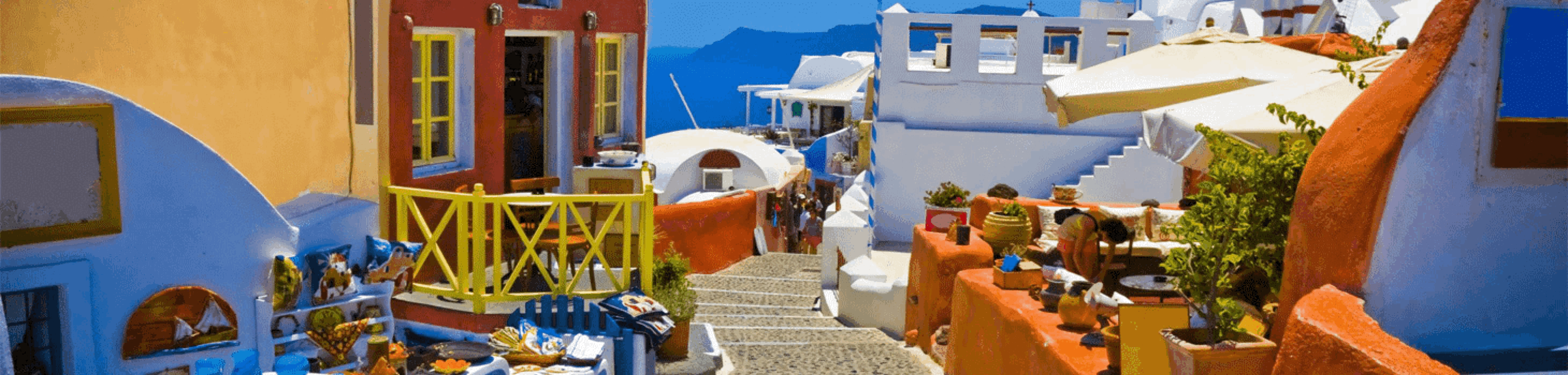
 Op vakantie naar Griekenland
Op vakantie naar Griekenland, een van de meest populaire vakantiebestemmingen in Europa, bekend om zijn rijke geschiedenis, adembenemende landschappen en talloze eilanden die elk hun eigen unieke charme hebben. Het land bestaat uit duizenden eilanden, gegroepeerd in verschillende archipels, die elk iets speciaals te bieden hebben voor reizigers. Een van de bekendste eilandengroepen is de Cycladen, waar het iconische eiland Santorini zich bevindt. Santorini staat bekend om zijn witte huizen met blauwe daken en spectaculaire zonsondergangen. Daarnaast biedt het een rijke archeologische geschiedenis, met opgravingen in Akrotiri die teruggaan tot de Minoïsche beschaving. Ook Mykonos, met zijn levendige nachtleven en mooie stranden, is een must voor bezoekers die op zoek zijn naar een mix van cultuur en ontspanning.
De Ionische eilanden, zoals Corfu en Zakynthos, zijn weelderig en groen, met een geheel eigen karakter vergeleken met de drogere Cycladen. Corfu, met zijn Venetiaanse invloeden en prachtige olijfgaarden, biedt een charmante mix van cultuur en natuur. Zakynthos is vooral bekend vanwege het beroemde Navagio Beach, ook wel het "scheepswrakstrand" genoemd, dat een van de meest gefotografeerde stranden ter wereld is. De Dodekanesos, waaronder Rhodos en Kos, staan bekend om hun middeleeuwse kastelen en Turkse invloeden. Rhodos herbergt het prachtige middeleeuwse oude centrum, dat op de werelderfgoedlijst van UNESCO staat. Kos is een ideale bestemming voor liefhebbers van archeologie, met indrukwekkende ruïnes van oude tempels en theaters.
Tot slot zijn er de Sporaden, zoals Skiathos en Skopelos, met hun prachtige stranden en weelderige natuur. Deze eilanden zijn ook beroemd vanwege de opnames van de film Mamma Mia!. Op vakantie naar Griekenland biedt een schat aan geschiedenis, cultuur en natuur, verspreid over honderden eilanden die allemaal hun eigen unieke ervaring bieden. Of je nu op zoek bent naar avontuur, ontspanning of cultuur, de Griekse eilanden hebben het allemaal. Op de volgende pagina's Wandelkaarten Griekenland & Wandelgidsen Griekenland is er bij BIBLIOTREK heel wat te vinden.

Landkaart Wegenkaart 322 Astypalea - Orama Editions • 9789608385849
Wegenkaart Astypalea - Orama Editions Productomschrijving: Gedetaillieerde wegenkaart van het eiland Astypalea in de eilandengroep Dodekanesos in de Egeïsche Zee. De kaart omvat hotels en campings, met toeristische symbolen die allerhande historische plaatsen, kloosters, museas aangeven. De kaart is meertalig, met belangrijke steden met hun centrum kaart en register, en degelijk kleurenge…

Landkaart Wegenkaart 323 Kalymnos - Orama Editions • 9789608385856
Wegenkaart Kalymnos - Orama Editions Productomschrijving: Gedetaillieerde wegenkaart van het eiland Kalymnos, in de regio van de Egeische eilanden. De kaart omvat hotels en campings, met toeristische symbolen die allerhande historische plaatsen, kloosters, museas aangeven. De kaart is meertalig, met belangrijke steden met hun centrum kaart en register, en degelijk kleurengebruik. Ook h…

Landkaart Wegenkaart 324 Karpathos - Orama Editions • 9789608385863
Wegenkaart Karpathos - Orama Editions Productomschrijving: Gedetaillieerde wegenkaart van het eiland Karpathos in de regio van de Dodekanesos eilanden. De kaart omvat hotels en campings, met toeristische symbolen die allerhande historische plaatsen, kloosters, museas aangeven. De kaart is meertalig, met belangrijke steden met hun centrum kaart en register, en degelijk kleurengebruik. O…
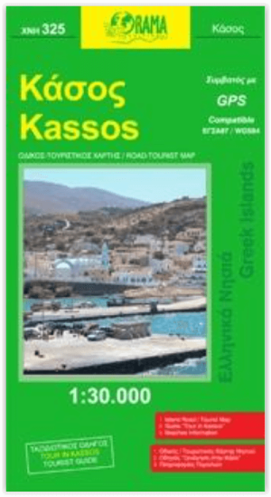
Landkaart Wegenkaart 325 Kassos - Orama Editions • 9789608385870
Wegenkaart Kassos - Orama Editions Productomschrijving: Gedetaillieerde wegenkaart van het eiland kassos in de regio van de Egeïsche Zee, vlak voor de kust van Turkije. De kaart omvat hotels en campings, met toeristische symbolen die allerhande historische plaatsen, kloosters, museas aangeven. De kaart is meertalig, met belangrijke steden met hun centrum kaart en register, en degelijk kle…

Landkaart Wegenkaart 326 Kos - Orama Editions • 9789608385887
Wegenkaart Kos - Orama Editions Productomschrijving: Gedetaillieerde wegenkaart van het eiland Kos, in het oosten van de Egeische zee. De kaart omvat hotels en campings, met toeristische symbolen die allerhande historische plaatsen, kloosters, museas aangeven. De kaart is meertalig, met belangrijke steden met hun centrum kaart en register, en degelijk kleurengebruik. Ook hoogteverschil…

Landkaart Wegenkaart 327 Leros - Orama • 9789608385894
Wegenkaart Leros - Orama Productomschrijving: Gedetaillieerde wegenkaart van de regio van de Dodekanesos eilanden in de egeische zee. De kaart omvat hotels en campings, met toeristische symbolen die allerhande historische plaatsen, kloosters, museas aangeven. De kaart is meertalig, met belangrijke steden met hun centrum kaart en register, en degelijk kleurengebruik. Ook hoogteverschill…
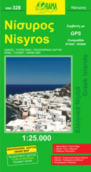
Landkaart Wegenkaart 328 Nisyros - Orama • 9789608385900
Wegenkaart Nisyros - Orama Productomschrijving: Gedetaillieerde wegenkaart gelegen ten zuiden van het eiland Kos, in het oosten van de Egeïsche Zee in de Griekse regio Zuid-Egeïsche Eilanden. De kaart omvat hotels en campings, met toeristische symbolen die allerhande historische plaatsen, kloosters, museas aangeven. De kaart is meertalig, met belangrijke steden met hun centrum kaart en reg…


Landkaart Wegenkaart 330 Rhodos - Orama Editions • 9789608385924
Wegenkaart Rhodos - Orama Editions Productomschrijving: Gedetaillieerde wegenkaart gelegen in de Egeïsche Zee, in de Griekse regio Zuid-Egeïsche Eilanden. De kaart omvat hotels en campings, met toeristische symbolen die allerhande historische plaatsen, kloosters, museas aangeven. De kaart is meertalig, met belangrijke steden met hun centrum kaart en register, en degelijk kleurengebruik. …

Landkaart Wegenkaart 332 Tilos Dodekanessos - Orama • 9789608385948
Wegenkaart Tilos Dodekanessos - Orama Productomschrijving: Gedetaillieerde wegenkaart van de regio van de Dodekanessos eilanden in Griekenland. De kaart omvat hotels en campings, met toeristische symbolen die allerhande historische plaatsen, kloosters, museas aangeven. De kaart is meertalig, met belangrijke steden met hun centrum kaart en register, en degelijk kleurengebruik. Ook hoogt…
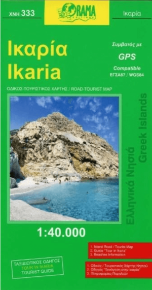
Landkaart Wegenkaart 333 Ikaria Egeische eilanden N.O. - Kompass • 9789608385955
Wegenkaart Ikaria - Kompas Productomschrijving: Gedetaillieerde wegenkaart van de Noord-Oostelijke Egeische eilanden in Griekenland. De kaart omvat hotels en campings, met toeristische symbolen die allerhande historische plaatsen, kloosters, museas aangeven. De kaart is meertalig, met belangrijke steden met hun centrum kaart en register, en degelijk kleurengebruik. Ook hoogteverschille…
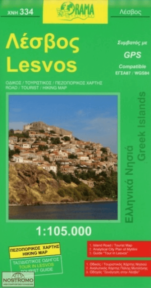
Landkaart Wegenkaart 334 Lesbos - Orama Editions • 9789608385962
Wegenkaart Lesbos - Orama Editions Productomschrijving: Gedetaillieerde wegenkaart van de regio gelegen in de Egeische zee, dicht bij de kust van Turkije en Klein-Azië. De kaart omvat hotels en campings, met toeristische symbolen die allerhande historische plaatsen, kloosters, museas aangeven. De kaart is meertalig, met belangrijke steden met hun centrum kaart en register, en degelijk kl…
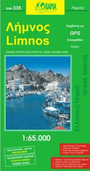
Landkaart Wegenkaart 335 Limnos, Noordelijke Egeische zee - Orama • 9789608385979
Wegenkaart Limnos, Noordelijke Egeische zee - Orama Productomschrijving: Gedetaillieerde wegenkaart van het eiland Limnos in de regio van de Noord Egeische eilanden in Griekenland. De kaart omvat hotels en campings, met toeristische symbolen die allerhande historische plaatsen, kloosters, museas aangeven. De kaart is meertalig, met belangrijke steden met hun centrum kaart en register, en d…

Landkaart Wegenkaart 336 Samos Griekenland - Orama Editions • 9789608385986
Wegenkaart Samos Griekenland - Orama Editions Productomschrijving: Gedetaillieerde wegenkaart van het eiland Samos, in de regio van de Egeische zee, tegen de kust van Turkije. De kaart omvat hotels en campings, met toeristische symbolen die allerhande historische plaatsen, kloosters, museas aangeven. De kaart is meertalig, met belangrijke steden met hun centrum kaart en register, en degeli…

Landkaart Wegenkaart 337 Hios Griekenland - Orama Editions • 9789608385993
Wegenkaart Hios Griekenland - Orama Productomschrijving: Gedetaillieerde wegenkaart van het eiland Hios in de regio van de Oostelijke Egeische zee in Griekenland. De kaart omvat hotels en campings, met toeristische symbolen die allerhande historische plaatsen, kloosters, museas aangeven. De kaart is meertalig, met belangrijke steden met hun centrum kaart en register, en degelijk kleurengeb…
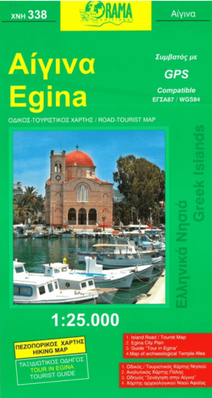
Landkaart Wegenkaart 338 Egina - Orama Editions • 9789604480005
Wegenkaart Egina, Saronische eilanden Griekeland - Orama Productomschrijving: Gedetaillieerde wegenkaart van het eiland Egina, gelegen in de Golf van Egina in de regio van de Saronische eilanden in Griekenland. De kaart omvat hotels en campings, met toeristische symbolen die allerhande historische plaatsen, kloosters, museas aangeven. De kaart is meertalig, met belangrijke steden met hun c…

Landkaart Wegenkaart 343 Hydra Egeische zee Griekenland - Orama • 9789604480289
Wegenkaart Hydra Egeische zee Griekenland - Orama Productomschrijving: Gedetaillieerde wegenkaart van het eiland Hydra, gelegen in de regio van de Noordelijke Egeische eilanden. De kaart omvat hotels en campings, met toeristische symbolen die allerhande historische plaatsen, kloosters, museas aangeven. De kaart is meertalig, met belangrijke steden met hun centrum kaart en register, en dege…
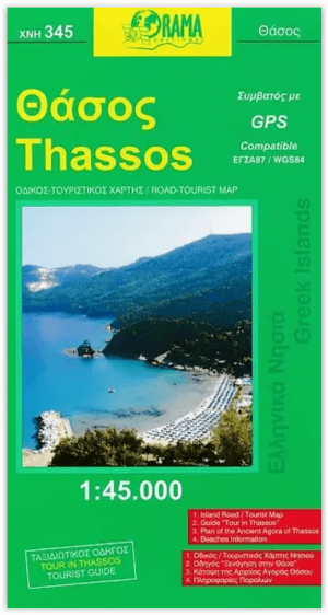
Landkaart Wegenkaart 345 Thassos - Orama Editions • 9789608283282
Wegenkaart Thassos - Orama Editions Productomshrijving: Gedetaillieerde wegenkaart van het eiland Thassos, in de regio van de Noordelijke Egeische eilanden nabij Thracië. De kaart omvat hotels en campings, met toeristische symbolen die allerhande historische plaatsen, kloosters, museas aangeven. De kaart is meertalig, met belangrijke steden met hun centrum kaart en register, en degelijk kl…

Landkaart Wegenkaart 347 Skiathos - Orama Editions • 9789604480296
Wegenkaart Skiathos - Orama Editions Productomshrijving: Gedetaillieerde wegenkaart van het eiland Skiathos, gelegen in de regio van de Noordelijke Sporaden, in het noordwesten van de Egeïsche Zee. De kaart omvat hotels en campings, met toeristische symbolen die allerhande historische plaatsen, kloosters, museas aangeven. De kaart is meertalig, met belangrijke steden met hun centrum kaart …

Landkaart Wegenkaart 348 Skopelos - Orama Editions • 9789604480302
Wegenkaart Skopelos - Orama Editions Productomshrijving: Gedetaillieerde wegenkaart van het eiland Skopelos, in de regio van de Noordelijke Sporaden, gelegen in het noordwesten van de Egeïsche Zee De kaart omvat hotels en campings, met toeristische symbolen die allerhande historische plaatsen, kloosters, museas aangeven. De kaart is meertalig, met belangrijke steden met hun centrum kaart e…

Landkaart Wegenkaart 349 Alonissos Griekenland - Orama • 9789604480319
Wegenkaart Alonissos Griekenland - Orama Productomschrijving: Een Algemene wegenkaart van het eiland van Alonissos in de Noordelijke sporaden van de Griekse egeische eilanden. De kaart omvat aanduidingen van Accomodaties, sightseeing, geschiedenis van het eiland, toeristische aanduidingen, en stranden.

Landkaart Wegenkaart 351 Skyros - Orama Editions • 9789604480326
Wegenkaart Skyros - Orama Editions Productomshrijving: Gedetaillieerde wegenkaart van het eiland Skyros, in de regio de Noordelijke sporaden in Griekenland. De kaart omvat hotels en campings, met toeristische symbolen die allerhande historische plaatsen, kloosters, museas aangeven. De kaart is meertalig, met belangrijke steden met hun centrum kaart en register, en degelijk kleurengebruik. …

Landkaart Wegenkaart 454 Kleine Cycladen - Orama Editions • 9789604486946
Wegenkaart Kleine Cycladen - Orama Editions Productomshrijving: Gedetaillieerde wegenkaart van de regio van de kleine Cycladen. De kaart omvat hotels en campings, met toeristische symbolen die allerhande historische plaatsen, kloosters, museas aangeven. De kaart is meertalig, met belangrijke steden met hun centrum kaart en register, en degelijk kleurengebruik. Ook hoogteverschillen zij…
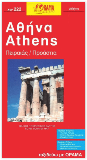
Stadskaart Plattegrond C222 Athene - Orama Editions • 9789609134170
Stadskaart Athene - Orama Editions Productomshrijving: Gedetaillieerde stadskaart en plattegrond van de stad Athene in Centraal Griekenland. De kaart omvat hotels en campings, met toeristische symbolen die allerhande historische plaatsen, kloosters, museas aangeven. De kaart is meertalig, met belangrijke steden met hun centrum kaart en register, en degelijk kleurengebruik. Ook hoogteve…

Landkaart Wegenkaart C237 Thessaloniki - Orama Editions • 9789608385382
Wegenkaart Thessaloniki - Orama Editions Productomshrijving: Gedetaillieerde Stadsplattegrond van de stad Thessaloniki in Centraal grieks Macedonië. De kaart omvat hotels en campings, met toeristische symbolen die allerhande historische plaatsen, kloosters, museas aangeven. De kaart is meertalig, met belangrijke steden met hun centrum kaart en register, en degelijk kleurengebruik. Ook …
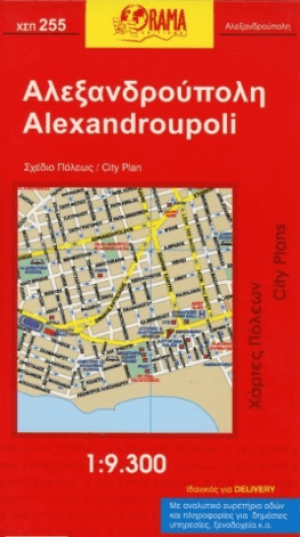
Stadskaart Plattegrond C255 Alexandroupoli Macedonië - Orama • 9789608283633
Stadskaart Alexandroupoli Oost-Macedonië Griekenland Productomschrijving: Deze stadskaart omvat alle details, straten, locaties, P.O.I's, touristen details, voor de Oost-Mecedonische stad van Alexandroupoli in Griekenland. This Orama Editions title provides street and tourist details for the city of Alexandroupoli.
Wandelen in griekenland
Wandelen in griekenland is een ideale bezigheid voor wandelaars, met een enorme variëteit aan wandelroutes door adembenemende landschappen. Van bergen tot kustlijnen en van historische paden tot ongerepte natuurgebieden, het land biedt tal van mogelijkheden voor zowel beginners als ervaren wandelaars. Een van de meest beroemde wandelroutes is de Samariakloof op het eiland Kreta. Deze kloof, de langste van Europa, loopt door het indrukwekkende Samaria Nationaal Park en biedt wandelaars een unieke ervaring tussen steile rotswanden en door een prachtige, wilde omgeving. De tocht eindigt aan de Libische Zee, waar je kunt ontspannen aan het strand. Hier en daar helpen Topografische kaarten wel.
Op het vasteland van Griekenland vind je de Mount Olympus, de hoogste berg van het land en volgens de mythologie de thuisbasis van de Griekse goden. De trek naar de top van Olympus, bekend als Mytikas, is een uitdaging voor avontuurlijke wandelaars, maar biedt spectaculaire uitzichten en een gevoel van prestatie. Voor wie de voorkeur geeft aan eilandwandelen, zijn er prachtige routes op de Cycladen. Op het eiland Naxos kun je de Zeusberg beklimmen, de hoogste piek in de Cycladen, terwijl je onderweg geniet van panoramische uitzichten over de Egeïsche Zee. Ook op Santorini vind je de beroemde wandelroute van Fira naar Oia, die langs de rand van de krater voert met spectaculaire uitzichten over de caldera. Daarnaast zijn er tal van kust- en bergwandelingen op eilanden zoals Corfu, Rhodos, en Andros. Wandelen in griekenland biedt wandelaars een unieke kans om geschiedenis, cultuur en natuur te combineren in één onvergetelijke ervaring.
Op het vasteland en op het schiereiland Peloponnesos trekt de stroom reizigers vooral naar de bezienswaardigheden van de klassieke oudheid. Met een Europese reisgids van Bibliotrek in handen, kunt u uiteraard ook goed op ontdekking.
Wandelroutes Griekenkland
Wandelroutes Griekenkland zijn een paradijs voor wandelaars met een breed scala aan routes die variëren van bergachtige paden tot kustwandelingen. Enkele van de meest iconische routes zijn:
Samariakloof (Kreta): Deze 16 kilometer lange wandeling door de langste kloof van Europa is beroemd om zijn ruige landschap en eindigt aan zee. Het is een dagtocht die zowel uitdagend als spectaculair is.
Mount Olympus: Bekend als de thuisbasis van de Griekse goden, biedt deze berg verschillende routes, waaronder de beklimming naar de top, Mytikas (2.917 meter). Het is een uitdagende tocht die meerdere dagen kan duren.
Naxos – Zeusberg: Deze wandeling voert naar het hoogste punt van de Cycladen, met panoramische uitzichten over de eilanden en zee. Het is een populaire route voor natuurliefhebbers.
Fira naar Oia (Santorini): Een schilderachtige route van 10 kilometer langs de caldera, met adembenemende uitzichten op de vulkaan en de Egeïsche Zee. Deze route is populair vanwege de prachtige zonsondergangen.
Corfu Trail: Een langeafstandspad van 220 kilometer, dat je langs olijfboomgaarden, stranden en traditionele dorpen voert. Het biedt een diverse ervaring van het eiland.
Deze routes, samen met vele andere op eilanden zoals Andros, Rhodos en Zakynthos, maken Griekenland tot een wandelbestemming vol variatie en natuurlijke schoonheid. De Griekse regio’s zijn: Attica, Centraal-Griekenland, Centraal-Macedonië, Kreta, Oost-Macedonië en Thracië, Epirus, de Ionische eilanden, de Noord Egeïsche eilanden, Peloponnesos, de Zuid-Egeïsche Eilanden, Thessalië, West-Griekenland, West-Macedonië en de monnikenstaat Athos.