

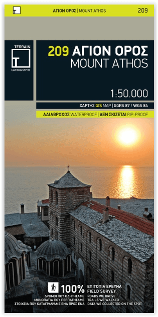
Wandelkaart 209 Mount Athos - Terrein Maps
The first highly accurate map of Mt Athos

Korte omschrijving
Wandelkaarten Macedonië, Balkan en Mount Athos, Griekenland van Terrain Editions. Ideaal voor tochten in Griekenland.
Wandelkaart Mount Athos - Terrein Maps Productomschrijving: The first highly accurate map of Mt Athos. Created with GPS technology and extensive field survey, this map of Mt. Athos from ...

Specificaties
- Uitgever: Terrain Editions
- ISBN-13: 9789609456999
- HOOFDCATEGORIEËN: Wandelkaart, Wegenkaart - Landkaart
- Activiteiten: Street/Road maps & city plans
- Regio: Macedonië, Balkan, Mount Athos, Griekenland
- Land: Griekenland
- Schaal: 1:50000
- Taal: Engels
- De Griekse Eilanden: Centraal Griekenland
Volledige omschrijving
Wandelkaart Mount Athos - Terrein Maps
Productomschrijving: The first highly accurate map of Mt Athos.
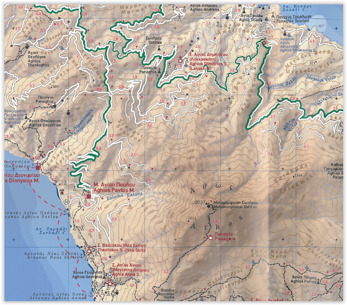
Created with GPS technology and extensive field survey, this map of Mt. Athos from TERRAIN Editions offers to the visitor a unique wealth of information. If you plan to hike from one monastery to the other, explore the mainland or climb to the top of Mt. Athos, this precise and reliable map will prove invaluable. FEATURES
Town plan in 1:3.000 scale and ?aryes area map in 1:10.000 scale
All monasteries, scetes, cells, seats and huts, marked with distinctive symbols and their names
All walking trails, with measured distances
A concise guide to the monasteries, and general information on Mt. Athos
Printed on polyart
Locatie op kaart
Artikelen uit dezelfde regio

Reisgids Anwb Extra Noord-Macedonië Balkan - Anwb • 9789018054441
Reisgids Noord-Macedonië Balkan - Anwb Productomschrijving: Beleef Macedonië met de compleet vernieuwde reisgids ANWB Extra Macedonië! (Noord) Macedonië wordt door zijn vele prachtige bergen en groene weides ook wel het Zwitserland van de Balkan genoemd. Hierdoor is Macedonië de perfecte bestemming voor een leuke vakantie. De compacte ANWB Extra reisgids Macedonië biedt naast diverse …
Stadskaart Plattegrond C255 Alexandroupoli Macedonië - Orama • 9789608283633
Stadskaart Alexandroupoli Oost-Macedonië Griekenland Productomschrijving: Deze stadskaart omvat alle details, straten, locaties, P.O.I's, touristen details, voor de Oost-Mecedonische stad van Alexandroupoli in Griekenland. This Orama Editions title provides street and tourist details for the city of Alexandroupoli.
Landkaart Wegenkaart Balkan West - Reise Know How • 9783831774890
Wegenkaart Westelijke Balkan - Reise Know How Productomschrijving: Reis Know-How-kaarten (wereldkaart-projectreeks) zijn gemakkelijk te lezen, waterdichte en zeer duurzame reiskaarten die speciaal zijn ontworpen voor dagelijks gebruik op de weg. Omvat: Voormalig Joegoslavië, Slovenië & Albanië. Onze kaarten combineren state-of-the-art, GPS-compatibele cartografie (inclusief hypsome…
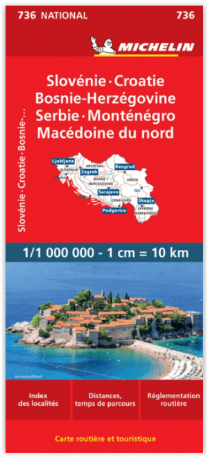
Landkaart Wegenkaart 736 Slovenië- Kroatië- Bosnië & Servië • 9782067171930
Wegenkaart Slovenië- Kroatië- Bosnië & Servië - Michelin Productomschrijving: Deze Nationale kaart van Slovenië- Kroatië- Bosnië- Servië & Macedonië, werd ontwikkeld, om zich snel uit de voeten wil maken, met plaatsnamenindex, en toeristische informatie, geven u alle elementen om dat werkelijkheid te maken. De kaarten zijn gemakkelijk leesbaar en gedrukt op sterk papier. De rode Michel…

Landkaart Wegenkaart Noord Macedonië T10 - F&B • 9783707924572
Wegenkaart Noord Macedonië T10 - F&B Productomschrijving: Deze gedetailleerde landkaart van Macedonië is zeer geschikt voor het plannen en voor het rondtrekken door het land. Het wegennetwerk is goed weergeven, zowel de hoofdwegen, de provinciale en lokale wegen. Tevens worden wegnummers duidelijk vermeld. Afstanden tussen plaatsen zijn in kilometers op de kaart ingetekend, daarnaast …