

Wandelgids Pembrokeshire Coast Path - Cicerone
Amroth to St Dogmaels - 291 km


Korte omschrijving
Wandelgidsen Pembrokeshire, Wales van CICERONE Press. Ideaal voor tochten in Wales.
Pembrokeshire Coast Path - Cicerone Productomschrijving: Deze nieuwe gids omvat de Pembrokeshire Coast Path National Trail, een 291 km lange kust wandelroute langs het befaamde Pembrokeshire...

Specificaties
- Uitgever: CICERONE Press
- ISBN-13: 9781786312082
- HOOFDCATEGORIEËN: Wandelgids
- Activiteiten: Wandelen, Hiking & Trekking
- Auteur: Dennis Kelsall, Jan Kelsall
- Regio: Pembrokeshire, Wales
- Land: Wales
- Lange afstand wandelroutes: Pembrokeshire Coast Path National Trail (299 km)
- Schaal: 1:25000
- Editie: 4
- Taal: Engels
- Reeks/Serie: National Trails, UK
- National Trails UK, England & Wales: Pembrokeshire Coast Path, Wales
Volledige omschrijving
Pembrokeshire Coast Path - Cicerone
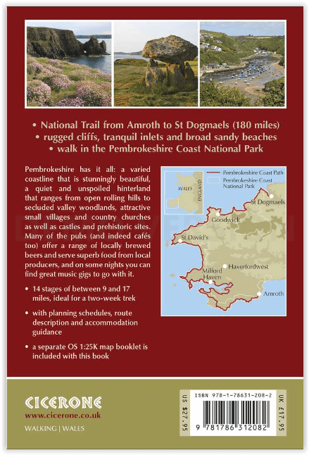
Productomschrijving: Deze nieuwe gids omvat de Pembrokeshire Coast Path National Trail, een 291 km lange kust wandelroute langs het befaamde Pembrokeshire Coastline in Wales.
Omvat: St-Dogmaels, Goodwick, St-David's, Milford Haven, Amroth.
Engelse omschrijving: This guidebook describes the Pembrokeshire Coast Path National Trail. The scenic 180 mile (291 km) long-distance walk from Amroth to St Dogmaels takes around 2 weeks to walk, with soaring rugged cliffs, tranquil inlets and broad sandy beaches. With planning schedules, route description and accommodation guidance. Includes a 1:25,000 OS map booklet.
Seasons:
The Pembrokeshire Coastal Path can be walked throughout the year. Accommodation may be more scarce in the winter months, but avoid high summer as it will be even more difficult to find.
Centres:
Tenby, Stackpole Quay, Freshwater, Pembroke, Milford Haven, Dale, St Brides, Newgale Sands, St David's, Whitesands Bay, Aber Castle, Strumble Head, Goodwick, Fishguard, Newport.
Difficulty:
Straightforward walking, although the route does amount to an overall ascent of 30,000 feet.
Must See:
Outstanding coastal views, birdwatching and sea wildlife, unspoilt landscape (with the exception of Milford Haven and Fishguard), generally mild climate.
.png)
Gekoppelde artikelen
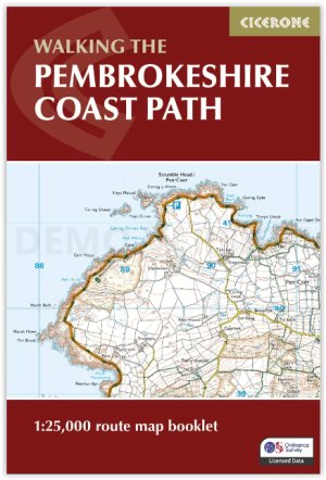
Map Nooklet Pembrokeshire Coast Path - Cicerone • 9781786312099
standaard versiePembrokeshire Coast Path - Cicerone Productomschrijving: OPGELET: Dit art. zit standard inbegrepen in de wandelgids van de route zelf. Pembrokeshire Coast Path National Trail, van 291 km langs de kust van de regio Pembrokeshire NP wales. Deze omvat de kaartjes boekje voor de route. Engelse omschrijving: Map of the 182 mile (291km) Pembrokeshire Coast Path National Trail, between …
Artikelen uit dezelfde regio
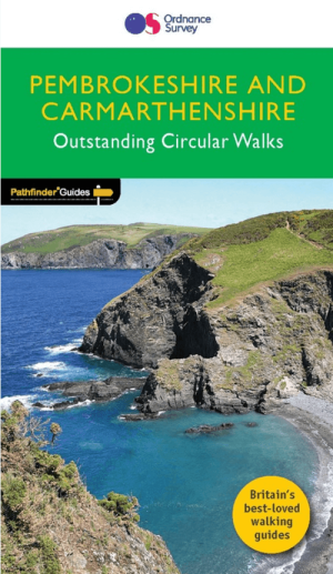
Wandelgids 034 Pathfinder guides Pembrokeshire Wales - OS • 9780319090374
Wandelgids Pembrokeshire Wales - OS Productomschrijving: This Pathfinder walks guidebook for Pembrokeshire and Carmarthenshire book contains 28 carefully planned walks created by seasoned walkers. The routes range from two to nine miles, and allow you to see some of the best that the area has to offer. The Pembrokeshire and Carmarthenshire area has some of the most spectacular coastal …
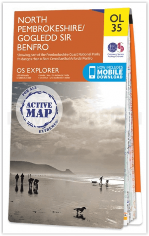
Wandelkaart OL35 North Pembrokeshire Wales - OSI • 9780319475744
Wandelkaart North Pembrokeshire Wales - OSI Productomschrijving: Kaart nummer OL35 in de OS Explorer serie bestrijkt de kust van North Pembrokeshire en het Pembrokeshire Coast National Park aan de westkust van Wales. Hoogtepunten van het gebied zijn: St Davids, Cardigan, Goodwick en Fishguard, samen met het Pembrokeshire Coast Path. National Trails and recreation paths: * Ceredigi…

Wandelkaart OL36 South Pembrokeshire- Wales - OSI • 9780319469545
Wandelkaart South Pembrokeshire - Wales Productbeschrijving: Kaart nummer OL36 is een all purpose kaart vol gepakt met informatie om u het gebied te helpen leren kennen. De kaarten bestrijken het land. Elke kaart heeft een oppervlakte van 40 km door 40 km (25 mijl door 25 mijl) en zoals andere kaarten van Ordnance Survey, National Grid-vierkanten worden verstrekt zodat elke functie een uni…
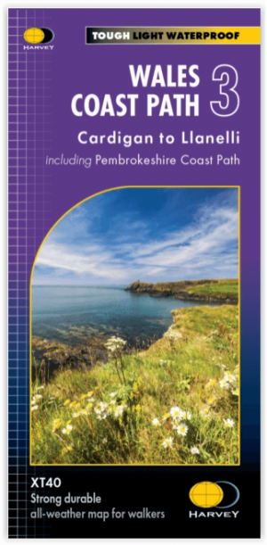
Wandelkaart XT40 Wales Coast Path 3 - Cardigan to LIanelli • 9781851376629
Wandelkaart Wales Coast Path 3 - Cardigan to LIanelli Productomschrijving: Het officiële pad is 300 kilometer, oftewel 186 mijl, en loopt van Amroth naar St. Dogmaels. Het Pembrokeshire Coast Path is een onderdeel van het Wales Coast Path, dat 1400 kilometer, oftewel 870 mijl, lang is en de gehele kust van Wales passeert. Het Pembrokeshire Coast Path passeert 58 stranden en 14 havens. …

Wandelkaart OL036 Pembrokeshire National Park South - OS • 9780319242759
Wandelkaart Pembrokeshire National Park South - OS Productomschrijving: Pembrokeshire National Park South Ontdek de OL-serie van Ordnance Survey: De OL-serie (Outdoor Leisure) van Ordnance Survey is dé referentie voor wie gaat wandelen op de Britse eilanden. Deze topografische kaarten maken deel uit van de Explorer-reeks en bieden ongeëvenaarde nauwkeurigheid en detail op een schaal …