

Wandelgids Isle of Wight walking guide - Cicerone
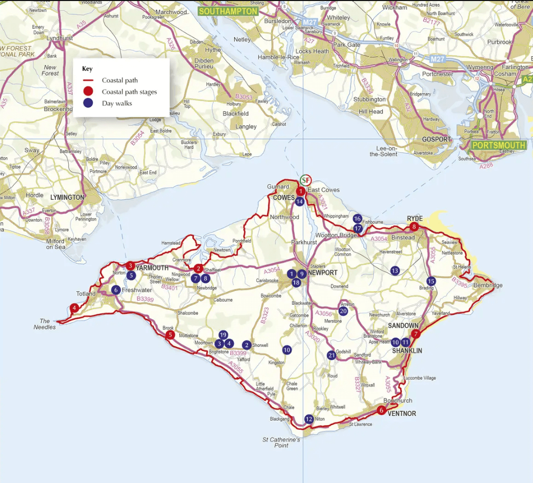
Yarmouth - Cowes - Ventnor / 33 Walking routes
Korte omschrijving
Wandelgidsen Isle of White, Engeland en South East England van CICERONE Press. Ideaal voor tochten in England.
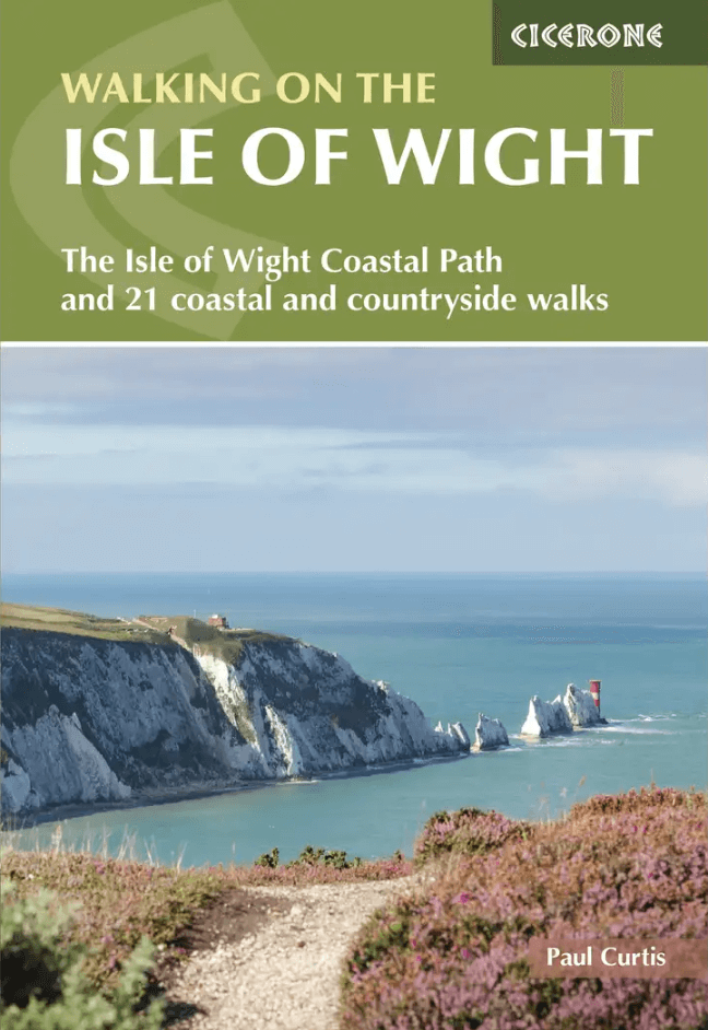
Wandelgids Isle of Wight - Cicerone Productomschrijving: Guidebook to 33 walking routes on the beautiful Isle of Wight, from 4 to 18 miles long. The routes are suitable for all abilities and...

Specificaties
- Uitgever: CICERONE Press
- ISBN-13: 9781786312563
- HOOFDCATEGORIEËN: Wandelgids
- Activiteiten: Wandelen, Hiking & Trekking
- Auteur: Paul Curtis
- Regio: Isle of White, Engeland, South East England
- Land: England
- AONB - Area of Outstanding Beauty/National Landscape: Isle of Wight, AONB (half the Island)
- Editie: 3
- Taal: Engels
- De Griekse Eilanden: Isle of White
- Grote Eilanden: Isle of White, Ierse zee
Volledige omschrijving
Wandelgids Isle of Wight - Cicerone
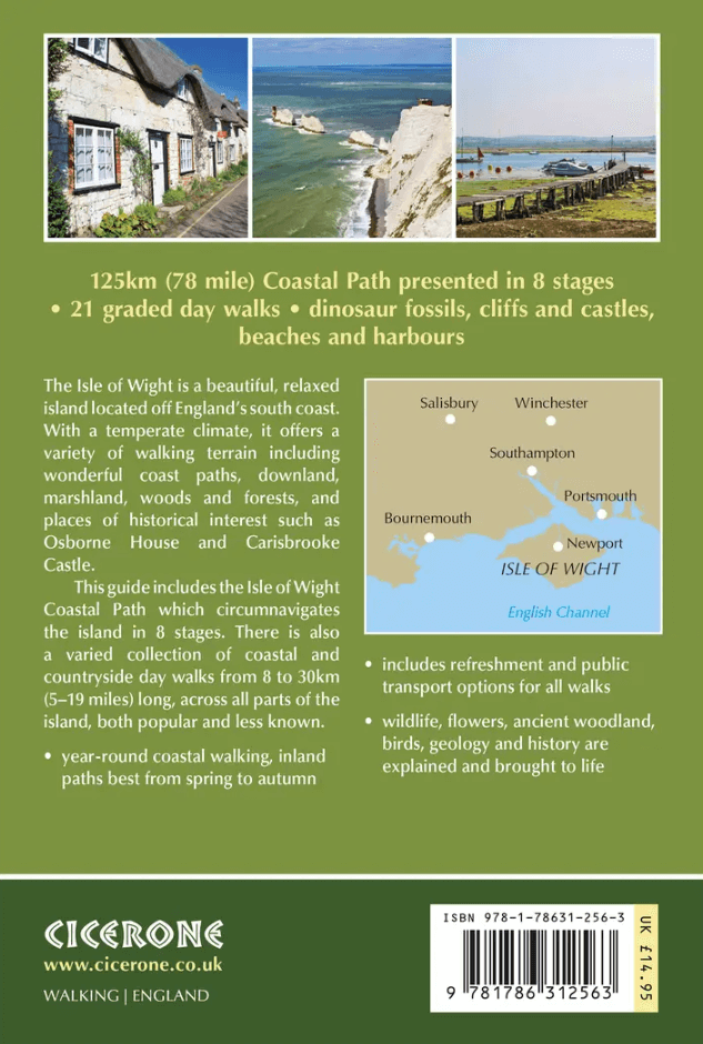
Productomschrijving: Guidebook to 33 walking routes on the beautiful Isle of Wight, from 4 to 18 miles long. The routes are suitable for all abilities and are accessible all year round. Includes a complete circuit of the island's spectacular coast as well as walks exploring forest trails and downland, and visiting the towns of Yarmouth, Cowes and Ventnor.
Seasons:
The climate is more temperate than on the mainland. Late spring to autumn perfect for inland walks, coastal path quite appropriate for winter (wildness, drama….) Some inland walks can be very muddy in winter.
Centres:
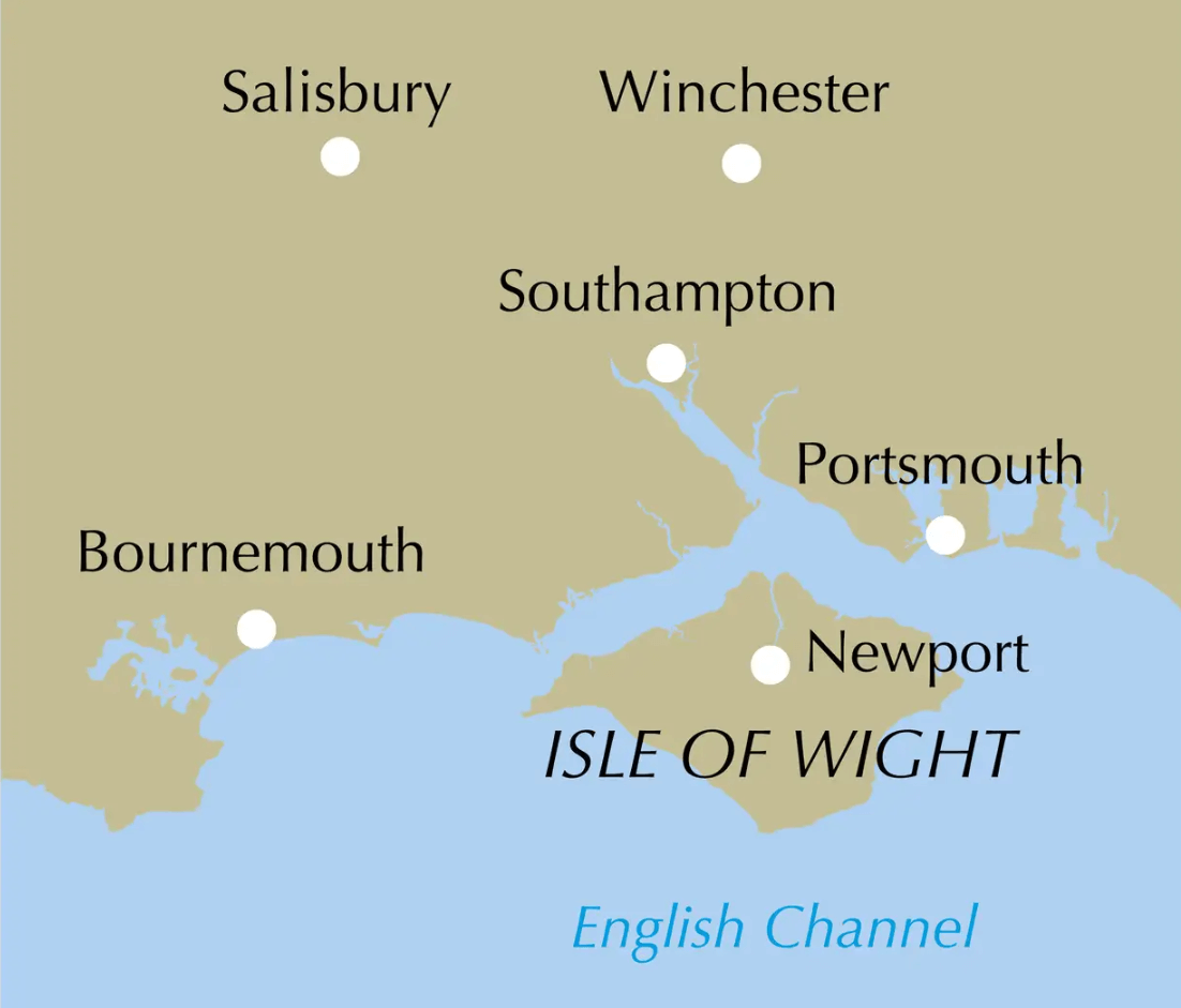
Sandown, Shanklin, Ventnor, Godshill, Ryde, Yarmouth, Newport.
Difficulty:
Walks graded from 'easy' up to 'moderate-strenuous'. Even children can do walks marked 'easy' (at discretion of parents) but optimum user of the book would be adult of at least average fitness. No special equipment needed for any walk.
Must See:
Magnificent and very varied Coastal Path, St Catherine's Lighthouse, constant outstanding views, dinosaur fossils on Compton Bay, red squirrels, honey-pot villages with cosy pubs, Carisbrooke Castle, Ventnor (beautiful with its own microclimate), beaches, under-explored gems like lonely Newtown Harbour... Over half the island is an Area of Outstanding National Beauty. Tennyson connection.
Artikelen uit dezelfde regio

Wandelkaart 135 Ashdown Forest Royal Tunbridge Wells - OSI • 9780319470077
Wandelkaart Ashdown Forest- Royal Tunbridge Wells - Kent England Productbeschrijving: Kaart nummer 135 in de OS Explorer kaarten reeks omvat Ashdown Forest, Royal Tunbridge Wells, East Grinstead, Haywards Heath, Crowborough, Uckfield, Heathfield en de High Weald. De OS Explorer kaart voor Ashdown Forest is beschikbaar in zowel als de standaard papieren versie en weerbestendige 'Actief' ve…

Wandelkaart 186 Aldershot & Guildford - England - OSI • 9780319475096
Wandelkaart Aldershot & Guildford- Camberley - Hampshire Productbeschrijving: Kaart nummer 186 OS Landranger kaarten reeks, is perfect voor het plannen van daguitstapjes in het gebied rond Aldershot en Guildford. Hier valt veel te doen en te zien, zoals de fantastische winkels in Guildford of wandelingen in de Noord-Downs. Hoogtepunten van het gebied: The North Downs Way, Guildford, Alton …
Wandelgids Hampshire & Isle of Wight - 50 walks - AA Publishing • 9780749583248
Wandelgids Hampshire & Isle of Wight - AA Productomschrijving: De Isle of White is bekend voor zijn natuur in open zee, daarenboven bevat dit eiland zijn eigen AONB, of Area of Outstanding Natural Beauty, of bij ons gekend als gebied van uitmuntend natuurschoon. Engelse omschrijving: Walking is one of Britain's favourite leisure activities, and AA 50 Walks in Hampshire & Isle of Wight …

Wandelkaart South Downs Way - Vertebrate Publ. • 9781839810305
Wandelkaart South Downs Way - Vertebrate Productomschrijving: Easy-to-use folding map and essential information, with custom itinerary planning for walkers, trekkers, fastpackers and trail runners The South Downs Way Guidemap from Vertebrate Publishing is a lightweight, waterproof, durable and easy-to-use folding map with 1:40,000-scale mapping for the linear SDW route. Includes an elevati…

Wandelgids 084 Pathfinder Berkshire- Buckinghamshire- Oxfordshire • 9780319092279
Wandelgids Berkshire- Buckinghamshire- Oxfordshire Productomschrijving: This all-new Pathfinder® Guide covering the ceremonial counties of Berkshire, Buckinghamshire and Oxfordshire features 28 outstanding circular walks across all three counties, offering more wonderful Pathfinder® routes in the south-central Midlands between the Cotswolds (PF 6 Cotswolds) and the Chilterns (PF 25 Thames…