

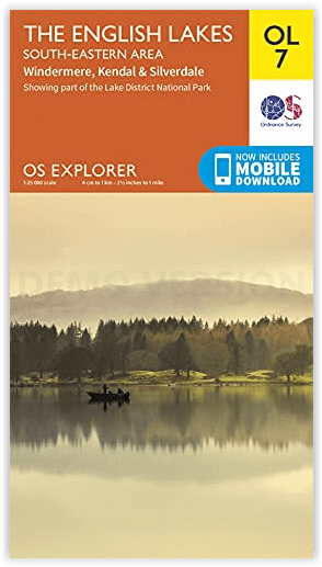
Wandelkaart OL07 English Lakes South Eastern area - OSI
Windermere- Kendal & Silverdale
Korte omschrijving
Wandelkaarten South East England en English Lakes, South Eastern England van Ordnance Survey. Ideaal voor tochten in England.
Wandelkaart English Lakes - South Eastern area - OSI Productomschrijving: De zuidoostelijke hoek van Lakeland is de thuisbasis van enkele van de bekendste plaatsen en steden van de regio. La...

Specificaties
- Uitgever: Ordnance Survey
- ISBN-13: 9780319475874
- HOOFDCATEGORIEËN: Wandelkaart
- Activiteiten: Wandelen, Hiking & Trekking
- Regio: English Lakes, South Eastern England, South East England
- Land: England
- Waterafstotende kaart: Ordnance Survey ACTIVE Explorer Weatherproof Maps
- Nationale parken: Lake District NP, Cumbria England, Yorkshire Dales NP, England
- TOPO's & Stafkaarten: Topografisch wandelen
- AONB - Area of Outstanding Beauty/National Landscape: Arnside AONB, Forest of Bowland AONB
- Schaal: 1:25000
- Taal: Engels
- Reeks/Serie: Explorer ACTIVE Series OSI
Volledige omschrijving
Wandelkaart English Lakes - South Eastern area - OSI
Productomschrijving: De zuidoostelijke hoek van Lakeland is de thuisbasis van enkele van de bekendste plaatsen en steden van de regio. Lake Windermere - met een lengte van maar liefst 10,5 mijl - is het grootste van de Engelse meren en een perfecte plek voor allerlei watersporten en wandelingen langs het meer. Mis de kans niet om het uitzicht over het meer en de bergen vanaf Orrest Head in u op te nemen.
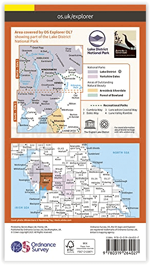
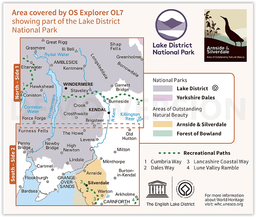
De OS Explorer OL7 helpt u uw weg te vinden langs het eerste deel van de Dales Way Walk. Hij brengt je naar het historische stadje Kendal, waar de energiereep staat die Hilary hielp de Everest te bedwingen. En hij leidt u naar het buitengewone Arndale en Silverside, een gebied van buitengewoon natuurschoon. Van varen bij Bowness tot paardrijden bij Rydal Water, er is geen betere gids voor Zuidoost-Lakeland dan de OS Explorer OL7.
Omvat: Windermere, Orrest Head, The Dales walk, Kendal, Shap Fells, and Silverdale.
Ectra, recreational paths:
- Cumbria Way - Dales Way - Lancashire Coastal Way - Lune Valley RambleEngelse omschrijving: The south eastern corner of Lakeland is home to some of the best-known sites and towns of the region. Lake Windermere – lying across the countryside at a staggering 10.5 miles long – is the largest of the English Lakes and a perfect spot for all kinds of water sports and lakeside rambling. Don’t miss the chance to take in the view of the lake and mountains, from Orrest Head.
The OS Explorer OL7 will help you find your way along the first part of the Dales Way Walk. It’ll take you to the historic town of Kendal, home of the energy bar that helped Hilary conquer Everest. And it will guide you to out-of-this-world Arndale and Silverside, an Area of Outstanding Natural Beauty. From boating by Bowness to riding by Rydal Water, there’s no better guide to South East Lakeland than the OS Explorer OL7.
Highlights of the area include: Windermere, Orrest Head, The Dales walk, Kendal, Shap Fells, and Silverdale.
Artikelen uit dezelfde regio

Wandelkaart 144 Basingstoke Alton & Whitchurch- Hampshire • 9780319470169
Wandelkaart Basingstoke- Alton & Whitchurch - Hampshire England Omvat ook: Odiham, Overton & Hook. Productbeschrijving: Kaart nummer 144 in de OS Explorer kaarten reeks heeft betrekking op een gebied in het noorden van Hampshire, van Whitchurch in het westen tot Odiham en Alton in het Oosten, en betrekken de stad van Basingstoke. De Wayfarer's walk kruist de North Wessex Downs, een geb…

Wandelkaart 186 Aldershot & Guildford - England - OSI • 9780319475096
Wandelkaart Aldershot & Guildford- Camberley - Hampshire Productbeschrijving: Kaart nummer 186 OS Landranger kaarten reeks, is perfect voor het plannen van daguitstapjes in het gebied rond Aldershot en Guildford. Hier valt veel te doen en te zien, zoals de fantastische winkels in Guildford of wandelingen in de Noord-Downs. Hoogtepunten van het gebied: The North Downs Way, Guildford, Alton …

Wandelkaart 135 Ashdown Forest Royal Tunbridge Wells - OSI • 9780319470077
Wandelkaart Ashdown Forest- Royal Tunbridge Wells - Kent England Productbeschrijving: Kaart nummer 135 in de OS Explorer kaarten reeks omvat Ashdown Forest, Royal Tunbridge Wells, East Grinstead, Haywards Heath, Crowborough, Uckfield, Heathfield en de High Weald. De OS Explorer kaart voor Ashdown Forest is beschikbaar in zowel als de standaard papieren versie en weerbestendige 'Actief' ve…
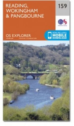
Wandelkaart 159 Reading- S.E. England - OSI • 9780319243527
Wandelkaart Reading - South East England Omvat ook: Wokingham & Pangbourne Productbeschrijving: Kaart nummer 159 in de OS Explorer reeks beslaat een gebied rond Reading, met inbegrip van delen van de North Wessex Downs AONB en Chilterns AONB, gebieden of Outstanding Natural Beauty AONB. Het Thames Path National Trail loopt over in het bovenste gedeelte van de kaart last Pangbourne en R…

Wandelkaart 170 Abingdon- Wantage & Vale - OSI • 9780319470428
Wandelkaart Abingdon- Wantage & Vale - Oxfordshire England Omvat ook: Wallingford & Faringdon. Productbeschrijving: Kaart nummer 170 in de OS Explorer kaarten reeks heeft betrekking op The Vale of the White Horse, en het paard zelf in Uffington, North Wessex Downs AONB, een verzameling van grote Westenlijke bossen en een klein deel van de Chiltern Hills AONB. Ook zijn de nederzettingen…