
Wandelgids Hadrian's Wall Path - Trailblazer
Wallsend op de East coast van Engeland tot Bowness-on-Solway

Korte omschrijving
Hadrian's Wall Path 135 km - Trailblazer Productomschrijving: Hadrian's Wall Path is een lange-afstandwandelroute in het noorden van Engeland. De route loopt voor 135 km van Wallsend op de E...

Specificaties
- Uitgever: Trailblazer Publications
- ISBN-13: 9781912716371
- HOOFDCATEGORIEËN: Wandelgids
- Activiteiten: Wandelen, Hiking & Trekking
- Auteur: Henry Stedman
- Regio: Cumbria & Lake District, England, Northumberland, Engeland
- Land: England
- Historische wandelroutes: Hadrian's Wall path (135 km)
- Lange afstand wandelroutes: Hadrian's Wall path (135 km)
- UNESCO werelderfgoed: Hadrian's Wall Path (135 km)
- Editie: 7
- Taal: Engels
Volledige omschrijving
Hadrian's Wall Path 135 km - Trailblazer
Productomschrijving: Hadrian's Wall Path is een lange-afstandwandelroute in het noorden van Engeland. De route loopt voor 135 km van Wallsend op de East coast van Engeland tot Bowness-on-Solway op de West kust. Voor het meeste van de route loopt het pad dicht bij Hadrian's Wall, die de defensieve muur omvat die gebouwd werd door de Romeinen op de noordelijke grens van hun rijk. Deze route wordt nu herkent als "Frontiers of the Roman Empire" en een World Heritage Site van Het Unesco gebueren?
New two-way edition with routes rewalked from Bowness-on-Solway to Wallsend (Newcastle) and Wallsend (Newcastle) to Bowness-on-Solway
(British Walking Guide)
244 pages,
59 trail maps + 8 town plans
40 colour photos + 4pp colour flower guide
Features:
1. Unique mapping features – In many walking guides the reader has to read a route description then try to relate it to the map. Our guides are easier to use because walking directions, tricky junctions, places to stay and eat, points of interest and walking times are all written onto the maps themselves in the places to which they apply. With their uncluttered clarity, these are not general-purpose maps but fullyedited maps drawn by walkers for walkers. Downloadable GPS waypoints also included.
2. The largest scale walking maps available – At just under 1:20,000 (8cm or 31/8 inches to 1 mile) our maps are bigger than even the most detailed walking maps currently available in the shops.
3. An all-in-one guide – Trailblazer guides include practical information not usually found in walking guides to the UK: reviews of places to stay, places to eat, attractions along the way and detailed public transport information showing all access points on the path, for weekend and day walkers.
4. Re-researched and rewritten two-way 6th edition – with routes rewalked from Bowness-on-Solway to Wallsend (Newcastle) and Wallsend (Newcastle) to Bowness-on-Solway. As with the new edition of Offa’s Dyke Path, we’ve given this book the full two-way treatment to make it easier to use in either direction.
Overzichtskaarten
Hystorische wandel- en fietsroutes
Hystorische wandel- en fietsroutes

Producten op de overzichtskaart
Klik op een product om naar de detailpagina te gaan.
- Wandelkaart - South Downs Way - Harvey maps
- Wandelgids - North Yorkshire historic walks - Cicerone
- Wandelkaart OL13 - Brecon Beacons NP - Eastern area - OSI
- Wandelgids - Pilgrim Pathways walking guide - Trailblazer
- Wandelgids - The Great Glen Way - Trailblazer
- Wandelgids - Hadrian's wall Path - Knife Edge
- Wandelgids - Hadrian's Wall Path - Trailblazer
- Wandelkaart XT40 - Offa's Dyke Path - Harvey Maps
- Wandelkaart OL43 - Hadrian's Wall - OSI
- Wandelkaart 351 - Dunbar & North Berwick- Schotland - OSI
- Wandelgids - Walking in the Forest of Dean - Cicerone
- Wandelkaart 130 - Salisburry & Stonehenge- Wiltshire - OSI
- Wandelkaart 256 - Wrexham- Wrecsam & Llangollen - OSI
- Wandelkaart 130 - Salisbury & Stonehenge- Wiltshire - OSI
- Wandelgids - John Muir Trail - Cicerone
- Wandelkaart - Rob Roy Way National trail - Harvey maps
- Wandelkaart - Hadrian's Wall Path - Harvey maps
- Wandelkaart - Offa's Dyke Path- Route Map Booklet - Cicerone
Artikelen uit dezelfde regio

Fietsgids Bikepacking in the Lake District - Cicerone • 9781786311177
Bikepacking in the Lake District - Cicerone Productomschrijving: Bikepacking is het off-road equivalent van fietstochten en biedt vaak de mogelijkheid om wild te kamperen naast de gebruikelijke overnachtingsmogelijkheden: het belooft een ongeëvenaarde kans om jezelf onder te dompelen in de omgeving terwijl je het beste van wat het gebied te bieden heeft op twee wielen verkent. Deze gids pr…

Wandelgids The Big Rounds - Cicerone • 9781852847722
Wandelgids - The Big Rounds - Cicerone Productomschrijving: Deze inspirerende gids kijkt naar elk van de 19 nationale routes in het Verenigd Koninkrijk, met informatie die vergelijkings- en contrastgemak mogelijk maakt, waardoor u wordt geïnspireerd om meer te weten te komen en een uitdaging op lange afstand aan te gaan. Sommige paden zijn kort en gemakkelijk, anderen veel langer, en veel …
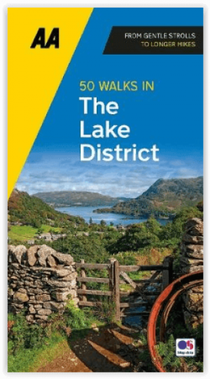
Wandelgids Lake District A 50 walks guide - AA Publishing • 9780749583255
Lake District - A 50 walks guide - AA Publishing Productomschrijving: Wandelen is een van de favoriete vrijetijdsbestedingen van Groot-Brittannië. Deze AA 50 Walks in the Lake District National Park bevat een verscheidenheid aan uitgestippelde wandelingen van twee tot tien mijl, geschikt voor alle niveaus. Het boek bevat alle praktische details die je nodig hebt, vergezeld van boeiende ach…
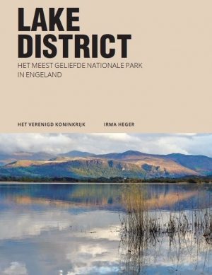
Reisgids The Lake District - Edicola • 9789492920621
Reisgids - The Lake District - Edicola Productomschrijving: Leuke wandelroutes, pittoreske dorpjes, adembenemende vergezichten, ambachtelijke etenswaren en dranken, ruige bergtoppen, sprankelende meren, watervallen en beekjes. Verken het meest populaire nationale park van Engeland, ga ‘off the beaten track’ en creëer herinneringen voor de rest van je leven. Zwemmen in een verlaten bergmeer…
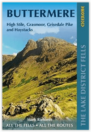
Wandelgids Lake District Fells - Buttermere - Cicerone • 9781786310361
Wandelgids - Lake District Fells - Buttermere - Cicerone Productomschrijving: Deze gids omvat een deel van de Lake District Fells series, met ongeveer 32 summits die kunnen beklommen worden vanuit Buttermere, Lorton & Newlands valley, met hoogtepunten als Haystacks, High Stile, Grasmoor & the fells of the Coledale Round. suggesties voor langere routes staan inbegrepen voorgesteld Prod…