

Landkaart Wegenkaart 502 Engeland Noord & Midlands - Michelin
De Michelin Reginonale Wegenkaarten voor England & the Midlands


Korte omschrijving
Regionale Wegenkaart Noord Engeland & the Midlands Productomschrijving: De volledig bijgewerkte MICHELIN-kaart van Engeland Noord, Midlands geeft u alle WEG- EN TOERISME-informatie die u no...

Specificaties
- Uitgever: Michelin
- ISBN-13: 9782067183230
- HOOFDCATEGORIEËN: Wegenkaart - Landkaart
- Activiteiten: Street/Road maps & city plans
- Regio: Midlands, England, Noord Engeland
- Land: England
- Schaal: 1:400000
- Taal: Engels, Frans
- Reeks/Serie: Michelin Local, Regionaal
Volledige omschrijving
Regionale Wegenkaart Noord Engeland & the Midlands
Productomschrijving: De volledig bijgewerkte MICHELIN-kaart van Engeland Noord, Midlands geeft u alle WEG- EN TOERISME-informatie die u nodig hebt om uw reizen in deze regio te optimaliseren: een INDEX VAN LOCATIES, een TABEL VAN AFSTANDEN en REISTIJDEN. Dankzij de schaal van 1:400.000 (1 cm = 4 km) kun je zowel de hoofdwegen als de kleinere wegen gemakkelijk zien. Om je wegwijs te maken in de steden kun je de plattegronden van Birmingham, Leeds, Manchester en Liverpool bekijken.
En vergeet de MICHELIN Groene Gids Engeland Wales niet. Met MICHELIN kaarten en atlassen, vindt u meer dan alleen uw route!

Locatie op kaart
Overzichtskaarten

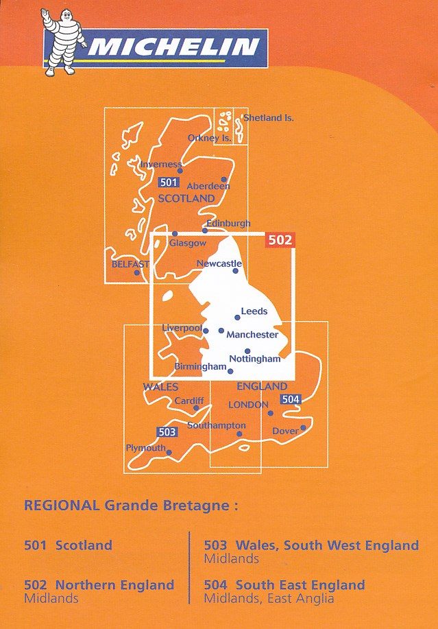
Michelin Wegenkaart Regionaal UK - 501 - 504 - 1.400.000
Michelin Wegenkaart Regionaal UK - 501 - 504 - 1.400.000
Producten op de overzichtskaart
Klik op een product om naar de detailpagina te gaan.
Artikelen uit dezelfde regio
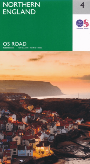
Landkaart Wegenkaart 4 Engeland Noord - OSI • 9780319263761
Wegenkaart Noord Engeland - OSI Productomschrijving: Plan your journey with this series of road maps from OS. Showing all major road, rail and ferry links as well as settlements and selected features in 1: 250 000 scale, this is the ideal map for planning trips and holidays by car or cycle. OS Road 4 covers: Northern England, including the Lake District, North York Moors Liverpool and…

Wandelgids White Peak walks Southern Dales - Cicerone • 9781852845186
Wandelgids - White Peak walks Southern Dales - Cicerone Productomschrijving: Deze gids gaat over wandelen in de zuidelijke dales van de witte piekoppervlakte van het Peak District, tussen Ashbourne, Matlock, Buxton en Leek. 30 gemakkelijke circulaire routes doorsteken de hoge plateau en volgen de Dove, Manifold en Hamps rivieren door de dales in het UK's eerste Nationaal Park. Eén van twee…
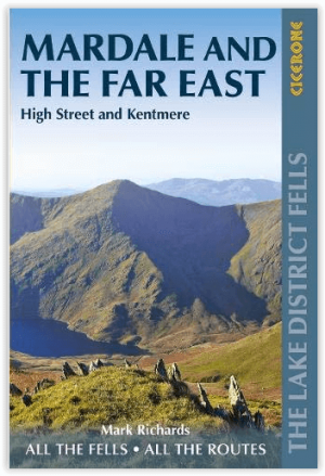
Wandelgids Mardale and the Far East - Cicerone • 9781786310354
Wandelgids - Mardale and the Far East - Cicerone Productomschrijving: Deze gids maakt deel uit van de serie "Walking the Lake District Fells" en behandelt een breed scala aan routes naar 36 Lakeland-toppen die kunnen worden beklommen vanuit de valleien van Ullswater, Haweswater, Troutbeck, Kentmere en Longsleddale, met hoogtepunten zoals High Street, Place Fell en Kentmere fells. Suggestie…
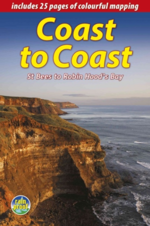
Wandelgids The Wainwright route - Rucksack readers • 9781898481829
Wandelgids - The Wainwright route- coast tot coast walking Productomschrijving: This challenging walk of 184 miles (296 km) crosses the north of England from St Bees on the Cumbria coast to Robin Hood’s Bay on the North Sea. It passes through three National Parks – the Lake District, Yorkshire Dales and North York Moors – with splendidly varied scenery. Many walkers complete it within 12 t…
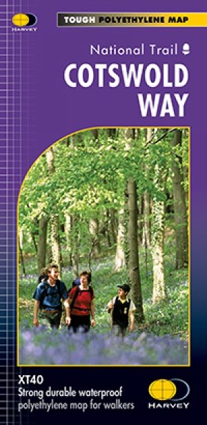
Wandelkaart Cotswold Way - Harvey maps • 9781851374182
Wandelkaart Cotswold Way - Chipping Campden to Bath - Harvey maps Productomschrijving: Toont de gehele 166km (103miles) van The Cotswold Way, door de Cotswolds van Chipping Campden naar Bath, Broadway, Winchcombe, Stroud, Wooton-under-Edge en Chipping Sodbury passeren. Informatie over het vinden van accommodatie, camping, voedsel. Routebeschrijving naar het begin. Ook Ranger Service en…