

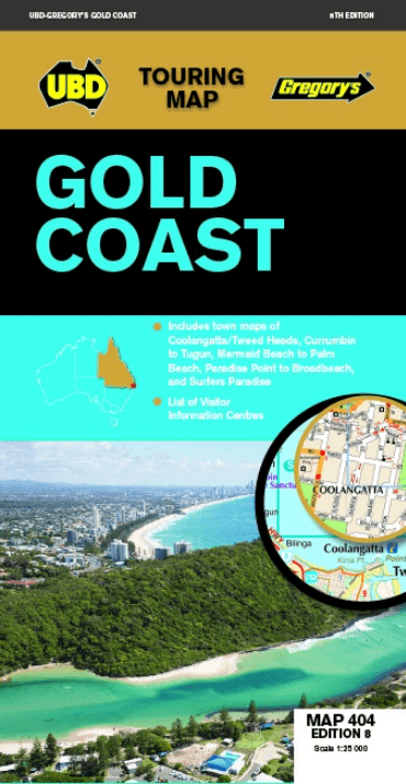
Landkaart Wegenkaart 404 Gold Coast Queensland - UBD Gregory's
Stradbroke Island- Bogangar NSW- Beaudesert- Beenleigh
Korte omschrijving
Wegenkaart Gold Coast Queensland - UBD Gregory's Productomschrijving: Gold Coast region map at a scale of 1 : 160 000 covering along the coast from South Stradbroke Island in the north to Bo...

Specificaties
- Uitgever: UBD Gregory's Universal Publishers
- ISBN-13: 9780731932023
- HOOFDCATEGORIEËN: Wegenkaart - Landkaart
- Activiteiten: Street/Road maps & city plans
- Regio: Queensland, Noord-Oost Australië
- Land: Australië
- Schaal: 1:25000
- Editie: 8
- Taal: Engels
- De Australische Regio's: Queensland
Volledige omschrijving
Wegenkaart Gold Coast Queensland - UBD Gregory's
Productomschrijving: Gold Coast region map at a scale of 1 : 160 000 covering along the coast from South Stradbroke Island in the north to Bogangar NSW in the south & Beaudesert in the west, Beenleigh in the north & Murwillumbah NSW in the south.
- Region map at a scale of 1 : 450 000 covering along the coast from Sandgate in the north to Casuarina NSW in the south & Toowoomba & Warwick in the west, Fernvale in the north & Rathdowney in the south plus an index to towns.
- Street level mapping at a scale of 1 : 25 000, 1 : 18 000 & 1: 15 000 for Runaway Bay to Broadbeach, Mermaid Beach to Palm Beach, Currumbin to Tugun, Coolangatta Tweed Heads & Surfers Paradise.
- Attractions & highlights.
- Visitor Information Centres.
- Ideal for use when touring the Gold Coast.
Artikelen uit dezelfde regio

Landkaart Wegenkaart Great Desert Tracks Simpson Desert - Hema • 9781922668073
Wegenkaart Great Desert Tracks Simpson Desert - Hema Productomschrijving: Great Desert Tracks Simpson Desert (9th edition) - discover the Simpson Desert with detailed mapping, relevant points of interest and essential touring information for the journey. Hema's Great Desert Tracks maps are essential for anyone travelling in the Australian outback. The mapping features roads and 4WD tr…

Landkaart Wegenkaart Queensland state handy - Hema • 9781922668776
Wegenkaart Queensland state handy - Hema Productomschrijving: A compact map of Queensland (QLD) at a scale of 1:2,500,000 for touring throughout the state which features highways, major roads and minor roads. Marked on the map are national parks, camping areas, caravan parks, rest areas, points of interest and 24-hour fuel accompanied by a distance grid and an index.

Landkaart Wegenkaart Frasereiland (K'gari) Queensland Australia • 9781922668783
Landkaart Frasereiland (K'gari) Queensland Australia - Hema Productomschrijving: Deze omvat het grootste zandeiland ter wereld! Fraser Island (K'gari) is one of the most diverse 4WD destinations in Australia, with beaches, rainforests, perched lakes, sand blows, and more fitting into the world’s largest sand island. The mapping is highly detailed (1:130,000), with 4WD tracks field che…

Landkaart Wegenkaart 43 South East Queensland - UBD Gregory's • 9780731932924
Wegenkaart South East Queensland - UBD Gregory's Productomschrijving: The latest edition of the South Eastern Queensland map has been fully revised and updated and includes regional coverage from Murgon, Gympie and Double Island Point in the north, Tenterfield and Evans Head (NSW) in the south, Columboola in the west and east along the coast from Double Island Point to Evans Head. There i…

Stadsplattegrond Brisbane City Streets & Suburbs - UBD Gregory's • 9780731933303
Stadskaart Brisbane City Streets & Suburbs - UBD Gregory's Productomschrijving: The latest edition of the Brisbane City Streets and Suburbs city map has been fully revised and updated and includes detailed street level mapping and a suburbs and localities index for Brisbane and surrounding suburbs at a scale of 1: 25 000 with coverage north to Zillmere, south to Sunnybank, east to Tingalp…