Fietskaart Mountainbikekaart Dartmoor NP- Devon - Goldeneye
Dartmoor national park verkennen op de mountainbike - 10 routes
Korte omschrijving
Mountainbikekaart Dartmoor NP - Goldeneye Productomschrijving: Dartmoor national park verkennen op de mountainbike, met deze waterdichte Dartmoor kaart. Deze gebruiksvriendelijke kaart met 1...

Specificaties
- Uitgever: Goldeneye
- ISBN-13: 9781859652701
- HOOFDCATEGORIEËN: Fietskaart
- Activiteiten: Fietsen / VTT / MTB
- Regio: Devon, England
- Land: England
- Nationale parken: Dartmoor NP, Devon England
- Editie: 3
- Taal: Engels
Volledige omschrijving
Mountainbikekaart Dartmoor NP - Goldeneye
Productomschrijving: Dartmoor national park verkennen op de mountainbike, met deze waterdichte Dartmoor kaart. Deze gebruiksvriendelijke kaart met 10 routes neemt u mee van de gebaande paden en helpt u de beste trails van Dartmoor te ontdekken.
Elke route is gekozen voor zijn algemene kwaliteit - een vaste overtuiging dat fietsen is om te rijden, het opnemen van technische moeilijkheden omwille van zichzelf, of te veel duwen of dragen, werd zoveel mogelijk vermeden.
De routes zijn als volgt samengesteld: Gemakkelijk - Bijna vlakke routes, meestal rond de 10 mijl in lengte en op een goede ondergrond die in alle omstandigheden, behalve extreme, 100% berijdbaar moet zijn.
Engelse omschrijving: Explore Dartmoor national park by bike, with this waterproof Dartmoor map. With 10 circular touring routes, this easy-to-use cycling map will take you off the beaten track and help you discover the best trails on Dartmoor.
Each route has been chosen for its overall quality - a firm belief that bikes are for riding, the inclusion of technical difficulty for its own sake, or too much pushing or carrying, has been avoided wherever possible. The routes are made up as follows: Easy - Almost flat routes, usually around 10 miles in length and on good surfaces that in all but extreme conditions should be 100% rideable.
With easy navigation and any real climbs on tarmac, these are particularly suitable for beginners or family groups. Moderate - More challenging routes, generally of 12 to 15 miles over more undulating terrain and varied surfaces (possibly including mud when wet). More exciting downhills, and steeper climbs may need the occasional push. More strenuous - Possibly longer routes with significant ascents which will certainly need pushing or carrying. Steep and/or technical, and rough and rocky descents. May cross high, remote moorland, requiring appropriate equipment and experience Here's a collection of superbly varied and rideable routes to help you discover the best of Dartmoor by bike.
Locatie op kaart
Artikelen uit dezelfde regio

Wandelgids Walking the Dartmoor way - Cicerone • 9781786311153
Walking the Dartmoor way - Cicerone Productomschrijving: Een gloednieuwe wandelgids van Cicerone over het wandelen van de befaamde Dartmoor Way, een bewegwijzerde wandelroute van 175 km (109 mijl) langs de rand van het prachtige Dartmoor NP in Devon. De route bestaat uit 10 etappes (plus de High Moor Link die kan worden gebruikt om twee kortere lussen te maken) en voert langs beboste valle…

Wandelkaart OL44 Torquay, Dawlish & Newton Abbot - OS • 9780319242834
Wandelkaart Torquay, Dawlish & Newton Abbot - OS Productomschrijving: parts of Dartmoor National Park & Parts of the South West Coast Path. Omvat: Torquay, Dawlish & Newton Abbot, E9 European Coastal Path, East Devon Way, Exe Valley Way, John Musgrave Heritage Way, Parts of the South West Coast Path SWCP, Templer Way & The Torbay-Totnes trail. Ontdek de OL-serie van Ordnance Surve…

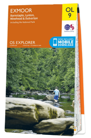
Wandelkaart OL09 Exmoor NP Devon England - OS • 9780319242483
Wandelkaart Exmoor NP Devon England - OS Productomschrijving: Exmoor National Park, Devon England Omvat: Exmoor National Park, Devon England, Barnstaple, Lynton, Minehead & Dulverton. Ontdek de OL-serie van Ordnance Survey: De OL-serie (Outdoor Leisure) van Ordnance Survey is dé referentie voor wie gaat wandelen op de Britse eilanden. Deze topografische kaarten maken deel uit va…

Wandelkaart 202 Torbay & South Dartmoor - OSI • 9780319475829
Wandelkaart Torbay & South Dartmoor - OSI Productomschrijving: De Landranger kaart nummer 202 is een kaart voor alle doeleinden, boordevol informatie om u te helpen een gebied echt te leren kennen. Elke kaart bestrijkt een gebied van 40 km bij 40 km. Omvat ook: Totnes, Salcombe, Totcross, Brixham, Paignton, Torquay, Newton Abbot, Ivybridge, Holbeton, Cornwood, een deel van het Dartmoor…

Wandelgids 001 Pathfinder guides South Devon & Dartmoor NP - OS • 9780319090084
Wandelgids South Devon & Dartmoor NP - OS Productomschrijving: Each of the Pathfinder titles features 28 circular routes, all tried and tested by seasoned walkers. The routes range from extended strolls to exhilarating hikes, so there is something for everyone. 28 circular walks • Graded by length ranging from 3 to 12 miles • Clear, large scale Ordnance Survey maps • GPS referen…


