
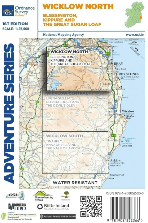
Wandelkaart Adventure Series Wicklow North - OSI
Blessington - Kippure - The great Sugar loaf

Korte omschrijving
Wandelkaarten Wicklow, Ireland, County Dublin, Ierland, County Kildare, Ireland en County Wicklow, Ireland van Ordnance Survey Ireland. Ideaal voor tochten in Ierland.
Wandelkaart Wicklow North - OSI Productomschrijving: This map is situated in south County Dublin, a small portion of County Kildare and north County Wicklow. A section of the southern e...

Specificaties
- Uitgever: Ordnance Survey Ireland
- ISBN-13: 9781908852366
- HOOFDCATEGORIEËN: Wandelkaart
- Activiteiten: Wandelen, Hiking & Trekking
- Regio: County Dublin, Ierland, County Kildare, Ireland, County Wicklow, Ireland, Wicklow, Ireland
- Land: Ierland
- Nationale parken: Wicklow National Park, Ireland
- Schaal: 1:25000
- Taal: Engels
- Reeks/Serie: Adventure Series, OSI
- De Nationale Parken: Wicklow Mountains National Park, Ireland
Volledige omschrijving
Wandelkaart Wicklow North - OSI
Productomschrijving: This map is situated in south County Dublin, a small portion of County Kildare and north County Wicklow.
A section of the southern end of the M50 is shown along with the M11/ N11. The N81 from Dublin to Blessington also features.
Wicklow North adventure map covers: the key towns of Blessington and Bray. Among the villages shown are Enniskerry and Newtownmountkennedy and Ballyknockan. Numerous mountains are shown including Mullaghcleevaun, Kippure, Djouce, Seefingan, Duff Hill, Gravale, Moanbane, War Hill, Carrigvore, Luggala or Fancy Mountain and the Great Sugar Loaf.
The River Liffey rises between Kippure and Tonduff and flows through the Pollaphuca Reservoir.The source of the Dargle River is between Tonduff North and War Hill. Other rivers shown are the Dodder River, the Vartry River, the Dargle River and the Glencree River. A feature of this map is the numerous brooks and among them are Slade Brook and Col Brook between Seefin Mountain and Kippure. Dealbog Brook, Boleyhemushboy Brook and Lugaculleen Brook are in the foothills of Mullaghcleevaun Mountain near Pollaphuca Reservoir.
Lough Bray Lower, Lough Bray Upper, Lough Tay, and the larger part of Pollaphuca reservoir and Glenasmole Reservoirs feature on the map. The Sally Gap features on this map along with part of Wicklow National Park.
The start of the Wicklow Way is shown on the map and also the start of Dublin Mountains Way.
Features of the area include a number of circular walks and routes and trails including Forest Loop, Hell Fire Wood, Massey’s Estate Nature Trail, Tibradden Trail, Tiknock Mountain Bike Trail, Barnasligan Trails, Lead Mines Way, Oak Glenn Loop Trail, Maulin Trail, Deerpark Trail, Kindlestown Trail, Ballinastoe Mountain Bike Trail, Slievethoul Lugg Loop and Saggart Hill Loop, and Blessington Greenway.
Two Discovery maps 1:50,000 also cover this area with sheet 50 covering a small section of the northern part of the map and sheet 56 covering the midsection and the southern part.
Gekoppelde artikelen
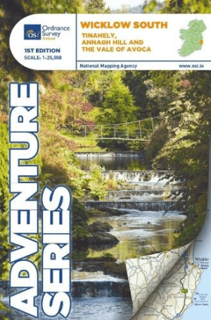
Wandelkaart Adventure Series Wicklow South - OSI • 9781908852380
standaard versieWandelkaart Wicklow South - OSI Productomschrijving: This map is situated in County Wicklow, County Carlow and County Wexford. Roads shown on this map include R752, R753, R747 and R748. A short portion of the M11 at Arklow is shown. The railway which runs through the Vale of Avoca to Arklow town is shown. Among the towns and villages shown on this map are Avoca, Aughrim, Arklow western sec…

Wandelkaart Adventure Series Wicklow Central - OSI • 9781908852373
standaard versieWandelkaart Wicklow Central - OSI Productomschrijving: The R756 and R755 are shown on the map along with the railway line running through Rathdrum. This map shows the towns and villages of Roundwood, Laragh, the Vale of Glendalough, Glenealy, Rathdrum, Ballyknockan and Hollywood. Lugnaquillia, the highest mountain in Wicklow, features on this map. Mullaghcleevaun is the second hig…
Artikelen uit dezelfde regio

Wandelkaart 62 County Carlow, Wexford & Wicklow - OSI • 9781912140664
Wandelkaart County Carlow, Wexford & Wicklow - OSI Productomschrijving: Ontdek Ierland met de Discovery Series Wandelkaarten van Ordnance Survey Ireland. Omvat de Counties: Carlow, Wexford & Wicklow. De Discovery Series wandelkaarten van Ordnance Survey Ireland (OSi) zijn dé keuze voor wandelaars, fietsers en avonturiers die Ierland echt willen verkennen. Deze hoogwaardige topogra…

Wandelkaart 61 County Carlow, Kildare, Kilkenny, Laois & Wicklow - OSI • 9781912140114
Wandelkaart County Carlow, Kildare, Kilkenny, Laois & Wicklow Productomschrijving: Ontdek Ierland met de Discovery Series Wandelkaarten van Ordnance Survey Ireland. Omvat de Counties: Carlow, Kildare, Kilkenny, Laois & Wicklow. De Discovery Series wandelkaarten van Ordnance Survey Ireland (OSi) zijn dé keuze voor wandelaars, fietsers en avonturiers die Ierland echt willen verkennen…

Wandelkaart 50 County Dublin & Counties Kildare, Meath & Wicklow - OSI • 9781912140336
Wandelkaart Dublin & Counties Kildare, Meath & Wicklow - OSI Productomschrijving: Ontdek Ierland met de Discovery Series Wandelkaarten van Ordnance Survey Ireland. Omvat: Dublin zelf, & de Counties: Kildare, Meath & Wicklow De Discovery Series wandelkaarten van Ordnance Survey Ireland (OSi) zijn dé keuze voor wandelaars, fietsers en avonturiers die Ierland echt willen verkennen. D…
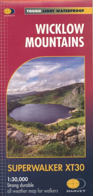
Wandelkaart XT30 Wicklow Mountains - Harvey Maps • 9781851376131
Wandelkaart - Wicklow Mountains XT30 - Harvey Maps Productomschrijving: De Wicklow Mountains zijn een bergketen in het zuidoosten van Ierland. Ze lopen van het noorden naar het zuiden, van County Dublin via County Wicklow naar County Wexford. Een van dit meer dan gekende gebied, zo'n 2800 hectare ervan, is beschermd natuurgebied, het Nationaal Park Wicklow Mountains. De Wicklow Way, een …

Wandelkaart 56 County Wicklow, Kildare & Dublin - OSI • 9781912140343
Wandelkaart County Wicklow, Kildare & Dublin - OSI Productomschrijving: Ontdek Ierland met de Discovery Series Wandelkaarten van Ordnance Survey Ireland. Omvat: de Counties Wicklow, Kildare & Dublin De Discovery Series wandelkaarten van Ordnance Survey Ireland (OSi) zijn dé keuze voor wandelaars, fietsers en avonturiers die Ierland echt willen verkennen. Deze hoogwaardige topograf…