

Waterafstotende kaart
TOPO's & Stafkaarten
Historische wandelroutes
Continent
Land
Taal
Lange afstand wandelroutes
Korte afstand wandelroutes
Nationale parken
Regionale parken
Uitgever


 Topografisch wandelen
Topografisch wandelen, hier spreken we eerder over Topografische kaarten. Topografische kaarten herkent u door de duidelijk hoogtelijnen die aanwezig over de ganse kaart heen. Zo worden dergelijke kaarten gebruikt om de hoogte te bepalen, maar ook om met kompas te werken, om het Noorden te gaan bepalen, en hun eigen wandelrichting te kunnen inschatten. topografische kaarten zijn talrijk bij Bibliotrek, zo worden alle IGN kaarten stilletjes aan vervangen door de ET en OT reeks die zowel de wandelroutes als de topografische informatie aantoont op de kaarten. Ga een kijkje nemen op de pagina die louter aan IGN is toegewijdt > IGN (ign-institut-geographique-national-france). Ook is onze eigen nationale cartograaf gekend voor dergelijke topografie > NGI (ngib-nationaal-geografisch-instituut-belgie). Bij Bibliotrek zijn eveneens de techniekgidsen te krijgen die u uitleggen hoe om te gaan met GPS, hoogtelijnen, navigatie dan in het algemeen, te vinden bij Techniekgidsen > Navigatie-techniek.


Wandelkaart 11-14 Camino Frances, Belorado > Boadilla - CNIG • 9788441615410
Wandelkaart Camino Frances, Belorado > Boadilla - CNIG Productomschrijving: Deel 5 van de bedevaart route Camino Frances die start St-jean-pied-de-Port, Omvat 4 kaarten met opeenvolgende etappes van de Camino de Santiago (Franse weg), van Belorado > Boadilla ETRS89-systeem compatibel met GPS. Opengevouwen formaat: 140 x 47 cm. Legenda: Frans, Engels, Duits, Italiaans, Portugees …
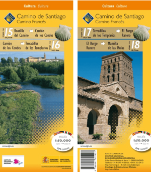
Wandelkaart 15-18 Camino Frances, Boadilla > Mansilla - CNIG • 9788441615427
Wandelkaart Camino Frances, Boadilla > Mansilla - CNIG Productomschrijving: Deel 6 van de bedevaart route Camino Frances die start St-jean-pied-de-Port, Omvat 4 kaarten met opeenvolgende etappes van de Camino de Santiago (Franse weg), van Boadilla > Mansilla ETRS89-systeem compatibel met GPS. Opengevouwen formaat: 140 x 47 cm. Legenda: Frans, Engels, Duits, Italiaans, Portugees …

Wandelkaart 19-22 Camino Frances, Mansilla > Rabanal - CNIG • 9788441615434
Wandelkaart Camino Frances, Mansilla > Rabanal - CNIG Productomschrijving: Deel 7 van de bedevaart route Camino Frances die start St-jean-pied-de-Port, Omvat 4 kaarten met opeenvolgende etappes van de Camino de Santiago (Franse weg), van Mansilla > Rabanal ETRS89-systeem compatibel met GPS. Opengevouwen formaat: 140 x 47 cm. Legenda: Frans, Engels, Duits, Italiaans, Portugees en…
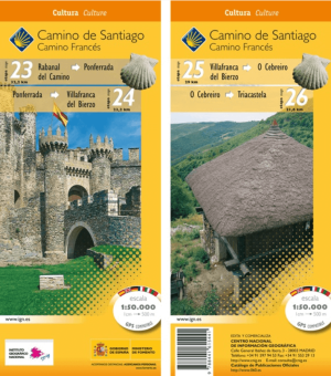
Wandelkaart 23-26 Camino Frances, Rabanal > Triacastela - CNIG • 9788441615441
Wandelkaart Camino Frances, Rabanal > Triacastela - CNIG Productomschrijving: Deel 8 van de bedevaart route Camino Frances die start St-jean-pied-de-Port, Omvat 4 kaarten met opeenvolgende etappes van de Camino de Santiago (Franse weg), van Rabanal > Triacastela ETRS89-systeem compatibel met GPS. Opengevouwen formaat: 140 x 47 cm. Legenda: Frans, Engels, Duits, Italiaans, Portug…
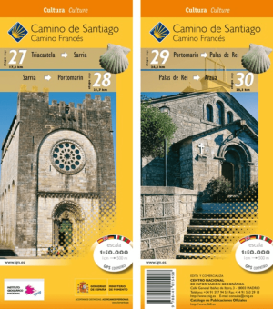
Wandelkaart 27-30 Camino Frances, Triacastela > Arzúa - CNIG • 9788441615458
Wandelkaart Camino Frances, Triacastela > Arzúa - CNIG Productomschrijving: Deel 9 van de bedevaart route Camino Frances die start St-jean-pied-de-Port, Omvat 4 kaarten met opeenvolgende etappes van de Camino de Santiago (Franse weg), van Triacastela > Arzúa ETRS89-systeem compatibel met GPS. Opengevouwen formaat: 140 x 47 cm. Legenda: Frans, Engels, Duits, Italiaans, Portugees …
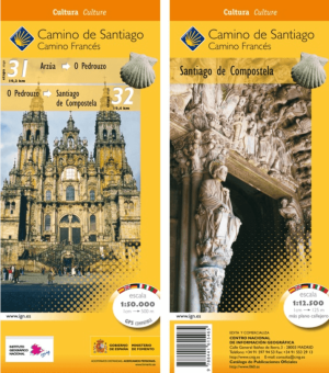
Wandelkaart 31-32 Camino Frances, Arzúa > Santiago - CNIG • 9788441615465
Wandelkaart Camino Frances, Arzúa > Santiago-de-Compostella Productomschrijving: Deel 10 van de bedevaart route Camino Frances die start St-jean-pied-de-Port, Omvat 4 kaarten met opeenvolgende etappes van de Camino de Santiago (Franse weg), van Arzúa > Santiago de Compostella ETRS89-systeem compatibel met GPS. Opengevouwen formaat: 140 x 47 cm. Legenda: Frans, Engels, Duits, Ita…

Landkaart Wegenkaart 3107 Puerto Rico Caraïben - Nat Geo • 9781566955188
Wegenkaart Puerto Rico Caraïben - Nat Geo Productomschrijving: Explore the rich history and many recreation activities available in this lovely island territory with National Geographic's Puerto Rico Adventure Map. Cities and towns are easy to identify and roadway designations are clearly indicated. Monuments and historical locations are noted in addition to a variety of sites for surfing…
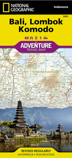
Landkaart Wegenkaart 3005 Bali- Lombok & Komodo - Nat Geo • 9781566955256
Wegenkaart Bali- Lombok & Komodo - Nat Geo Productomschrijving: Discover the natural beauty and exciting recreational opportunities available to travelers in Indonesia with National Geographic's Adventure Map of Bali, Lombok, and Komodo. This map includes the locations of thousands of towns and villages, plus a clearly marked road network complete with distances and designations for expre…

Landkaart Wegenkaart 3202 Egypte Noord Afrika - Nat Geo • 9781566955294
Wegenkaart Egypte Noord Afrika - Nat Geo Productomschrijving: Explore the extraordinary history and great mysteries of the cradle of civilization with National Geographic's Egypt Adventure Map. This expertly crafted map provides global travelers with the perfect combination of detail and perspective, highlighting hundreds of points of interest and the diverse and unique destinations withi…

Landkaart Wegenkaart 3109 Nicaragua, Honduras & El Salvador • 9781566955287
Wegenkaart Nicaragua, Honduras & El Salvador - Nat Geo Productomschrijving: Explore the heart of Central America with National Geographic's Nicaragua, Honduras, and El Salvador Adventure Map. Hundreds of points of interest are highlighted including national parks and reserves, World Heritage sites, archeological sites, churches, shipwrecks, castles, and more. This map includes the locatio…
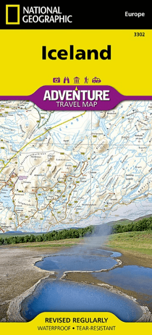
Landkaart Wegenkaart 3302 Ijsland - Nat Geo • 9781566955348
Wegenkaart Ijsland - Nat Geo Productomschrijving: Let National Geographic's Iceland Adventure Map guide you as you discover the pristine nature and unique scenery on this Nordic island. The expertly researched map, with its accurate and detailed information, is designed to meet the needs of adventure travelers. In addition to a clearly marked road network, with distances and destinations …

Landkaart Wegenkaart 3304 Italië - Nat Geo • 9781566955362
Wegenkaart Italië - Nat Geo Productomschrijving: National Geographic's Adventure Map of Italy is an invaluable tool for travelers seeking to explore the rich history, romance, and iconic landscapes of this remarkable country. Cities and towns are clearly indicated and easy to find in the user-friendly index. A road network complete with distances and designations for roads, motorways, exp…
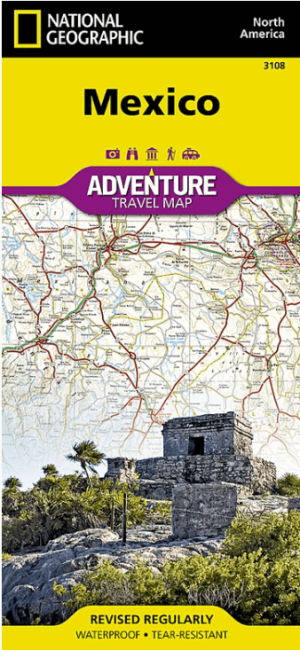
Landkaart Wegenkaart 3108 Mexico - Nat Geo • 9781566955270
Wegenkaart Mexico - Nat Geo Productomschrijving: With its rich cultural history, numerous ecosystems and vast biodiversity, Mexico is one of the most visited countries in the world. National Geographic's Mexico Adventure Map was created for adventure travelers with its unparalleled detailed and convenience. The north side of the map includes Tijuana and the Baja California peninsula, the …
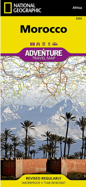
Landkaart Wegenkaart 3203 Adventure Map Morocco - Nat Geo • 9781566955300
Wegenkaart Morocco - Nat Geo Productomschrijving: National Geographic's Morocco Adventure Map provides global travelers with the perfect combination of detail and perspective, highlighting hundreds of points of interest and the unique and exotic destinations within the country. This expertly crafted map includes the locations of thousands of cities and towns with an index for easily locat…

Landkaart Wegenkaart 3306 Spanje Noord - Nat Geo • 9781566955386
Wegenkaart 3306 Noord Spanje - Nat Geo Productomschrijving: National Geographic's Northern Spain Adventure Map is designed to meet the unique needs of adventure travelers with its detailed, accurate information and user-friendly design. The map includes the locations of thousands of major cities and towns with an index for easily locating them, plus a clearly marked road network complete …
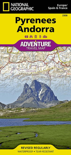
Landkaart Wegenkaart 3308 Pyreneeën & Andorra - Nat Geo • 9781566955409
Wegenkaart Pyreneeën & Andorra - Nat Geo Productomschrijving: National Geographic's Pyrenees and Andorra Adventure Map provides global travelers with the perfect combination of detail and perspective in a highly functional travel tool. This map includes the locations of cities and towns with a user-friendly index, plus a clearly marked road network complete with distances and designations…

Landkaart Wegenkaart 3301 Zweden Zuid & Noorwegen - Nat Geo • 9781566955331
Wegenkaart Zuid-Zweden & Noorwegen - Nat Geo Productomschrijving: National Geographic's Southern Sweden and Norway Adventure Map provides global travelers with the perfect combination of detail and perspective in a highly functional travel tool. The hundreds of points of interest that highlight the diverse and unique destinations within the countries such as World Heritage sites, museums,…
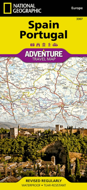
Landkaart Wegenkaart 3307 Spanje & Portugal - Nat Geo • 9781566955393
Wegenkaart Spanje & Portugal - Nat Geo Prodeuctomschrijving: National Geographic's Spain and Portugal Adventure Map is designed to meet the unique needs of adventure travelers with its detailed and accurate information. Cities and towns are clearly indicated and easy to find in the user-friendly index. A road network complete with distances and designations for motorways, expressways, an…
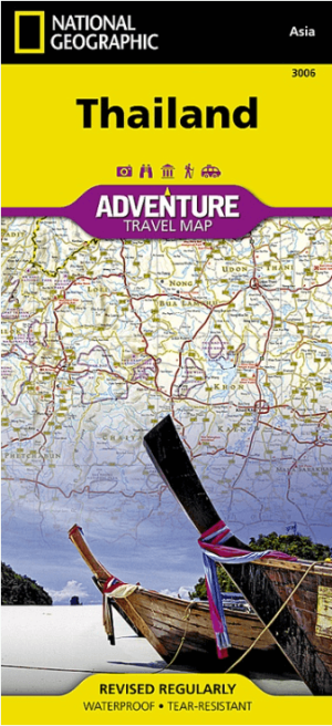
Landkaart Wegenkaart 3006 Thailand - Nat Geo • 9781566955263
Wegenkaart Thailand - Nat Geo Productomschrijving: National Geographic's Thailand Adventure Map is designed to meet the needs of adventure travelers with its detailed, accurate information and user-friendly design. Hundreds of points of interest that highlight the diverse, unique, and exotic destinations within the country such as national parks and reserves, World Heritage sites, archeol…

Landkaart Wegenkaart 3305 Toscane - Nat Geo • 9781566955379
Wegenkaart Toscane - Nat Geo Productomschrijving: Rolling plains, picturesque mountains, sunny beaches, and architectural masterpieces attract scores of tourists each year who seek to experience first-hand the romantic charm that permeates Tuscany's countryside. Explore this extraordinary destination with National Geographic's Tuscany Adventure Map. Hundreds of points of interest are…

Landkaart Wegenkaart 3015 Vietnam Noord - Nat Geo • 9781566956017
Wegenkaart Noord Vietnam - Nat Geo Productomschrijving: National Geographic's Vietnam North Adventure Map provides global travelers with the perfect combination of detail and perspective, highlighting hundreds of points of interest and the diverse and unique destinations within the country. Cities and towns are clearly indicated and easy to find in the user-friendly index. A road network …

Landkaart Wegenkaart 3016 Vietnam Zuid - Nat Geo • 9781566956024
Wegenkaart Zuid Vietnam - Nat Geo Productomschrijving: National Geographic's Adventure Map of Vietnam South is an invaluable tool for travelers seeking to explore the vibrant beauty of a land known for its scenic river deltas, terraced paddy fields, striking pagodas, and sleek skyscrapers. Designed to meet the needs of adventure travelers with its detailed, accurate information, this map …

Landkaart Wegenkaart 3011 Indië India - Nat Geo • 9781566955966
Wegenkaart Indië - Nat Geo Productomschrijving: National Geographic's Adventure Map of India is an invaluable tool for travelers seeking to explore the rich history, vibrant cultures, and exotic landscapes of this remarkable country. Designed to meet the needs of adventure travelers with its detailed, accurate information, this map includes the location of cities and towns with a user-fri…

Landkaart Wegenkaart 3012 Indië India Noordoost - Nat Geo • 9781566955973
Wegenkaart Noordoost India - Nat Geo Productomschrijving: National Geographic's India Northeast Adventure Map provides global travelers with the perfect combination of detail and perspective in a highly functional travel tool. Designed to meet the needs of adventure travelers with its detailed, accurate information, this map includes the location of cities and towns with a user-friendly i…

Landkaart Wegenkaart 3013 Indië India Noordwest - Nat Geo • 9781566955980
Wegenkaart Noordwest India - Nat Geo Productomschrijving: National Geographic's India Northwest Adventure Map provides global travelers with the perfect combination of detail and perspective. This expertly crafted map includes the locations of thousands of cities and towns with an index for easily locating them, plus a clearly marked road network complete with distances and designations f…
Wanneer kiest u voor een topografische kaart ?
Wanneer kiest u voor een topografische kaart? Iederaan gaat graag wandelen met een Wandelkaart, wat betekend dat men bijgevolg ook de route op zak heeft waar men ook naartoe wil. Wandelkaarten zijn niet meer weg te denken in de wereld van de wandelaar. Maar om dan topografisch te gaan aanschaffen, daarvoor moet u wel een reden hebben.
Topografische gegevens zijn er alijd voor wij ze nodig heeft, maar wie ze niet nodig heeft zoals de gewone wandelaar, die hoeft ze dan ook niet aan te schaffen. Deze gegevens zijn voor locaties waar geen routes voorafbepaald zijn, weze dit nu voor wandelaars of fietsers. Locaties zoals de Schotse Highland's, Gebieden in Zuid-amerika, Alaska en de USA, waar er soms duizenden kilometers zijn zonder weg of aanduiding. Op deze plaatsen kunt u niet anders dat zich topografische te gaan oriënteren.
Wat verstaat men onder topografisch wandelen
Wat verstaat men onder topografisch wandelen? Heel veel artikelen in het ons gamma zijn topo's & stafkaarten, ze zijn bijna allemaal zo, dus word er niet direct veel over gesproken. Wat wel niet voor de hand liggend is, is dat de Topo's & stafkaarten ook de GRID lijnen bevatten waarop u de GPS kunt afstellen. Met een curvimeter kan de afstand die op de kaart is afgebeeld worden omgerekend in de werkelijke lengte, en met een planimeter kan de werkelijke oppervlakte worden bepaald aan de hand van de contouren van een perceel. In ons land worden de topografische Topo's & stafkaarten door het Nationaal Geografisch Instituut., ook gekend als de uitgever NGI(B), en als federaal Geografisch instituut. Voor het Franse landschap zijn dat de IGN kaarten bijvoorbeeld, het Instituut Geographic Nationale
Topo bestaat al sinds 1831, toen ze al aantekeningen begonnen te maken van de hoogteverschillen van het landschap op de kaarten, nu gekend als hoogtelijnen. Uiteraard bestaan verschillende soorten kaarten, als thematische kaarten, Reliëf en wegenkaarten, Wandelkaarten en Fietskaarten, toeristische kaarten. Het nationale coördinatensysteem dat in België in gebruik is heet Lambert. Om kaarten leesbaar en overzichtelijk te houden, worden er voor de afbeelding van bijzondere objecten, terreinkenmerken, bestuurlijke grenzen & symbolen gebruikt.
De kleur van het vlak kan ook als symbool worden gebruikt, daar info word gegeven over de terreingesteldheid. Zo is paars bijvoorbeeld een heideveld, donkergroen voor bossen, lichtgroen voor grasvlaktes, geel voor zandbedden, blauw voor water, rood voor bebouwing & zwart voor hoogbouw. Afhankelijk van de type kaart, kunnen er afwijkende kleuren & symbolen worden gebruikt, waarvoor dan weer een verklarende legenda word getoond om uitleg te bieden over de desbetreffende symbolen.
Wat is nu het verschil tussen stafkaarten en topografische kaarten?
In principe is er geen verschil. Stafkaarten zijn de oudere benaming van topografie die al bestaat sinds 1831. Sinds het beroep van cartograaf bestaat is de wereld van het navigeren dusdanig uitgegroeid tot de noden van de internationale gemeenschap voor allerlei soorten onderwerpen. Vandaag de dag zijn het allemaal topografische kaarten, van staf wordt er nog nauwelijks gesproken. Bij Bibliotrek vindt u topografisch wandelkaarten en topografische fietskaarten, en voor één enkele uitgever bestaan ook wandelgidsen met topografische kaarten ingewerkt. Deze uitgever is het Franse FFR, die bekend staat voor het de benamingen van franse langeafstand wandelen, meerbepaald de GR-routes.
Algemene topografische informatie
Algemene topografische informatie. Navigeren is de dag van vandaag haast niet meer weg te denken uit onze wereld. Mensenlevens hangen er op zee vanaf. Op land zijn dan weer de bergen, en de zeer afgelegen plaatsen een perfecte navigatie plaats. Kunnen omgaan met GPS, Navigatie en topografie is een must als wandelaar. Wie ooit een opleiding volgde in alpine wandelen, of bergwandelaar gids, of iets in die aard, die weet dat topografie in elk aspect voorkomt in tijdens de lessen. Dag van vandaag zijn enkel kaarten gevuld met topografische gegevens, de wandel- & trekking gidsen op de andere pagina, daar worden topografische gegevens niet echt in gevonden, tenzij er opnieuw kaarten in verwerkt zijn. De enige uitgever die er tegenwoordig wel in zijn gidsen heeft geintegreerd is de Franse Fédération Francais de Randonnée Pédistré, of FFR in het kort.
Voor wie weet heeft over de wandelkaart, die weet dat wandel- en trekking maps meer dan alleen topografische gegevens bevatten. Velen weten, dat indien u een kaart koopt die een bepaalde plaats- of regio omvatten, dat daar eveneens de verblijfplaatsen & accommodaties voor campings opstaan. Ook toeristische informatie en eventuele bezienswaardigheden komen op vele wandelkaarten ruimschoot aan bod.
De markt van de wandelkaarten, worden wereldwijd gedomineerd door de grote cartografen als: IGN in Frankrijk, Ordnance Servey voor het ganse Groot Brittannië. NGIB voor ons Belgen, enz... De grote cartografen bezitten al gauw een paar duizenden kaarten in hun gamma, in vele gevallen zijn dergelijke cartofgrafen zo groot geworden, dat men er zelfs tot 200 man personeel in dienst heeft, om er het ganse jaar door aan te werken. Men wil zich steeds opnieuw heruitvinden, en kaarten ontwerpen die steeds beter en vlotter over de toonbank gaan. Werkt een bepaalde kaart niet ?, dan word die opnieuw bekeken, en heruitgezonden, en dat tot die wel aanslaat, of toch tenminste zijn basis oplagen verkoopt na de druk ervan.