

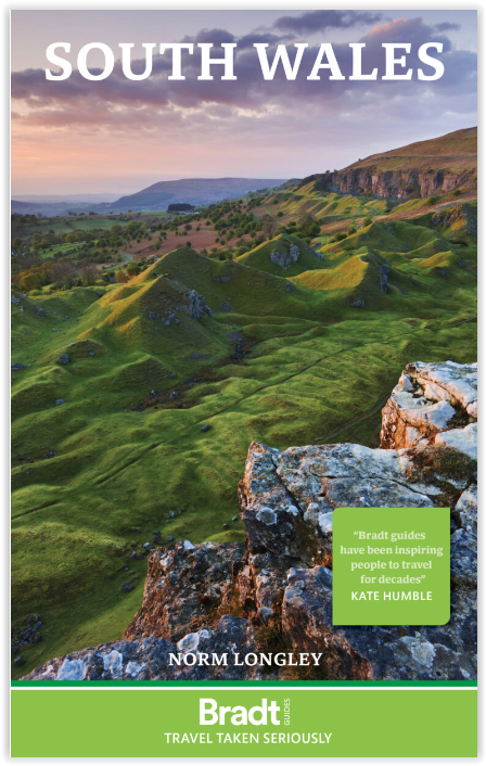
Reisgids South Wales - Bradt Travel Guides
Monmouthshire- Glamorgan- Carmarthenshire & Pembrokeshire
Korte omschrijving
Reisgidsen South Wales van Bradt guides. Ideaal voor tochten in Wales.
Reisgids Wales South - Bradt Productomschrijving: Deze nieuwe Bradt-gids is de eerste die uitsluitend gewijd is aan een specifiek deel van Wales en omvat het zuidelijke derde deel van het la...

Specificaties
- Uitgever: Bradt guides
- ISBN-13: 9781784778378
- HOOFDCATEGORIEËN: Reisgids
- Activiteiten: Toerisme
- Auteur: Norm Longley
- Regio: South Wales
- Land: Wales
- Editie: 1
- Taal: Engels
Volledige omschrijving
Reisgids Wales South - Bradt
Productomschrijving: Deze nieuwe Bradt-gids is de eerste die uitsluitend gewijd is aan een specifiek deel van Wales en omvat het zuidelijke derde deel van het land. Deze gids bestrijkt Monmouthshire, Glamorgan, Carmarthenshire, Pembrokeshire en het Brecon Beacons National Park en biedt een diepgaande beschrijving van een breed scala aan attracties. Voor wandelaars, liefhebbers van erfgoed, natuurliefhebbers, gezinnen, mountainbikers, fijnproevers en stadsliefhebbers biedt deze gids alle praktische informatie die u nodig heeft om uw verblijf in Zuid-Wales te plannen en te genieten.
De regio beschikt over 400 mijl kustlijn, waarlangs enkele van de mooiste stranden van Groot-Brittannië zich nestelen tussen gezellige badplaatsen en traditionele vissersdorpen, waaronder in het dramatische Pembrokeshire Coast National Park. In het binnenland omvatten The Valleys een voormalige krachtcentrale van de Britse kolenmijnindustrie, waar verlaten mijnen zijn uitgegroeid tot bloeiende toeristische attracties in een landschap dat op de Werelderfgoedlijst staat.
Engelse omschrijving: This new Bradt guidebook is the first solely dedicated to a specific part of Wales, encompassing the country’s southern third. Covering Monmouthshire, Glamorgan, Carmarthenshire, Pembrokeshire and Brecon Beacons National Park, this guide provides in-depth coverage of a broad range of attractions. Catering for walkers, heritage aficionados, wildlife lovers, families, mountain bikers, foodies and city-lovers, it furnishes all the practical information you need to plan and enjoy time in South Wales.
The region boasts 400 miles of coastline, along which some of Britain’s finest beaches nestle between comely resorts and traditional fishing villages, including in the dramatic Pembrokeshire Coast National Park. Inland, The Valleys encompass a former powerhouse of the British coal-mining industry where abandoned collieries have become thriving tourist attractions in a World Heritage landscape.
Alternatively, enjoy peace and quiet in the Brecon Beacons, one of few British International Dark Sky Reserves, characterised by high peaks, wild moorland and thrashing waterfalls. From here, mountains extend east to the renowned book town of Hay-on-Wye. In South Wales, you can embrace history, landscape and culture in quick succession.
Hikers come from all over to walk the Wales Coast Path, the first footpath worldwide to extend the entire length of a country’s coastline. Bike Park Wales in Merthyr is Britain’s leading mountain-bike centre, while St David’s Peninsula offers thrilling coasteering and the Gower Peninsula exciting surfing. The region’s special wildlife ranges from puffins and deer on offshore islands to porpoises and dolphins powering across sheltered bays.
Urbanites will love the Welsh capital of Cardiff, fast becoming one of Britain’s most dynamic cities, following exciting regeneration crowned by the Millennium Centre. Wales is nicknamed the Land of the Castles, with more fortifications per square mile than any European country: South Wales boasts twenty where your imagination can run riot. Unexpected treats gather here too: visit Europe’s second-tallest sand dune (The Big Dipper in Merthyr Mawr), the UK’s smallest city (St David’s), or even vineyards and whisky distilleries.
Whether you are an adrenaline-seeker or culture-lover, a wildlife watcher or beach-goer, foodie or hiker, discover South Wales with Bradt’s comprehensive guide.
Locatie op kaart
Artikelen uit dezelfde regio

Wandelkaart 177 Carmarthen & Kidwelly South Wales - OSI • 9780319470497
Wandelkaart 177 - Carmarthen & Kidwelly- South Wales - OSI Omvat ook: Pendine & Laugharne. Productbeschrijving: Kaart nummer 177 omvat Carmarthen en Kidwelly. Hoogtepunten zijn onder andere het Pembrokeshire Coast National Park, Carmarthen Bay, de rivieren Taf- en Tywi. Omvat ook Laugharne en Pendine. De OS Explorer kaart voor Carmarthen & Kidwelly is beschikbaar in zowel de standaard …
Wandelkaart XT40 Brecon Beacons Oost Wales - Harvey Maps • 9781851376001
Wandelkaart -XT40 Brecon Beacons Oost Wales - Harvey Maps Productomschrijving: Omvat een grote oppervlakte, maar is heel handig & compact. Gedetailleerde kaart voor hardlopers en wandelaars van het oostelijke deel van het Brecon Beacons National Park en de Black Mountains op de magische schaal van 1:40, 000. Omvat: Pen y Fan en de Black Mountains. Welsh-Engelse tekst.

Wandelkaart 166 Rhondda & Merthyr - Wales - OSI • 9780319470381
Wandelkaart Rhondda & Merthyr & Merthyr Tudful - Wales Productbeschrijving: Kaart nummer 166 in de OS Explorer kaarten reeks is ideaal voor het ontdekken van het gebied van Rhondda en Merthyr Tydfil in Zuid-Wales. Dit gebied ligt net ten zuiden van de Brecon Beacons, met bijzonder hoge natuurlijke schoonheid en vele wandelingen. Hoogtepunten van het gebied zijn onder andere: Aberdare, Bar…
Wandelgids 50 walks in the Brecon Beacons & South Wales - AA • 9780749583705
Wandelgids Brecon Beacons & South Wales - AA Productomschrijving: De Brecon Beacons in Wales vormen een waar paradijs voor wandelaars. Met zijn uitgestrekte landschappen, ruige bergen en diepe valleien biedt dit nationale park meer dan genoeg om de avontuurlijke wandelaar bezig te houden. Stel je voor dat er 50 wandelroutes zijn, elk met hun eigen charme en uitdaging, variërend van eenvoud…

Wandelgids The Wye Valley walk - Welsh Borders - Cicerone • 9781786311986
The Wye Valley walk along the Welsh Borders - Cicerone Productomschrijving: De Wye Valley Walk volgt de rivier de Wye over een afstand van 218 Km door het het Cambriumgebergte in Wales lang de grenzen van Wales. De route begint in Chepstow en volgt de Wye vallei tot aan de hellingen van Plynlimon, Powys, en duurt meestal 10 dagen. De Wye Valley Walk is een perfecte mix van rivier- en bergw…