
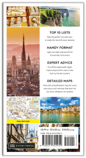
Reisgids Normandy - Top 10 - DK Eyewitness
Rouen cathedral - Etretat - Mont-St-Michel - D-Day beaches

Korte omschrijving
Reisgidsen Normandië, Frankrijk van Dorling Kindersley Limited. Ideaal voor tochten in Frankrijk.
DK Eyewitness Normandy Omvat: Northwestern Normandy, Central Normandy, Southwestern Normandy, Southern Normandy. Productomschrijving: Verken de kathedraal van Rouen, breng tijd door in ...

Specificaties
- Uitgever: Dorling Kindersley Limited
- ISBN-13: 9780241355954
- HOOFDCATEGORIEËN: Reisgids
- Activiteiten: Toerisme
- Regio: Normandië, Frankrijk
- Land: Frankrijk
- Taal: Engels
- Reeks/Serie: Eyewitness, Dorling Kingsley, TOP 10 - Eyewitness
Volledige omschrijving
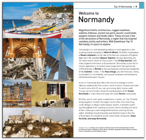
DK Eyewitness Normandy
Omvat: Northwestern Normandy, Central Normandy, Southwestern Normandy, Southern Normandy.
Productomschrijving: Verken de kathedraal van Rouen, breng tijd door in de badplaats Etretat, bezoek de eilandgemeente Mont-St-Michel, bekijk de D-Day stranden of ga terug naar de natuur in de heuvels van Suisse Normande. Van Top 10 restaurants tot de Top 10 natuurgebieden - deze gebruiksvriendelijke reisgids staat boordevol informatie om u het allerbeste van Normandië te laten ontdekken.
Engelse omschrijving: Explore Rouen cathedral, spend time at the seaside resort of Etretat, visit the island commune of Mont-St-Michel, see the D-Day beaches or get back to nature in the hills of Suisse Normande. From Top 10 restaurants to the Top 10 areas of natural beauty - this easy-to-use travel guide is packed with information to help you discover the very best of Normandy.
Inside Top 10 Normandy:
- Seven easy-to-follow itineraries, perfect for a day trip, a weekend or a week
- Top 10 lists showcase Normandy's best attractions, covering Mont-St-Michel, Pays d'Auge, Rouen, Etretat and many more
- Free laminated pull-out map of Normandy, plus five colour neighbourhood maps
- In-depth neighbourhood guides explore Normandy's most interesting areas, with the best places for shopping, going out and sightseeing
- Colour-coded chapters divided by area make it easy to find information quickly and plan your day
- Essential travel tips including our expert choices of where to stay, eat, shop and sightsee, plus useful transport, visa and health information
- Colour maps help you navigate with ease.
Locatie op kaart
Artikelen uit dezelfde regio

Wandelkaart Landkaart Normandie D Day- june 6 1944 - IGN • 9782758555810
Landkaart Normandie D Day- june 6 1944 - IGN Omvat: Bayeux, Caen, Cherbourg-en-Cotentin, Coutances, Gold Beach, Juno Beach, Omaha Beach, St-Lô, Sword Beach, Utah Beach Productomschrijving: De IGN publiceert de D-Day-kaart van Normandië – 6 juni 1944 ter herdenking van het 80-jarig jubileum. Deze kaart, op een schaal van 1:100.000 (1 cm = 1 km), presenteert de invasiestranden, de positi…
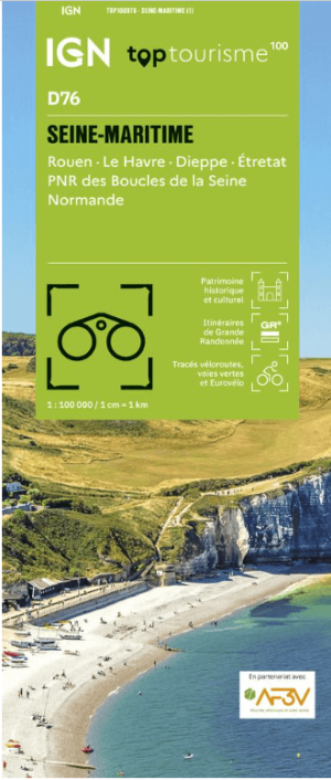
Wandelkaart Fietskaart TOP100 D76 Seine-Maritime - IGN • 9782758556688
Wandelkaart Fietskaart Seine-Maritime - IGN Productomschrijving: Cette nouvelle édition possède un nouveau découpage départemental. Elle intègre les parcours vélo en partenariat avec l'association AF3V – VéloRoutes et Voies Vertes. La nouvelle TOP 100 grâce à son échelle au 1:100 000ème (1 cm = 1 km) est la carte idéale pour découvrir une région et faire du tourisme à pied, à vélo ou en vo…
Wandelkaart 1613 SB St-Pierre-Dives & Mézidon - IGN • 9782758537014
Wandelkaart 1613 SB St-Pierre-Dives & Mézidon Productomschrijving: St-Pierre-Dives, Mézidon & Bretteville-sur-Laize zijn gemeentes in het Franse departement Calvados, regio Basse-Normandie. De plaats maakt deel uit van het arrondissement Lisieux. Tussen 2014 en 2018, worden alle SERIE BLUE kaarten in de collectie vernieuwd. Een nieuwe kaart voor optimale leesbaarheid, met de precieze meet…
Wandelgids Autour de Rouen à pied - Chamina Editions • 9782844667311
Autour de Rouen à pied - Chamina Editions Productomschrijving: La collection "Les Incontournables" change de charte ! Le guide: Un guide indispensable pour découvrir Rouen, son patrimoine foisonnant et ses environs verdoyants. L’ouvrage propose 3 parcours pour explorer les différents quartiers de la «ville au cent clochers », ainsi que des départs de balades à moins de 40 minutes de voitur…
Fietsgids Paris- Mont-St-Michel à vélo - Chamina • 9782844665751
Paris - Mont-St-Michel à vélo - Chamina Productomschrijving: Een uitzonderlijke en gemakkelijke route van 500 km die vanuit de hoofdstad in 31 etappes naar Mont-Saint-Michel en zijn baai voert. Een route tussen erfgoed en natuur: u doorkruist de steden Versailles, Chartres en Alençon en komt door verschillende regionale natuurparken: de Haute Vallée de Chevreuse, de Perche en het Parc Norm…