

Fietsgids 20 Rides in South West England - Cicerone
Z.W. Engeland & Zuid-Wales- Cornwall- Devon- Somerset & Avon


Korte omschrijving
Fietsgidsen South West England van CICERONE Press. Ideaal voor tochten in England.
20 Classic Sportive Rides in South West England - Cicerone Omvat: South West England Deze gids biedt 20 sportieve wielerroutes in de meest uitdagende en mooie fietsgebieden van Zuid-Wes...

Specificaties
- Uitgever: CICERONE Press
- ISBN-13: 9781852847449
- HOOFDCATEGORIEËN: Fietsgids
- Activiteiten: Fietsen / VTT / MTB
- Regio: South West England
- Land: England
- Editie: 1
- Taal: Engels
Volledige omschrijving
20 Classic Sportive Rides in South West England - Cicerone
Omvat: South West England
Deze gids biedt 20 sportieve wielerroutes in de meest uitdagende en mooie fietsgebieden van Zuid-West Engeland en Zuid-Wales. Cornwall, Devon, Somerset en Avon, Dorset, Brecon, Glamorgan en de Welsh Borders. Ze beschikken allemaal over km's aan fietsvriendelijke wegen geschikt voor sportieve training. Gegradueerde routes over rustige landelijke wegen kunnen worden gemengd en op elkaar afgestemd.
Engelse omschrijving: This guidebook offers 20 sportive routes in the most challenging and scenic cycling areas of south west England and south Wales. Cornwall, Devon, Somerset and Avon, Dorset, Brecon, Glamorgan and the Welsh Borders all have miles of cycle-friendly roads suitable for sportive training. Graded routes on quiet country roads can be mixed and matched.
Seasons:
With its mild climate and great sunshine record, the south west is the perfect playground for year-round sportive training regimes.
Centres:
Plymouth, Exeter, Honiton, Wellington, Taunton, Wells, Glastonbury, Weston-Super-Mare, Bristol, Bath, Swindon, Chepstow, Cheltenham, Gloucester, Salisbury, Dorchester, Shaftesbury, Bournemouth, Poole, Frome, Cirencester.
Difficulty:
The south west plays host to many well-known mountainous and hilly regions, and this book takes full advantage of these quality training grounds. Some of the toughest climbs in the UK are to be found here, but there's more to the south west than just climbing. This guide features 20 challenging yet achievable training rides for all sportive enthusiasts to enjoy.
Must See:
The moody backdrops of Dartmoor and Exmoor to the flat open going of the Somerset Levels and the rolling countryside of Dorset's Jurassic coastline, Sportive riders will enjoy testing themselves against some of the toughest and most scenic terrain that the UK has to offer.
Locatie op kaart
Artikelen uit dezelfde regio
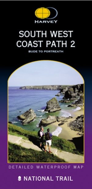
Wandelkaart South West Coast Path 2 - Harvey maps • 9781851374274
Wandelkaart - South West Coast Path 2 - Harvey maps - Covers: The path from Bude to Portreath. Productomschrijving: Waterdichte XT40 kaart van Harvey. Een ideale kaart voor wandelaars op de langste en op één van haar meest populairste nationale routes. Het loopt langs de kust van Somerset, Cornwall en Devon, Dorset van Minehead round via Land's end naar Poole. Het omvat alle 95 mijls …
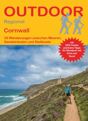
Wandelgids Cornwall, 32 Wanderungen - Conrad Stein • 9783866866201
Wandelgids Cornwall, 32 Wanderungen - Conrad Productomschrijving: 33 Wanderungen Cornwall is een compacte wandelgids voor wie Cornwall actief wil ontdekken. Deze regio in het zuidwesten van Engeland staat bekend om ruige kliffen, zandstranden, vissersdorpen, heidevelden en het open landschap van Bodmin Moor. De gids beschrijft 33 wandelingen langs de noordkust, de zuidkust en het binnenla…

Fietsen rond het kanaal - DEEL 1 Zuid-Engeland - SRF • 9789077056479
Fietsen rond het kanaal - DEEL 1 Zuid-Engeland - SRF Productomschrijving: Fietsen rond Het Kanaal is een tweedelige gids, bedoeld voor iedereen die een stuk langs of rond Het Kanaal wil fietsen. De route verbindt alle veerhavens aan de Engelse en Franse Kanaalkust. Zo kan een groot of klein rondje rond Het Kanaal gereden worden door voor een verderweg of dichterbij gelegen overtocht tussen…

Landkaart Wegenkaart Bath & S.W. England Planning map - Lonely Pl • 9781788687690
Wegenkaart Bath & S.W. England Planning map - Lonely Planet Productomschrijving: From Lonely Planet, the world's leading travel guide publisher Durable and waterproof, with a handy slipcase and an easy-fold format, Lonely Planet's Bath & Southwest England Planning Map helps you get around with ease. Get more from your map and your trip with images and information about top attractions. …

Reisgids Go Slow Cotswolds (AONB) - Bradt travel guides • 9781804691717
Reisgids Cotswolds - Bradt Productomschrijving: In deze nieuwe, grondig bijgewerkte 3e editie van Bradt's The Cotswolds, onderdeel van Bradt's kenmerkende 'Slow travel' serie van gidsen over Britse regio's, deelt lokale inwoner en ervaren reisschrijfster Caroline Mills haar favoriete plekken in een regio die onverminderd populair is. Op basis van meer dan 50 jaar wonen in de Cotswolds, en …