

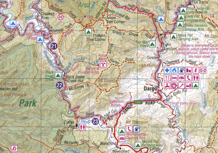
Wegenatlas Victoria High Country Atlas & Guide - Hema
40 atlas pages - Top 30 4WD Trips - Adventure activities

Korte omschrijving
Wegenatlas Victoria High Country Atlas & Guide - Hema Productomschrijving: The definitive guidebook for discovering the Victorian High Country, featuring the Top 30 4WD Trips written by Ron...

Specificaties
- Uitgever: Hema Maps
- ISBN-13: 9781876413149
- HOOFDCATEGORIEËN: Wegenatlas
- Activiteiten: Road atlases & maps, Street/Road maps & city plans
- Auteur: Ron Moon, Viv Moon
- Regio: Australië, Victoria, Victoria High Country, Australia, Victoria, Australië
- Land: Australië
- Schaal: 1:200000
- Editie: 3
- Taal: Engels
- Reeks/Serie: Victorian High Country series, Hema, Wegenatlassen
- De Australische Regio's: Victoria
Volledige omschrijving
Wegenatlas Victoria High Country Atlas & Guide - Hema
Productomschrijving: The definitive guidebook for discovering the Victorian High Country, featuring the Top 30 4WD Trips written by Ron and Viv Moon, in combination with topographic atlas mapping for the region.
• 40 atlas pages at a scale of 1:150 000
• Top 30 4WD Trips
• Best campsites
• Adventure activities
• Trip planning tips
This brand new edition of Hema’s best-selling outdoor guidebook for discovering the Victorian High Country now features 40 atlas pages at a large scale of 1:150 000 in a stunning new cartographic style. The guide now features the Top 30 4WD Trips for the High Country, which has been written by off-road legends Ron and Viv Moon.
Also included is an introduction to the region, as well as information sections on planning the trip and what to see and do. There are detailed touring sections on the distinct regions of the High Country, including the Great Alpine Road, Alpine National Park as well as Snowy River and Baw Baw national parks.
The Top 30 4WD Trips are broken into their respective localities, with each trip containing comprehensive trip information including gradings, distances, relevant travel information and drive coverage from start to finish.

Artikelen uit dezelfde regio
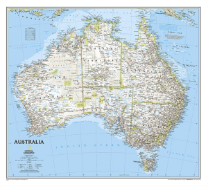
Plano Politieke Wandkaart Australië 77 x 69 cm - Nat Geo • 9780792250159
Wandkaart Australië 77 x 69 cm - Nat Geo Productomschrijving: National Geographic's wall map of Australia is one of the most authoritative maps of the "Land Down Under." The Classic style map uses a bright color palette featuring blue oceans and stunning shaded relief that has been a signature of National Geographic wall maps for over 75 years. This map features thousands of place name…

Reisgids Australia - Insight Guides ENG • 9781780057279
Reisgids Australia - Insight Guides Engels Productomschrijving: From deciding when to go, to choosing what to see when youarrive, this Insight Guides book is allyou need to plan your trip and experience the best of Australia, with in-depthinsider information on must-see, top attractions like Uluru and hidden culturalgems like Port Arthur. · Insight Guides Australia is ideal for travel…

Reisgids Australia Australië - Rough Guides • 9781835293799
Reisgids Australia - Rough Guides Productomschrijving: With jumping crocs in Kakadu, elemental Uluru and Sydney’s world-famous surf beaches, Australia is packed full of unforgettable adventures, and The Rough Guide to Australia will ensure you don’t miss a thing. Now in its twelfth edition, The Rough Guide to Australia has been fully updated with more insider tips from Rough Guide’s ex…
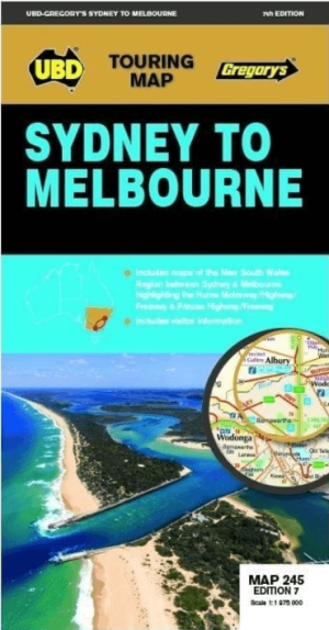
Landkaart Wegenkaart 245 Sydney to Melbourne NP - UBD Gregory's • 9780731933174
Wegenkaart Sydney to Melbourne NP - Gregory's Productomschrijving: The latest edition of the Sydney to Melbourne touring map has been fully revised and updated. It includes strip maps for travelling both the Princes Highway/Freeway and the Hume Motorway/Highway/Freeway with information on the major towns along these routes. There is also state mapping at a scale of 1: 975 000 highligh…

Landkaart Wegenkaart Victoria state map - Hema Maps • 9781865009834
Wegenkaart Victoria state map - Hema Productomschrijving: A comprehensive map of Victoria for touring throughout the state that has camping and rest areas, 24-hour fuel and points of interest marked on the mapping. On the reverse are CBD, the surrounding region and through road maps of Melbourne in addition to maps of the Great Ocean Road and East Gippsland. Also included is a national pa…