

Wegenatlas Baltische Staten atlas - Jana Seta Publ.
incl. Tallinn, Riga and Vilnius vicinity maps

Korte omschrijving
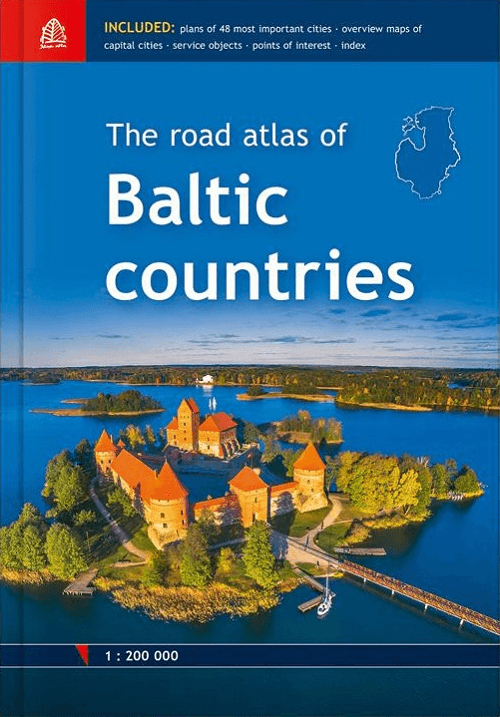
Baltische Staten wegenatlas - Jana Seta Publ. Productomschrijving: For the first time the road atlas of the Baltic countries is published at scale 1: 200 000. It is the most detailed map at...

Specificaties
- Uitgever: Jana Seta Map Publishers
- ISBN-13: 9789984077413
- HOOFDCATEGORIEËN: Wegenatlas
- Activiteiten: Street/Road maps & city plans
- Regio: Baltische staten, Europa, Estland, Baltische staten, Letland, Baltische staten, Litouwen, Baltische staten
- Land: Estland, Baltische staten, Letland, Baltische staten, Litouwen, Baltische staten
- Schaal: 1:200000
- Taal: Engels
- Reeks/Serie: Wegenatlassen
Volledige omschrijving
Baltische Staten wegenatlas - Jana Seta Publ.
Productomschrijving: For the first time the road atlas of the Baltic countries is published at scale 1: 200 000. It is the most detailed map atlas covering the entire territory of the Baltic States. Atlas has a new, larger format and a hardback cover.
Atlas basemap is supplemented with plans of the 48 largest cities at scale 1: 20 000 as well as Tallinn, Riga and Vilnius vicinity maps at scale 1: 85 000. The reader will find the Baltic Sea region map in the introduction section, and place name index in the final section. For travellers information about points of interest and tourism services will be useful.
Map legend in Estonian, Latvian, Lithuanian, English, German and Russian language.
- Latvia, Estonia and Lithuania road maps in scale 1:200'000
- Atlas base map is supplemented with plans of the 48 largest cities in scale 1:20'000
- Tallinn, Riga and Vilnius vicinity maps in scale 1:85'000
- Information about points of interest and tourism services
- Index of place names
- Size 21,5 x 30,6 cm
- 254 pages
- Hardback
Locatie op kaart
Artikelen uit dezelfde regio
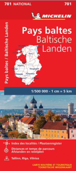
Landkaart Wegenkaart 781 Baltische Staten - Michelin • 9782067173774
Wegenkaart Baltische Staten - Michelin Productomschrijving: Deze Nationale kaart van de Baltische Staten, biedt een gedetailleerd overzicht van alle plaatsen. het wegennet wordt verfijnd aangeduid met allerhande symbolen, en voorziet in alle behoeftes, of u op zoek bent naar specifieke wegen, of zich snel uit de voeten wil maken, de plaatsnamenindex, en toeristische informatie, geven u all…

Reisgids Tallinn Estland - Top 10 - DK Eyewitness • 9781409355830
DK Eyewitness - Tallinn Estland Omvat: Toompea (Castle Hill), the Old Town & the New Town. Productomschrijving: Slenter door Pikk Street, bewonder middeleeuwse schatten in de Niguliste kerk, verken het traditionele Estse openluchtmuseum op de fiets of geniet van de sfeer op het levendige Stadhuisplein. Van de Top 10 kroegen en bars tot de Top 10 manieren om te ontspannen - ontdek het b…
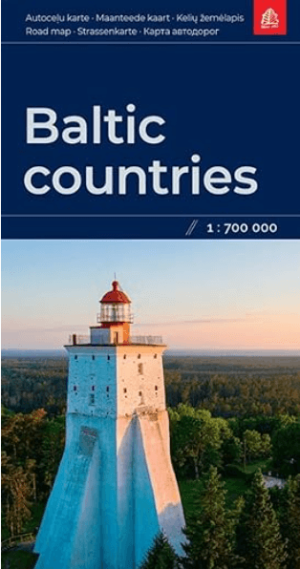
Landkaart Wegenkaart Baltische Staten - Jana Seta Publ. • 9789984074085
Landkaart Wegenkaart Baltische Staten - Jana Seta Productomschrijving: Wegenkaart Baltische Staten Bijgewerkte situatie van het wegennetwerk. Kaart wordt aangevuld met een lijst met plaatsnamen.
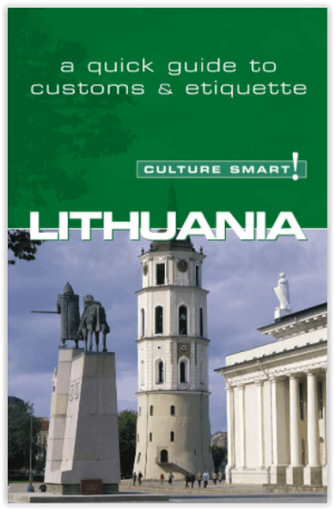
Reisgids Culture Smart Lithuania - Litouwen • 9781857333503
Reisgids Litouwen Productomschrijving: De essentiële gids voor gebruiken & cultuur. Culture smart Litouwen is een verhelderende en praktische gids over de Litouwse cultuur en samenleving. Het zal u helpen om van uw bezoek - of het nu voor zaken of voor plezier is - een gedenkwaardige en verrijkende ervaring te maken. Met veel praktische tips om met het onverwachte om te gaan. Engelse o…
Reisgids Latvia Letland - Bradt Guides • 9781804690406
Reisgids Latvia - Bradt Guides Productomschrijving: De nieuwe, zesde en grondig bijgewerkte editie van Bradt's Letland blijft de enige zelfstandige gids voor deze fascinerende en steeds veranderende Baltische natie. Dit is een klein maar betoverend gevarieerd land dat cultuurliefhebbers, geschiedenisfanaten, natuurliefhebbers en fijnproevers zal aanspreken. Letland is internationaal vooral…