

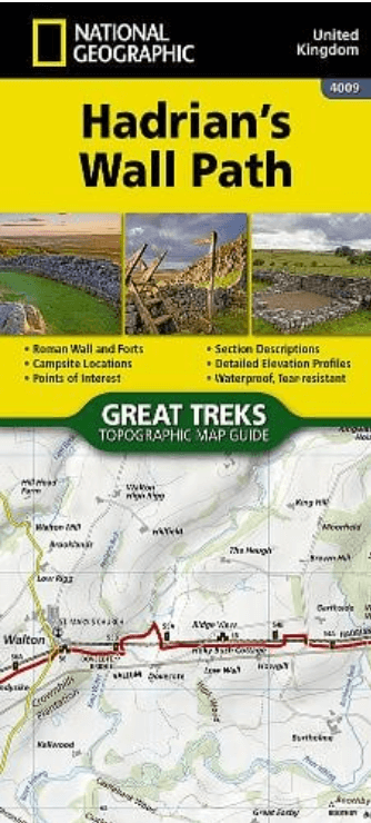
Wandelkaart 4009 Hadrian's Wall Path - Nat Geo
From Bowness-on-Solway to Wallsend - 135 kilometer
Korte omschrijving
Wandelkaarten North & North East England en North West England van National Geographic. Ideaal voor tochten in England.
Wandelkaart Hadrian's Wall Path - National Geographic Productomschrijving: As a demonstration of the Roman Empire's power and strength, Emperor Hadrianus conceived the idea to build a wall t...

Specificaties
- Uitgever: National Geographic
- ISBN-13: 9781566959421
- HOOFDCATEGORIEËN: Wandelkaart
- Activiteiten: Wandelen, Hiking & Trekking
- Auteur: National Geographic
- Regio: North & North East England, North West England
- Land: England
- Historische wandelroutes: Hadrian's Wall path (135 km)
- Lange afstand wandelroutes: Hadrian's Wall path (135 km)
- Schaal: 1:25000
- Taal: Engels
- Reeks/Serie: National Geographic Trails Illustrated
- Iconische Wandelroutes: Hadrians Wall Path, UK
- National Trails UK, England & Wales: Hadrians Wall, England
Volledige omschrijving
Wandelkaart Hadrian's Wall Path - National Geographic
Productomschrijving: As a demonstration of the Roman Empire's power and strength, Emperor Hadrianus conceived the idea to build a wall to deter attacks on his Roman territory Britannia. At the time — and even today — building a 73-mile (135-kilometer) long wall, standing 5 meters (16 feet) high and 3 meters (10 feet) wide was an exceptional undertaking. In a.d. 122, approximately 15,000 soldiers were enlisted to begin construction of this project, which included forts, turrets, bridges, milecastles, and the interconnecting wall.
Today, Hadrian's Wall is recognized as a UNESCO World Heritage Site. From Bowness-on-Solway to Wallsend, the 84-mile (135-kilometer) Hadrian’s Wall Path meanders the wild and scenic English countryside providing an opportunity to learn more about these historic sites.
The Hadrian's Wall Path Topographic Map Guide booklet makes a perfect traveling companion when traversing the route. A detailed description of each trail section is included that tells travelers about the many landmarks encountered along the way. Every Great Treks map is printed on "Backcountry Tough" waterproof, tear-resistant paper. A full Lat/Long grid is printed on the map to aid with GPS navigation. Every map purchase helps support the National Geographic Society, an impact driven, nonprofit organization with global reach that uses the power of science, exploration, education, and storytelling to illuminate and protect the wonder of our world.
Artikelen uit dezelfde regio
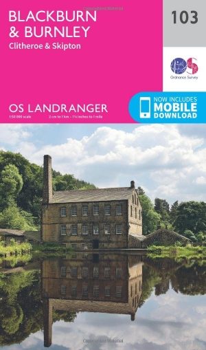
Wandelkaart 103 Blackburn & Burnley- N.W. England - OSI • 9780319262016
Wandelkaart Blackburn & Burnley - NW England - Ordnance Survey Productbeschrijving: Kaart nummer 103 in de OS Landranger kaarten serie, is de ideale kaart om te gebruiken bij het plannen van excursies rond het noordwesten van Engeland. Onderdeel van de Walliser way vertraagt in het oosten van de kaart, samen met de onderste rand van het Yorkshire Dales National Park. Andere plaatsen die zi…

Wandelgids North Yorkshire historic walks - Cicerone • 9781852843892
Wandelgids - North Yorkshire historic walks - Cicerone Productomschrijving: Een gids over historische wandelingen in North Yorkshire, in 20 meestal circulaire routes. Zij brengen u van open heidegebied en blootgestelde delen van heuvel en kliffen naar de meer beschutte dales en de straten van York. Wandelingen bevatten Skipton Castle, Ripon en Fountains Abbey, Ripley Castle, Castle Howard,…
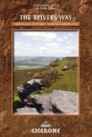
Wandelgids Reivers Way through historic Northumberland- Cicerone • 9781852844981
Wandelgids- Reivers Way through historic Northumberland- Cicerone Productomschrijving: Een handige zakformaat handleiding voor iedereen die van plan is om de Reivers Way af te lopen. Volg in de voetstappen van de border reivers op deze 150 mijl lange route, die loopt van Corbridge naar Alnmouth. De reivers route dwaalt door wilde en schilderachtige delen van Northumberland, en kan worden g…

Wandelkaart 275 Liverpool- South West England - OSI • 9780319244722
Wandelkaart Liverpool - South West England Omvat ook: St Helens, Widnes & Runcorn. Productbeschrijving: OS Explorer kaart 275 omvat Liverpool, St Helens, Widnes Runcorn, alsmede de rivier de Mersey. Hoogtepunten zijn onder andere de Trans Pennine Trail, Mersey way en de Liverpool circelvormige lijn. De OS Explorer kaart voor Liverpool is beschikbaar in zowel de standaard papieren versi…

Wandelgids West Pennine Moors walking guide - Cicerone • 9781852845803
Wandelgids - West Pennine Moors walking guide - Cicerone Productomschrijving: Wandelen in de West Pennine Moors, beschrijft 30 wandelingen op het platteland rondom Blackburn, Darwen, Chorley en Bolton, de thuis van enkele van de meest inspirerende en opwindende wandelgebieden. De wandelingen variëren van korte, gemakkelijke scrambles tot meer uitdagende wandelingen die betrekking hebben op…