

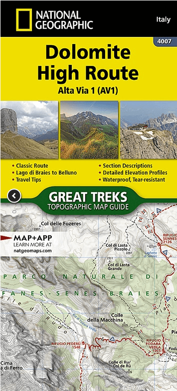
Wandelkaart 4007 Dolomite High Route - Alta Via 1 - NatGeo
Lake Braies to Belluno - 125 Km
Korte omschrijving
Wandelkaarten Bozen, Zuid Tirol, Oostenrijk van National Geographic. Ideaal voor tochten in Italië en Oostenrijk.
Dolomite High Route - Alta Via 1 - NatGeo Productomschrijving: The Alta Via n. 1 (High Route One) of the Dolomites is considered to be the most beautiful classic route in the entire Dolomite...

Specificaties
- Uitgever: National Geographic
- ISBN-13: 9781566959254
- HOOFDCATEGORIEËN: Wandelkaart
- Activiteiten: Wandelen, Hiking & Trekking
- Auteur: National Geographic
- Regio: Bozen, Zuid Tirol, Oostenrijk
- Land: Italië, Oostenrijk
- Lange afstand wandelroutes: ALTA VIA 1 (120 km)
- TOPO's & Stafkaarten: Topografisch wandelen
- Taal: Engels
Volledige omschrijving
Dolomite High Route - Alta Via 1 - NatGeo
Productomschrijving: The Alta Via n. 1 (High Route One) of the Dolomites is considered to be the most beautiful classic route in the entire Dolomite territory. It connects Lake Braies with Belluno, winds along a route of approximately 125 kilometers (78 miles), with 7,300 meters (23,950 feet) of altitude difference in 12 stages. The route cuts from north to south and is normally followed starting from Braies. The Alta Via n. 1 crosses five different mountain groups: the Braies Dolomites, the Fanes Group (Fanis), the Ampezzo Dolomites, the Northern Dolomites of Zoldo, and the Southern Dolomites of Zoldo.
The Dolomite Topographic Map Guide booklet makes a perfect traveling companion when traversing these routes. A detailed description of each trail section is included that tells travelers about the many landmarks encountered along the way.
Every Great Treks map is printed on "Backcountry Tough" waterproof, tear-resistant paper. A full Lat/Long grid is printed on the map to aid with GPS navigation. Every map purchase helps support the National Geographic Society, an impact driven, nonprofit organization with global reach that uses the power of science, exploration, education, and storytelling to illuminate and protect the wonder of our world.
Artikelen uit dezelfde regio

Fietskaart 23 Bozen Zuid Italië - Outkomm • 9783905916591
Supertrail map 23 - Bozen Zuid Italië - Outkomm Productomschrijving: De regio Bozen is bekend voor zijn sporters en zijn jaarlijkse Mtb kampioenschappen. Deze kaart brengt u dan ook dichter bij de wereld met een perfect overzicht over alle mogelijke trails Uitgever zelf: Op basis van de kennis van de lokale bevolking en speciaal onderzocht door de kaartauteurs bevatten de Supertrail Ma…

Fietskaart 30 Meran Zuid- Bozen Zuid-tyrol - Outkomm • 9783905916669
Supertrail map 30 - Meran Zuid - Bozen Zuid-tyrol Italië - Outkomm Productomschrijving: Meran is na de hoofdstad Bozen de grootste stad van de Italiaanse autonome provincie Bozen-Zuid-Tirol. De zuid kant is de bergkant, en hier heerst eerder de downhill versie van de Mtb routes. De stad ligt in een dalbekken, op de kruising van het Passeiertal, de Vinschgau en het Ultental en wordt omgeven…

Fietskaart 29 Meran Noord Bozen Zuid-tyrol Italië- Outkomm • 9783905916157
Supertrail map 29 - Meran Noord - Bozen Zuid-tyrol Italië - Outkomm Productomschrijving: Meran is na de hoofdstad Bozen de grootste stad van de Italiaanse autonome provincie Bozen-Zuid-Tirol. De noord kant is dan het meest bosrijke gedeete, waar Mtb'ers zich zeker thuis voelen, en waar talrijke trails reeds vele jaren aanwezig zijn. De stad ligt in een dalbekken, op de kruising van het Pas…

Wandelkaart 030 Brixen-Bressanone & Val di Funes - Tabacco • 9788883151729
Wandelkaart Brixen-Bressanone & Val di Funes - Tabacco Productomschrijving: Voor een ontspannende wandeling of een uitdagende beklimming. Om het prachtige landschap te verkennen of voor het plannen van wandel-, mountainbike en skireizen. Voor iedereen, op elk moment van het jaar, in de hele oostelijke Alpen. Een internationale garantie voor leesbaarheid, precisie en veiligheid. De kaart wo…


Wandelgids ALTA Via 1 - Trekking the Dolomites - Cicerone • 9781786310811
ALTA Via 1 - Trekking the Dolomites - Cicerone Omschrijving: Italië's beroemde Alta Via lange afstand wandelroutes zijn verspreid over de Dolomieten met ruwweg Noord naar Zuid tot de Oostenrijkse grens. Ze nemen in moeilijkheidgraad toe van AV1 om AV6, ze variëren in lengte van 6 tot 13 dagen en variëren van eenvoudige ambles tot moeilijk. Voor de twee eerste routes, in detail beschreven i…