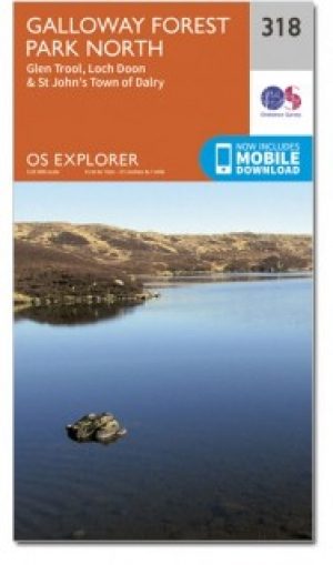
Wandelkaart 318 Galloway Forest Park North - OSI
Het noordelijk deel van het Gallowway Forest Park
Korte omschrijving
Wandelkaart Galloway Forest Park North - Schotland Omvat ook: Glen Trool & Loch Doon St John’s Town of Dalry. Productbeschrijving: OS Explorer kaart nummer 318 toont het noordelijk deel ...

Specificaties
- Uitgever: Ordnance Survey
- ISBN-13: 9780319471906
- HOOFDCATEGORIEËN: Wandelkaart
- Activiteiten: Wandelen, Hiking & Trekking
- Regio: Dumfries & Galloway, Schotland
- Land: Schotland
- Waterafstotende kaart: Ordnance Survey ACTIVE Explorer Weatherproof Maps
- Regionale parken: Galloway Forest park, Schotland
- TOPO's & Stafkaarten: Topografisch wandelen
- Schaal: 1:25000
- Taal: Engels
- Reeks/Serie:: Explorer ACTIVE Series OSI
Volledige omschrijving
Wandelkaart Galloway Forest Park North - Schotland
Omvat ook: Glen Trool & Loch Doon St John’s Town of Dalry.
Productbeschrijving: OS Explorer kaart nummer 318 toont het noordelijk deel van het Gallowway Forest Park, Doon Loch, Loch Trool, de Southern Upland Way en de E2 Europese Long Distance pad. De OS Explorer kaart voor Galloway Forest Park North is beschikbaar in zowel de standaard papieren versie als de weerbestendige 'Actief' versie.
Productdiscription: OS Explorer Map sheet 318 shows the northern part of Fallowway Forest Park, Loch Doon, Loch Trool, The Southern Upland Way and the E2 European Long Distance Path. The OS Explorer map for Galloway Forest Park North is available in both the standard paper version and weatherproof 'Active' version.
Locatie op kaart
Gekoppelde artikelen

Wandelkaart 318 Galloway Forest Park North- Ayrshire • 9780319245705
standaard versieWandelkaart Galloway Forest Park North - Ayrshire Schotland Productbeschrijving: Glen Trool & Loch Doon St John’s Town of Dalry. 318 / Galloway Forest Park North, Ayrshire, Schotland - OS Explorer kaart 318 toont het noordelijk deel van het Fallowway Forest Park, Doon Loch, Loch Trool, de Southern Upland Way en de E2 Europese Long Distance pad. De OS Explorer kaart voor Galloway Fores…

Wandelkaart 318 Galloway Forest Park North - OSI • 9780319471906
weatherproof versieWandelkaart Galloway Forest Park North - Schotland Omvat ook: Glen Trool & Loch Doon St John’s Town of Dalry. Productbeschrijving: OS Explorer kaart nummer 318 toont het noordelijk deel van het Gallowway Forest Park, Doon Loch, Loch Trool, de Southern Upland Way en de E2 Europese Long Distance pad. De OS Explorer kaart voor Galloway Forest Park North is beschikbaar in zowel de standaar…
Artikelen uit dezelfde regio

Wandelkaart 312 Kirkcudbright & Castle Douglas - OSI • 9780319245644
Wandelkaart Kirkcudbright & Castle Douglas - Schotland 312 / Kirkcudbright & Castle Douglas, Dumfries, Schotland. Kaart nummer 312 is een all purpose, avontuurlijke watervaste kaart vol gepakt met informatie om u het gebied te helpen leren kennen. De 204 Landranger-kaarten bestrijken het land. Elke kaart heeft een oppervlakte van 40 km door 40 km (25 mijl door 25 mijl) en zoals andere …

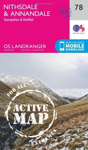
Wandelkaart 78 Nithsdale & Annandale Schotland - OSI • 9780319474013
Wandelkaart Nithsdale & Annandale - Schotland Productbeschrijving: OS Landranger kaart 78 toont Nithsdale en Annandale, de steden Sanquhar, Moffat, Lockerbie, Lochmaben, de Lowther Hills en het bos van Ae. De OS Landranger kaarten reeks heeft betrekking op Groot-Brittannië met 204 gedetailleerde kaarten, perfect voor dagtochten en korte pauzes. Elke kaart bevat alle informatie die u nodig …

Wandelkaart 311 Wigtown- Whithorn & The Machars - OSI • 9780319245637
Wandelkaart Wigtown- Whithorn - Dumfries & Galloway Productbeschrijving: OS Explorer kaart 331 omvat Whithorn en The Machars. De Machars zijn een gebied met glooiende groene heuvels waarvan sommige met belangrijke vroege oude nederzettingen. Wigton Bay is een Site van bijzonder wetenschappelijk belang zowel als een natuurreservaat terwijl Luce Bay een speciale beschermingszone is. De OS Ex…

Wandelkaart 323 Eskdale & Castle O'er Forest- Schotland - OSI • 9780319245750
Wandelkaart Eskdale & Castle O'er Forest - Schotland Productbeschrijving: Langholm, Canonbie & Gretna Green. 323 / Eskdale & Castle O'er Forest, Dumfries & Galloway, Schotland - Net op de grens tussen Schotland en Engeland omvat OS Explorer 323 de beroemde Gretna Green, kasteel O'er bos, Langholm and Canonbie. De OS Explorer kaart voor Eskdale en kasteel O'er Forest is beschikbaar in z…

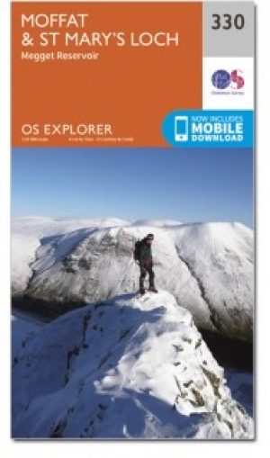
Wandelkaart 330 Moffat & St Mary's Loch Schotland - OSI • 9780319472026
Wandelkaart Moffat & St Mary's Loch - Schotland Omvat ook: Megget Reservoir. Productbeschrijving: OS Explorer kaart nummer 330 toont St. Mary's Loch, Megget, die betrekking heeft op Moffat in Dumfries and Galloway, de Reservoir en deel van de Southern Upland Way lange afstand wandelroute. De OS Explorer kaart voor Moffat & St Mary's Loch is beschikbaar in zowel de standaard papieren ve…


