

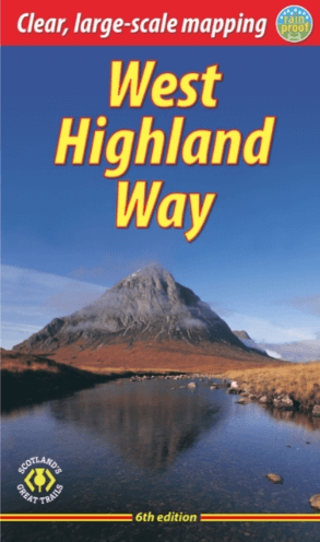
Wandelgids The West Highland Way - Rucksack Readers
Milngavie nabij Glasgow tot Fort William door de Schotse Hoogland
Korte omschrijving
Wandelgidsen Schotland en Highlands, Schotland van RUCKSACK READERS. Ideaal voor tochten in Schotland.
The West Highland Way - Rucksack Readers Productomschrijving: Een unieke intussen zeer gekende wandelroute, die loopt van Milngavie nabij Glasgow tot Fort William door de Schotse Hooglanden....

Specificaties
- Uitgever: RUCKSACK READERS
- ISBN-13: 9781913817213
- HOOFDCATEGORIEËN: Wandelgids
- Activiteiten: Wandelen, Hiking & Trekking
- Auteur: Jacquetta Megarry
- Regio: Highlands, Schotland, Schotland
- Land: Schotland
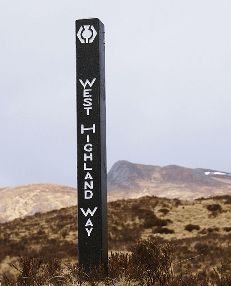
- Lange afstand wandelroutes: West Highland Way, Schotland (152 km)
- Schaal: 1:40000
- Editie: 6
- Taal: Engels
- Iconische Bergketens van Europa: De Schotse Highlands
- Iconische Wandelroutes: West Highland Way, Schotland
- Scotlands Great Trails: West Highland Way
Volledige omschrijving
The West Highland Way - Rucksack Readers
Productomschrijving: Een unieke intussen zeer gekende wandelroute, die loopt van Milngavie nabij Glasgow tot Fort William door de Schotse Hooglanden. De Route is 152 km Lang en brengt u door de westelijke Highlands van Schotland starten vanuit Glasgow.
Engelse omschrijving: The West Highland Way is the first, and remains the most famous, of Scotland’s Great Trails, running for 96 miles (152 km) through superb scenery. Starting from the outskirts of Glasgow, it passes through Scotland’s first National Park, along the shores of beautiful Loch Lomond, across the wilds of Rannoch Moor and ends in Fort William at the foot of Ben Nevis, Britain’s highest mountain.
This sixth edition of our popular rucksack-friendly guidebook has been revised for 2024 with various updates. It has more pages, fresh photos and mapping at 1:42,500 on 15 pages, yet thanks to robust perfect binding (glued and sewn) it’s lightweight, pocketable and rainproof.
This guidebook contains all you need to plan and enjoy the West Highland Way:
• the Way in sections, with summaries of distance, terrain and altitude profiles
• where to find food and drink, accommodation and how to split the distance
• concise background on the history, heritage and wildlife
• information about side-trips, e.g. Ben Lomond and Ben Nevis
• background information about Loch Lomond, history, habitats and wildlife
• planning information for travel by car, train, bus or plane
• 15 pages with detailed route mapping at 1:42,500
• in full colour, with 120 photographs
• rucksack-friendly and on rainproof paper.

Locatie op kaart
Artikelen uit dezelfde regio
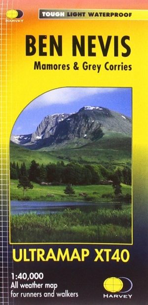
Wandelkaart XT40 Ben Nevis Grampian - Harvey Ultramaps • 9781851375776
Wandelkaart XT40 - Ben Nevis Grampian - Harvey Ultramaps Productomschrijving: Ben Nevis is de hoogste berg van Schotland en ligt in het Grampian Gebergte in het graafschap Inverness aan de ingang van de Glenmore. Het is eveneens de hoogste berg van het volledige Verenigd Koninkrijk. Ben Nevis is 1345 meter hoog en bevindt zich nabij Fort William, ongeveer 160 km ten noorden van Glasgow. He…
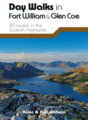
Wandelgids Day Walks in Fort William & Glen Coe - Vertebrate publ • 9781912560646
Day Walks in Fort William & Glen Coe Scotland Productomschrijving: 20 routes in the Scottish Highlands Day Walks in Fort William & Glen Coe features 20 routes between 4.4 and 14.4 miles (7km and 23.2km) in length, spread across the Scottish Highlands. Researched and written by experienced and knowledgeable authors Helen and Paul Webster, founders of the Walkhighlands website, the walk…

Wandelkaart 432 Black Isle & Munlochy - OSI • 9780319246641
Wandelkaart Black Isle- Munlochy - Highland Schotland Productbeschrijving: Fortrose, Cromarty & Dingwall. 432 / Black Isle, Munlochy, Highland, Schotland - OS Explorer kaart 432 toont de Black Isle, inclusief de Moray Firth, Cromarty Firth en Dingwall. het beste deel van dit eiland Blask is dat het niet daadwerkelijk een eiland is, hoewel de toegang beperkt is van Noord en Zuid. Het is…

Wandelkaart 384 Glen Coe & Glen Etive- Highlands - OSI • 9780319246306
Wandelkaart Glen Coe & Glen Etive - Highlands Schotland Productbeschrijving: Ballachulish & Kinlochleven. 384 - Glen Coe & Glen Etive, Highlands, Schotland - Kaart nummer 384 in de OS Explorer kaart reeks is de ideale kaart voor bezoekers aan de Glen Coe, Glen Etive en Ballachulish Kinlochleven gebieden. Het gebied omvat 17 Munro's die de wandelaars aantrekken. Hoogtepunten van het ge…

Wandelkaart 413 Knoydart- Loch Hourn & Loch Duich - OSI • 9780319246481
Wandelkaart Knoydart- Loch Hourn & Loch Duich - Highlands 413 / Knoydart, Loch Hourn & Loch Duich, Highlands, Schotland. Explorer kaart 413 omvat de Kyle of Lochalsh tot Inverie: dit gebied van ruige kustlijnen nodigt u uit tot exploratie. Met 4 van de Munros en diverse andere belangrijke toppen, naast twee nationale natuurgebieden is het een populaire regio voor degenen die graag de S…