
Wandelgids GR10 Trail - CIcerone
Through the French Pyrenees - Hendaye naar Banyuls-sur-Mer 955km


Korte omschrijving
Wandelgidsen Franse Pyreneeën, Frankrijk van CICERONE Press. Ideaal voor tochten in Frankrijk.
Wandelgids GR10 Trail en wandelroute - CIcerone Productomschrijving: Wandelgids overde GR10, de Sentier des Pyrénées, een 955 km lange tocht door de Franse Pyreneeën van Hendaye aan de Atlan...

Specificaties
- Uitgever: CICERONE Press
- ISBN-13: 9781786311160
- HOOFDCATEGORIEËN: Wandelgids
- Activiteiten: Wandelen, Hiking & Trekking
- Auteur: Brian Johnson, Stuart Butler
- Regio: Franse Pyreneeën, Frankrijk
- Land: Frankrijk
- GR® routes: GR10
- Lange afstand wandelroutes: GR10 Traversé des Pyrenées (950 km)
- Editie: 2
- Taal: Engels
- Iconische Wandelroutes: GR10, Pyreneeën Frankrijk
Volledige omschrijving
Wandelgids GR10 Trail en wandelroute - CIcerone
Productomschrijving: Wandelgids overde GR10, de Sentier des Pyrénées, een 955 km lange tocht door de Franse Pyreneeën van Hendaye aan de Atlantische kust naar de Middellandse Zeekust bij Banyuls-sur-Mer. Het boek beschrijft 55 etappes, met informatie over planning, transport, accommodatie en faciliteiten. Loop de hele GR10 in ongeveer 45 dagen of in kortere tochten.
Engelse omschrijving: Guidebook to walking the GR10, the Sentier des Pyrénées, a 955km trek across the French Pyrenees from Hendaye on the Atlantic Coast to the Mediterranean coast at Banyuls-sur-Mer. The book describes 55 stages, with information on planning, transport, accommodation and facilities. Walk the entire GR10 in around 45 days or in shorter trips.
Seasons:
Best July to October (June in a low snow year).
Centres:
Hendaye-Plage on the Atlantic coast to Banyuls-sur-Mer on the Mediterranean through the French Pyrenees.
Difficulty:
The GR10 is extremely well waymarked following good mountain paths with short sections of boulderfield and occasional very easy scrambling. It is tough because there is more steep climb and descent than on many long-distance paths. Good network of inexpensive accommodation for those who prefer not to camp. Frequent resupply possible. In early season (May/June) ice-axe and crampons may be required.
Must See:
The GR10 starts with the rolling hills of the Basque country leading to the High Pyrenees including Pic du Midi d'Ossau, Vignemale and Gavarnie. The remote Ariège with Mont Vallier follows and Canigou dominates the approach to the Mediterranean. Wildflower meadows are magnificent throughout.

Artikelen uit dezelfde regio
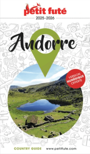
Reisgids Andorre 2025-2026 - Petit Futé • 9782305121970
Reisgids Andorre '25'26 - Petit Futé Productomschrijving: Nichée au coeur des Pyrénées, l'Andorre est aussi un mélange subtil de nature sauvage et de cultures. Ses montagnes préservées à découvrir selon les saisons à pied, en VTT, en Quad ou à ski, déploient des trésors de la biodiversité européenne, et s'enorgueillissent du plus vaste domaine skiable des Pyrénées. Ses eaux thermales ont d…

Klimgids Mountaineering in the Pyrenees - Vertebrate Publ. • 9781910240564
Mountaineering in the Pyrenees - Vertebrate Productomschrijving: 25 classic mountain routes. Mountaineering in the Pyrenees by François Laurens features 25 classic mountain routes and link-ups – many of them accessible from spring to autumn – along the entire Pyrenean chain. Featured peaks include Pic des Posets, Monte Perdido and the Vignemale. Each route features technical notes, a topo …

Wandelgids Pyrénéens Randonnées vers cols d'Antan - Rando Ed. • 9782344040669
100 passages Pyrénéens vers cols d'Antan Productomschrijving: Bruno Mateo en Bruno Valcke wandelen graag in de Pyreneeën en geven betekenis aan hun wandelingen. Zij nodigen u uit hen te volgen op deze routes, die sinds mensenheugenis zijn gebruikt door de plaatselijke bevolking, legers, kooplieden, pelgrims, vluchtelingen en deserteurs, maar ook door Pyreneeërs. Zo reist u mee met de smokk…

Wandelgids Pyrénées- petits secrets et grandes histoires • 9782817710396
Wandelgids Pyrénées - petits secrets et grandes histoires Productomschrijving: De GR10, die van de Atlantische Oceaan naar de Middellandse Zee loopt (of omgekeerd), loopt langs plaatsen, dorpen, natuurgebieden en valleien waar mythes in overvloed bestaan, waar legendes uit de voorchristelijke samenleving de ronde doen, waar bronnen hun heilzame werking hebben bewezen, waar men zegt dat men…
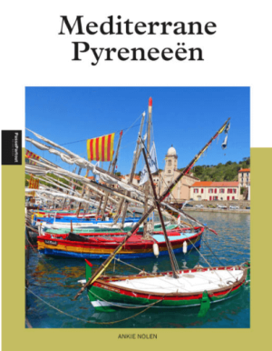
Reisgids Mediterrane Pyreneeën - Edicola • 9789493358676
Mediterrane Pyreneeën - Edicola Productomschrijving: Frankrijk staat bovenaan de lijst van Nederlandse vakantiegangers, je komt ze overal tegen ! Toch zijn er nog minder bekende streken, zoals Frans-Catalonië en de mediterrane Pyreneeën. Het gebied is pas sinds de 17de eeuw onderdeel van Frankrijk. Je waant je er in Spanje, want de bewoners van Catalogne du Nord voelen zich nauw verbo…