

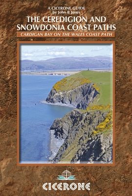
Wandelgids Ceredigion & Snowdonia coastal paths - Cicerone
Volg de Ceredigion Coast Path en Snowdonia Coast Path voor 233km
Korte omschrijving
Wandelgidsen North Wales van CICERONE Press. Ideaal voor tochten in Wales.
Wandelgids - Ceredigion & Snowdonia coastal paths - Cicerone Productomschrijving: Als onderdeel van het Wales Coast Path, traceren de Ceredigion Coast Path en het Snowdonia Coast Path een cu...

Specificaties
- Uitgever: CICERONE Press
- ISBN-13: 9781852847388
- HOOFDCATEGORIEËN: Wandelgids
- Activiteiten: Wandelen, Hiking & Trekking
- Auteur: John B Jones
- Regio: North Wales
- Land: Wales
- Nationale parken: Snowdonia NP, Wales UK
- Editie: 1
- Taal: Engels
- Wandelen in de Bossen & natuurgebieden van Europa: Snowdonia, Wales
Volledige omschrijving
Wandelgids - Ceredigion & Snowdonia coastal paths - Cicerone
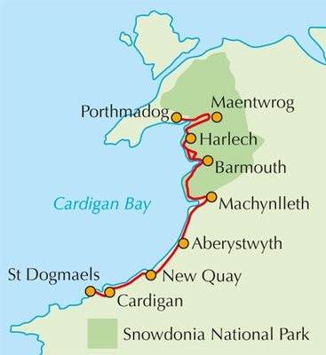
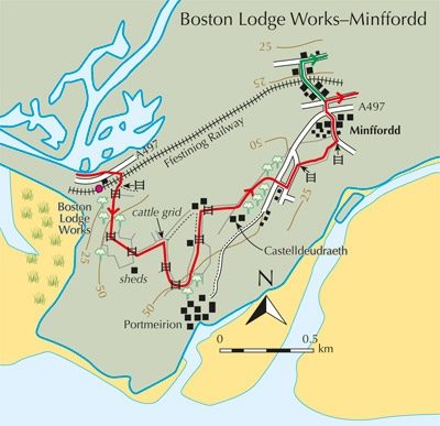
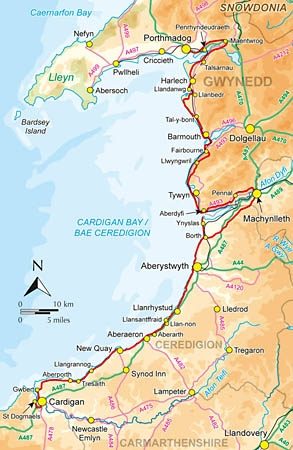
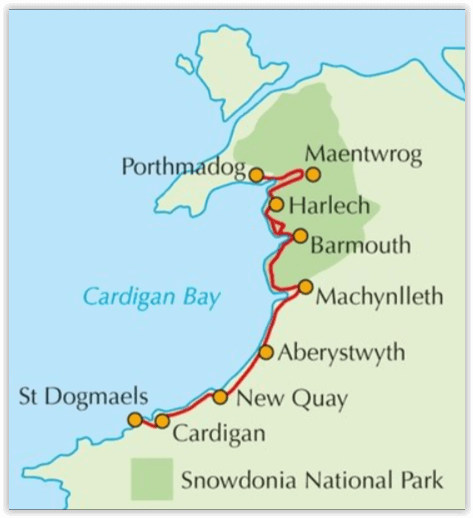
Productomschrijving: Als onderdeel van het Wales Coast Path, traceren de Ceredigion Coast Path en het Snowdonia Coast Path een curve van 233km (145 mijl) van kust- en binnenwaterwegen langs Cardigan Bay. Deze gids beschrijft een 16-fasige gids over de wandeling van Porthmadog aan St. Dogmaels die betrekking hebben op de trail tussen het Llyn-schiereiland en het Pembrokeshire Coast Path. In 16 dagstadia van Porthmadog St. Dogmaels, biedt deze gids alle wandelaars de nodige informatie.
Product description: As part of the Wales Coast Path, the Ceredigion Coast Path and Snowdonia Coast Path trace a curve of 233km (145 miles) of coastal and inland walking down Cardigan Bay. This guidebook describes a 16-stage guide to the walk from Porthmadog to St Dogmaels covering the trail between the Llyn Peninsula and the Pembrokeshire Coast Path. In 16 day stages from Porthmadog to St Dogmaels, this guidebook offers all the information walkers need to complete the 233km (145 miles) section of the Wales Coast Path that curve down Cardigan Bay, passing through a range of contrasting landscapes.
Seasons:
Technically, it is possible to trek this route at any time of the year. However, spring into summer tends to be the most favourable season for weather and also for the wild flowers. Early autumn can also be rewarding, especially for the quality of the light and autumnal colours.
Centres:
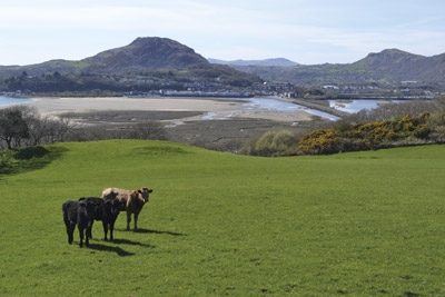
The walk passes through a number of attractive settlements, from towns such as Aberystwyth to villages such as Llangrannog.
Difficulty:
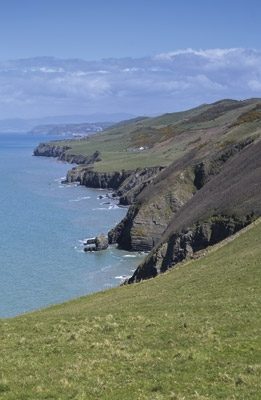
While many stretches of the Snowdonia Coast Path enable a fast walking pace, there are also some big climbs. The Ceredigian Coast Path is surprisingly challenging and a good level of fitness is required.
Must See:
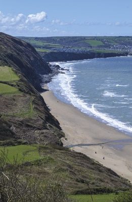
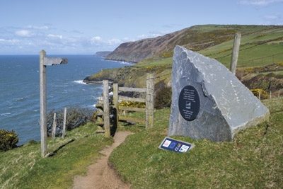
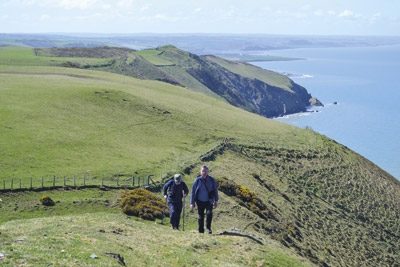
The Snowdonia and Ceredigian Coast Paths, part of the Welsh Coast Path, run some 230kms down Cardigan Bay. The walk crosses fine sandy beaches, rugged cliffs, salt marshes and hill country. There are great coastal and inland views, fascinating geology and history, and wide varieties of plants and wildlife.
Locatie op kaart
Artikelen uit dezelfde regio

Wandelkaart 115 Snowdon & Yr Wyddfa - Snowdonia NP - OSI • 9780319262139
Wandelkaart 115 - Snowdon & Yr Wyddfa- Snowdonia NP Productbeschrijving: Kaart nummer 115 in de OS Landranger kaarten reeks, is de ideale kaart voor uw wandel-reizen en vakantie planning op het gebied van de Snowdon. Goed-gekend voor haar adembenemende landschappen, uitdagende wandelingen en beklimmingen, is Snowdon de perfecte plek voor alle liefhebbers van het buitenleven. Hoogtepunten v…

Wandelgids Snowdonia NP Wales - Cicerone • 9781852847678
Wandelgids Snowdonia NP Wales - Cicerone Productomschrijving: Gids naar 40 van Snowdonia's beste dagwandelingen, met de routes "Snowdon" en "Tryfan", met inbegrip van de Snowdon Horseshoe, Cadair Idris, Y Garn en The Rhinogs. De routes variëren van Grade 1 scrambles zoals wieg Goch of Bristly Ridge, tot riverside. Bevat details van een twee-daagse doorkruisen van alle 15 van Snowdonia …
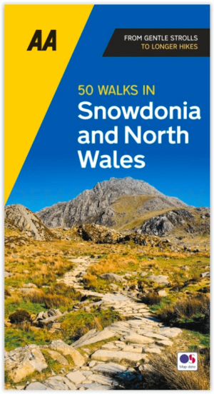
Wandelgids Snowdonia NP & North Wales - 50 walks guide - AA Publ. • 9780749583279
Snowdonia NP & North Wales - 50 walks guide - AA Publishing Productomschrijving: Wandelen is een van de favoriete vrijetijdsbestedingen van Groot-Brittannië en deze AA gids - 50 wandelingen in Snowdonia & Noord-Wales bevat een verscheidenheid aan uitgestippelde wandelingen van 3 tot 10 km, geschikt voor alle niveaus. Het boek bevat alle praktische details die u nodig heeft, vergezeld van f…

Wandelgids Snowdonia Way National park - Cicerone • 9781852848569
Wandelgids - Snowdonia Way National park - Cicerone Productomschrijving: Het Nationaal park Snowdonia is een bergachtig gebied in het noorden van Wales. Het park is genoemd naar Snowdon, en is met 1085 meter de hoogste berg in Wales. De route is 97 miles lang en kan worden afgelegd in 6 etappes. De route loopt door het nationale park van Noord wales Snowdonia, en kan worden bestempeld als …

Wandelkaart XT40 Anglesey Coastal Path N. Wales - Harvey Maps • 9781851375851
Wandelkaart XT40 - Anglesey Coastal Path N. Wales - Harvey Maps Productomschrijving: Anglesey, is een eiland en bestuurlijk graafschap aan de noordwestkust van Wales. Het vormt een onderdeel van het ceremoniële behouden graafschap Gwynedd en is tevens een historisch graafschap. Deze kaart brengt u per wandelpad langs de kust van dit uitermate geschikt wandeleiland Nieuwe generatie HARV…