
Organisation of swisstopo
The Federal Office of Topography “measures” Switzerland. It surveys and documents the landscape and the underground, and produces high-quality spatially-referenced geodata. Its most important products include landscape and height models, aerial images, orthophotos, geological data and maps, reference data and of course the well-known series of national maps.
The Federal Office of Topography swisstopo is Switzerland’s geoinformation centre. We supply accurate, up-to-date and reliable basic information for surveying Switzerland, collecting data on the landscape and subsoil and documenting this over time. With swisstopo, every location in Switzerland can be precisely determined to the last centimetre. swisstopo thus fulfils a federal task.
Our products include national maps, elevation and landscape models, aerial photographs, orthophotos, geological data and maps or applications on the Internet, as well as on mobile devices. The federal government’s map viewer at map.geo.admin.ch is a particularly important element.
The legal basis for swisstopo’s activities is the Federal Geoinformation Act. In addition to developing products, swisstopo is also responsible for coordinating activities relating to geoinformation and geology at the federal level, as well as for managing the Institute for Military Geography. Furthermore, it is responsible for the supervision of the cadastral survey and the Cadastre of public-law restrictions on landownership (PLR Cadastre), as well as for supervising the coordination of Swiss geodata in cooperation with the cantons, municipalities and the private sector.


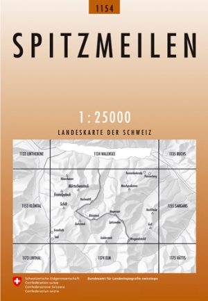
Wandelkaart 1154 - Spitzmeilen Glarner Alpen - Swisstopo • 9783302011547
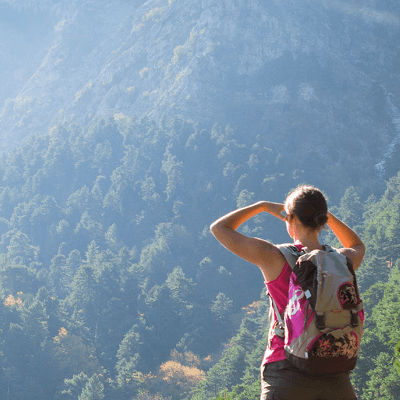
Wandelkaart Spitzmeilen - Glarner Alpen Zwitserland Productomschrijving: Kaart 1154 - Glarus is een bergachtige regio waar het i.p.v. wandelen, eerder hiking en schrambling wordt - De Spitzmeilen is een 2501 meter hoge berg in de Glarner Alpen in Zwitserland. De top heeft een markante spitse vorm en steekt als een tand omhoog vanuit de omliggende hellingen. Detail: Zeer gedetailleerde …