

Mountainbikegids Lake District Mountain Biking - Vertebrate Publ.
20 of the best mountain bike rides in the Lake District NP


Korte omschrijving
Fietsgidsen Cumbria & Lake District, England van Vertebrate Publishing. Ideaal voor tochten in England.
Lake District Mountain Biking - Vertebrate Productomschrijving: Essential Trails is the fully updated third edition of Vertebrate Publishing's bestselling mountain bike guide to the Lake Di...

Specificaties
- Uitgever: Vertebrate Publishing
- ISBN-13: 9781839810732
- HOOFDCATEGORIEËN: Fietsgids
- Activiteiten: Fietsen / VTT / MTB
- Auteur: Chris Gore, Richard Staton
- Regio: Cumbria & Lake District, England
- Land: England
- Nationale parken: Lake District NP, Cumbria England
- Taal: Engels
- Fietsen: Fietsen in het Buitenland
- De Nationale Parken: Lake district National Park, England
- Wandelen in de Bossen & natuurgebieden van Europa: Lake district, England
- VTT / MTB: Mountainbike
Volledige omschrijving
Lake District Mountain Biking - Vertebrate
Productomschrijving: Essential Trails is the fully updated third edition of Vertebrate Publishing's bestselling mountain bike guide to the Lake District National Park. It includes rides around Grizedale, High Street and Borrowdale, and much more, and features industry-standard Ordnance Survey mapping, and is illustrated with action photography.
Lake District Mountain Biking – Essential Trails is the full third edition of the bestselling guide to some of the finest mountain bike riding in the UK.
Featured are over 20 of the best mountain bike rides in the Lake District, between 12 and 60 kilometres in length, suitable for all levels of mountain bikers.
Explore classic rides around Walna Scar, High Street and Borrowdale, and discover several lesser-known gems. Ride moorland singletrack, tackle massive climbs and rattle along some of the rockiest trails you’ll ever encounter on two wheels. Enjoy lakeside cruises, picturesque valleys and 360-degree panoramas. Researched, ridden and written by local riders Richard Staton and Chris Gore, each route features clear and easy to use Ordnance Survey 1:50,000 maps; easy-to-follow directions; details of distance, timings and difficulty gradings; and refreshment stops and local knowledge.
A Bonus Section includes information about the man-made trails at Whinlatter and Grizedale, Top Tens and a detailed Appendix.
.png)
Artikelen uit dezelfde regio
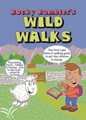
Wandelgids Rocky Rambler's wild walks - Cicerone • 9781852843472
Wandelgids - Rocky Rambler's wild walks - Cicerone Productomschrijving: Een gids over familiewandelen in het Lake District. Rocky Rambler's Wild Walks stimuleert kinderen om uit te kiezen, en de wandelingen te leiden. Gericht op kinderen van 6 tot 14 jaar, de gids bevat duidelijke instructies en heldere illustraties, die iedere wandeling gemakkelijk en leuk maakt om te volgen. 10 wandeling…
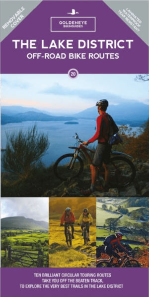
Mountainbike kaart Lake District NP - Goldeneye • 9781859653005
MTB kaart Lake District NP - Goldeneye Productomschrijving: The routes are graded with approximate time & mileage. Unsurprisingly, the mountainous landscape of the Lake District has some of the toughest mountain biking in the UK and, on major routes crossing the steep sided ridges between major valleys, long pushes or carries are inescapable - even for the fittest. This is only one asp…

Wandelgids The Cumbria Way - Rucksack Readers • 9781913817299
The Cumbria Way - Rucksack Readers Productomschrijving: The Cumbria Way, begins at Ulverston and heads north through the Lake District for 73 miles (123 km) through unspoiled dales, passing stone-built farms, going around charming lakes and running beneath rugged fells. Busy tourist towns and villages contrast with woodland, wild fellside, high passes and remote moorlands. The Way passes …

Wandelgids Lake District Low level & lake walks - Cicerone • 9781786312273
Lake District NP Low level & lake walks - Cicerone Productomschrijving: This guidebook describes 30 of the best low-level walks in the Lake District. From delightful wooded glades and sparkling tarns, to waterfalls and glacier-carved valleys towered over by craggy mountains. The walks described aim to seek out the best walking that the lower areas of the Lake District have to offer. Se…

Reisgids Lake District NP Cumbria England - Marco Polo • 9783829758406
Reisgids Lake District - Marco Polo Productomschrijving: Marco Polo reisgids voor het Lake District! Handig pocket formaat, boordevol informatie, met 8 bladzijden atlas in de gids én uitneembare kaart. Met 'insider tips' om deze waterrijke Britse regio écht te ontdekken, de TOP 15 van bezienswaardigheden in één oogopslag, up-to-date informatie in overzichtelijke hoofdstukken: sightseeing, …