

Wegenatlas Latgale Letland Oost - Jana Seta Publ.
Regionale toeristische atlas Oost-Letland
Korte omschrijving
Wegenatlas Latgale Letland Oost - Jana Seta Publ. Productomschrijving: The most important complementation of the second edition of map series “With a map in nature” is information about nat...

Specificaties
- Uitgever: Jana Seta Map Publishers
- ISBN-13: 9789984077055
- HOOFDCATEGORIEËN: Wegenatlas
- Activiteiten: Street/Road maps & city plans
- Regio: Baltische staten, Europa, Latgale, Oost-Letland
- Land: Letland, Baltische staten
- Schaal: 1:100000
- Editie: 2
- Taal: Engels
- Reeks/Serie: Wegenatlassen
Volledige omschrijving
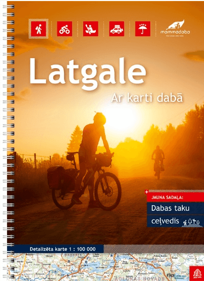
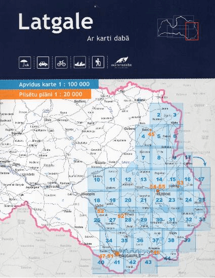
Wegenatlas Latgale Letland Oost - Jana Seta Publ.
Productomschrijving: The most important complementation of the second edition of map series “With a map in nature” is information about nature trails in each of regions. With more than 60 nature trails it is the most complete edition and is made together with experts from dodies. Information about each trail consists of its description, detailed map, photos and information about trail lenght, time needed, pavement and level of its difficulty. You will find there information about signs, rest places and fire-places, accesssibility for bicycles, baby carriages and invalid carriages as well.
Each page of the edition is laminated, thus being more resistant to moisture and various forms of damage caused by active use, whereas the spiral binding allows the map to be used and pages turned conveniently. For greater user convenience, the map in the scale 1:100 000 (1 cm on the map = 1 km in nature), which is the most detailed map of Latvia available to a wide range of users, has been divided in four region editions – Kurzeme, Zemgale, Vidzeme, Latgale.
The intention of the new series editions is to be an accurate tool in terrain conditions (on a road, on a river, in a forest), helping its user to determine his/her location and plan the further route. The advantages in comparison to maps that are available in navigation devices, smartphones and tablets, are the transparency and detailing of the maps, as well as the chance to use them in any conditions and for any duration, regardless of a device’s battery life or internet accessibility.
We have especially thought about active tourism lovers – those, who travel by bicycles or boats. For the first time on maps with this kind of scale, we have given distances for all boating rivers of Latvia (for each river kilometre, so that it is easy to follow the already covered distance and plan the remaining route), as well as we have indicated most of the cycling routes that are marked with the standard symbols in nature. The map series was developed in cooperation with the JSC Latvijas valsts meži brand Mammadaba, maps include the most important Mammadaba sightseeing and recreation objects, as well as a description of those objects and services offered.
Take a map and dive into nature!
Locatie op kaart
Artikelen uit dezelfde regio
Landkaart Wegenkaart Estland - Reise Know-How Verlag • 9783831773282
Wegenkaart Estland - Reise Know-How Verlag Productomschrijving: De Reise Know-How wegenkaart van Estland is een betrouwbare, gedetailleerde en duurzame landkaart voor wie Estland zelfstandig wil verkennen. Deze hoogwaardige reiskaart is ideaal voor gebruik tijdens een rondreis met de auto, camper, motor of fiets en biedt alle informatie die je nodig hebt voor een zorgeloze reisplanning. …
Guide Routard Pays Baltes 2026-27 - Le Routard • 9782017357582
Reisgids Pays Baltes - Le Routard Productomschrijving: De l'architecture baroque de Vilnius à l'Art nouveau de Riga en passant par le centre médiéval de Tallinn, les reines de la Baltique nous charment par leurs joyeux folklores, leurs fortes identités et une harmonieuse fusion entre riche passé, émouvante histoire politique et sincère hospitalité. Dans Le Routard Pays Baltes, mis à jo…
Reisgids Culture Smart Lithuania - Litouwen • 9781857333503
Reisgids Litouwen Productomschrijving: De essentiële gids voor gebruiken & cultuur. Culture smart Litouwen is een verhelderende en praktische gids over de Litouwse cultuur en samenleving. Het zal u helpen om van uw bezoek - of het nu voor zaken of voor plezier is - een gedenkwaardige en verrijkende ervaring te maken. Met veel praktische tips om met het onverwachte om te gaan. Engelse o…

Landkaart Wegenkaart 1 Letland N.W.Ziemelkurzeme - Jana Seta • 9789984074245
Wegenkaart Letland N.W.Ziemelkurzeme - Jana Seta Productomschrijving: Wegenkaart van het meestwestelijke deel van Letland en dat op schaal 1:200.000 Including town maps: Kandava, Kuldiga, Sabile, Talsi, Tukums, Ventspils on scale 1:20 000 Languages: Latvian, English, German, Russian.
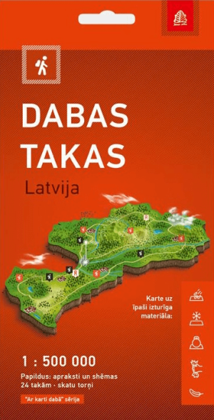
Wandelkaart Dabas Takas, Natuurwandelingen in Letland - Jana Seta • 9789984077437
Wandelkaart Dabas Takas, Natuurwandelingen Letland - Jana Seta Productomschrijving: Toeristische kaart met natuurtochten in Letland. Informatie over de natuurtochten en observatietorens in Letland. Voor 24 bijzonder interessante tochten is er meer informatie met gedetailleerde kaarten. De kaart is gemaakt van een zeer duurzaam synthetisch vezelmateriaal. Ze is waterdicht, on…