

Wandelkaart Camino de Santiago DEEL 1 - NAT GEO
Saint-Jean-Pied-de-Port to Santo Domingo de la Calzada

Korte omschrijving
Wandelkaarten Nouvelle-Aquitaine, Frankrijk van National Geographic. Ideaal voor tochten in Frankrijk en Spanje.
Wandelkaart Camino de Santiago DEEL 1 - NAT GEO Productomschrijving: De Camino de Santiago, of kortweg El Camino (De Weg), is een van de meest iconische wandelroutes van Europa sinds pelgri...

Specificaties
- Uitgever: National Geographic
- ISBN-13: 9781566959193
- HOOFDCATEGORIEËN: Wandelkaart
- Activiteiten: Wandelen, Hiking & Trekking
- Auteur: National Geographic
- Regio: Nouvelle-Aquitaine, Frankrijk
- Land: Frankrijk, Spanje
- Waterafstotende kaart: Nat Geo waterproof series
- Departement: Pyrénées-Atlantiques (64)
- Schaal: 1:50000
- Taal: Engels
- Reeks/Serie: National Geographic Trails Illustrated
- De Franse Regio's: Nouvelle Aquitaine
- De Spaanse Regio's: Galicië
Volledige omschrijving
Wandelkaart Camino de Santiago DEEL 1 - NAT GEO
Productomschrijving: De Camino de Santiago, of kortweg El Camino (De Weg), is een van de meest iconische wandelroutes van Europa sinds pelgrims in de 9e eeuw op weg gingen naar de kathedraal van Santiago de Compostela om de overblijfselen van de heilige Jacobus te vereren. Hoewel geworteld in de christelijke traditie, is de route herboren als een niet-confessionele spirituele rite en epische langeafstandswandelroute die langs Romeinse wegen, over bergen en door schilderachtige landschappen en historische stadjes loopt.
Engelse omschrijving: The Way of Saint James, known in Spanish as Camino de Santiago — or simply El Camino (The Way) — has been one of Europe's most iconic walking routes since 9th century pilgrims began making their way to the Cathedral of Santiago de Compostela to venerate the remains of Saint James. Though rooted in Christian tradition, the route has been reborn as a nondenominational spiritual rite and epic long distance trail that runs along Roman roads, across mountains, and through picturesque countryside and historic towns.
The Saint-Jean-Pied-de-Port to Santo Domingo de la Calzada Topographic Map Guide booklet makes a perfect traveling companion when traversing the furthest east section of the Camino Francés (French Route). This section of the trail passes over the Pyrenees from France into Spain and then through Pamplona (Iruña) and includes sections 1–9. A detailed description of each trail section is included that tells travelers about the many landmarks encountered along the way.
Each Camino de Santiago Topographic Map Guide includes detailed topographic maps of 2 cm = 1 km. Each page is centered on the trail and overlaps with the adjacent pages so there is little chance of getting lost. Along the bottom of each page is a trail profile that shows the distance between towns, rest houses, and trail access points. The map and trail profile provide a step by step visual guide to hiking the trail.
Every Great Treks map is printed on "Backcountry Tough" waterproof, tear-resistant paper. A full Lat/Long grid is printed on the map to aid with GPS navigation. Every map purchase helps support the National Geographic Society, an impact driven, nonprofit organization with global reach that uses the power of science, exploration, education, and storytelling to illuminate and protect the wonder of our world.
Locatie op kaart
Gekoppelde artikelen

Wandelkaart Camino de Santiago DEEL 2 - NAT GEO • 9781566959209
weatherproof versieWandelkaart Camino de Santiago DEEL 2 - NAT GEO Productomschrijving: De Camino de Santiago, of kortweg El Camino (De Weg), is een van de meest iconische wandelroutes van Europa sinds pelgrims in de 9e eeuw op weg gingen naar de kathedraal van Santiago de Compostela om de overblijfselen van de heilige Jacobus te vereren. Hoewel geworteld in de christelijke traditie, is de route herboren als…

Wandelkaart Camino de Santiago DEEL 3 - NAT GEO • 9781566959216
weatherproof versieWandelkaart Camino de Santiago DEEL 3 - NAT GEO Productomschrijving: De Camino de Santiago, of kortweg El Camino (De Weg), is een van de meest iconische wandelroutes van Europa sinds pelgrims in de 9e eeuw op weg gingen naar de kathedraal van Santiago de Compostela om de overblijfselen van de heilige Jacobus te vereren. Hoewel geworteld in de christelijke traditie, is de route herboren als…
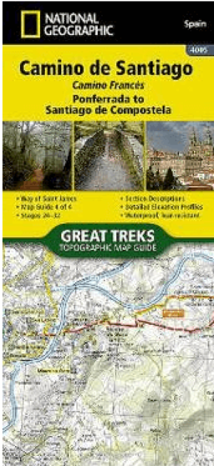
Wandelkaart Camino de Santiago DEEL 4 - NAT GEO • 9781566959223
weatherproof versieWandelkaart Camino de Santiago DEEL 4 - NAT GEO Productomschrijving: De Camino de Santiago, of kortweg El Camino (De Weg), is een van de meest iconische wandelroutes van Europa sinds pelgrims in de 9e eeuw op weg gingen naar de kathedraal van Santiago de Compostela om de overblijfselen van de heilige Jacobus te vereren. Hoewel de route geworteld is in de christelijke traditie, is hij herb…
Artikelen uit dezelfde regio

Wandelkaart 2333 SB Bort-les-Orgues & Neuvic - IGN • 9782758546238
Wandelkaart 2333 SB - Bort-les-Orgues & Neuvic Productomschrijving: Bort-les-Orgues & Neuvic zijn gemeentes in het Franse departement Corrèze in de regio Nouvelle-Aquitaine. De plaats maakt deel uit van het arrondissement Ussel. De locaties liggen pal naast het Europees gekende Parc Régional Naturèlles des Volcans d'auverge. Productomschrijving: Tussen 2014 en 2018 vernieuwt IGN haar v…

Wandelkaart 1832 SB Montbron- Piégut & Pluviers - IGN • 9782758548140
Wandelkaart 1832 SB - Montbron- Piégut & Pluviers Productomschrijving: Montbron- Piégut & Pluviers zijn gemeentes in het Franse departement Charente in de regio Nouvelle-Aquitaine. De plaats maakt deel uit van het arrondissement Angoulême. Tussen 2014 en 2020 vernieuwt IGN haar volledige collectie serie blauw. Een nieuwe toewijzing voor optimale leesbaarheid, met een grotere mate van g…

Wandelgids Vallées d'Ossau, d'Aspe et de Barétous à pied- Chamina • 9782844667038
Vallées d'Ossau, d'Aspe et de Barétous à pied - Chamina Productomschrijving: Les vallées d'Ossau, d'Aspe et de Barétous, sont les 3 vallées béarnaises qui entaillent la chaîne pyrénéenne entre Bigorre et Pays basque. Elles communiquent avec l'Aragon aux cols du Pourtalet et du Somport, et avec la Haute-Navarre au col de la Pierre-Saint-Martin. C'est une région des Pyrénées qui combine de …

Wandelkaart 1545 ET Pau - IGN • 9782758551829
Wandelkaart Pau - IGN Productomschrijving: Deze locatie op de IGN kaart genaamd Pau, ligt in het departement Pyrénées-Atlantiques, in de regio Nouvelle-Aquitaine. Op zich is Pau nu een universiteitstad, die vele jaren geleden gekend was als een kuuroord locatie voor de Britten die er de berglucht kwamen opsnuiven. De TOP 25-serie is de cartografische referentie in Frankrijk. - Een na…

Wandelgids Corrèze - 30 plus beaux sentier à pied - Chamina • 9782844666277
Corrèze - 30 plus beaux sentier à pied - Ed. Chamina Productomschrijving: Het gebied dat in deze gids wordt verkend strekt zich uit van de oevers van de Dordogne in het oosten van het departement tot de grens met de Haute-Vienne in het westen. Dit is een goede gelegenheid om de weinig bekende schoonheden van dit departement te ontdekken, dat rijk is aan ongerepte natuur (oevers van de Vézè…