Wandelkaart 257 Crewe- Nantwich & Whitchurch - OSI
South Cheshire Way- bisschop Bennet way & sandstone Trail
Korte omschrijving
Wandelkaart Crewe & Nantwich- Whitchurch & Tattenhall - England Productbeschrijving: Kaart nummer 257 in de OS Explorer reeks beslaat een gebied van Tattenhall in het noorden aan Whitchurch ...

Specificaties
- Uitgever: Ordnance Survey
- ISBN-13: 9780319471296
- HOOFDCATEGORIEËN: Wandelkaart
- Activiteiten: Wandelen, Hiking & Trekking
- Regio: Cheshire, England, North West England
- Land: England
- Waterafstotende kaart: Ordnance Survey ACTIVE Explorer Weatherproof Maps
- TOPO's & Stafkaarten: Topografisch wandelen
- Schaal: 1:25000
- Taal: Engels
- Reeks/Serie:: Explorer ACTIVE Series OSI
Volledige omschrijving
Wandelkaart Crewe & Nantwich- Whitchurch & Tattenhall - England
Productbeschrijving: Kaart nummer 257 in de OS Explorer reeks beslaat een gebied van Tattenhall in het noorden aan Whitchurch in het zuiden, Crewe in het oosten aan de rand van Wales, en in het westen de steden van overton en Bangor on Dee. Hoogtepunten zijn de South Cheshire Way, bisschop Bennet way, sandstone Trail, Crewe & Nantwich circulaire Walk. De OS Explorer kaart voor Crewe & Nantwich is beschikbaar in zowel de standaard papieren versie als de weerbestendige 'Actief' versie.
Productdiscription: Map sheet number 257 in the OS Explorer series covers an area from Tattenhall in the North to Whitchurch in the south, Crewe in the east to the border of Wales in the west and the towns of overton and Bangor on Dee. Highlights of the area include: South Cheshire Way, Bishop Bennet Way, Sandstone Trail and Crewe and Nantwich Circular Walk. The OS Explorer map for Crewe & Nantwich is available in both the standard paper version and weatherproof 'Active' version.
Locatie op kaart
Gekoppelde artikelen
Wandelkaart 257 Crewe & Nantwich & Cheshire East - OSI • 9780319244531
standaard versieWandelkaart Crewe & Nantwich - Cheshire East England Productbeschrijving: Whitchurch & Tattenhall. 257 / Crewe & Nantwich, Cheshire East, England - Kaart nummer 257 in de OS Explorer reeks beslaat een gebied van Tattenhall in het noorden, Whitchurch in het zuiden, Crewe in het oosten, en de rand van Wales in het westen, plus de steden van Overton en Bangor op Dee. Hoogtepunten van…
Wandelkaart 257 Crewe- Nantwich & Whitchurch - OSI • 9780319471296
weatherproof versieWandelkaart Crewe & Nantwich- Whitchurch & Tattenhall - England Productbeschrijving: Kaart nummer 257 in de OS Explorer reeks beslaat een gebied van Tattenhall in het noorden aan Whitchurch in het zuiden, Crewe in het oosten aan de rand van Wales, en in het westen de steden van overton en Bangor on Dee. Hoogtepunten zijn de South Cheshire Way, bisschop Bennet way, sandstone Trail, Crewe & …
Artikelen uit dezelfde regio
Wandelgids Forest of Bowland walking guide - Cicerone • 9781852842512
Wandelgids - Forest of Bowland walking guide - Cicerone Productomschrijving: Gids voor wandelingen in het Forest of Bowland, Lancashire, Noord-Engeland, een Area of Outstanding Natural Beauty. 30 routes in het hele Forest met inbegrip van de zachte uitlopers in het zuiden en noorden, op de top van de moerassen en in de valleien. De Forest of Bowland, is een wilde en dunbevolkte regio van z…

Wandelgids Peak District-Bakewell & The White Peak - Cicerone • 9781786312570
Wandelgids Peak District-Bakewell & The White Peak - Cicerone Productomschrijving: Would you like to explore the best of Bakewell and the White Peak? This guidebook covers 15 of the best short walks in the Peak District (between 4 and 10km, all under three hours), including Taddington, Chatsworth Park, Sheldon and Magpie Mine, Elton and Robin Hood's Stride, and the Monsal Trail. Why c…
Wandelkaart 267 Northwich & Delamere Forest - OSI • 9780319244647
Wandelkaart Northwich & Delamere Forest - Cheshire England Omvat ook: Winsford & Middlewich Productomschrijving: De Mersey Forest omvat Northwich, Winsford en Delamere Forest. Met routes om te wandelen, fietsen en om te paardrijden, er zijn ook evenementen het hele jaar door. De OS Explorer kaart voor Northwich & Delamere Forest is beschikbaar in zowel de standaard papieren versie als …
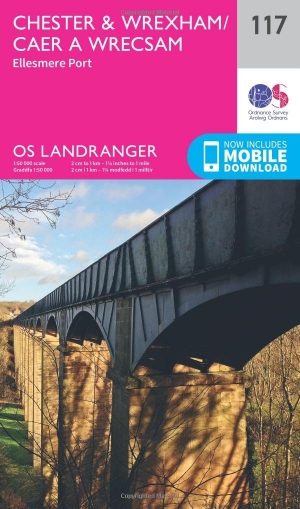
Wandelkaart 117 Chester & Wrexham West Cheshire - OSI • 9780319262153
Wandelkaart Chester & Wrexham - West Cheshire England - OSI Productbeschrijving: Kaart nummer 117 in de OS Landranger kaarten reeks beslaat een gebied van Llangollen in het zuiden aan Ellesmere Port in het noorden met Chester, die ligt aan de rivier de Dee. De belangrijkste bezienswaardigheden van de stad zijn Chester Zoo en de renbaan. Een korte reis naar het noorden brengt u naar de grot…
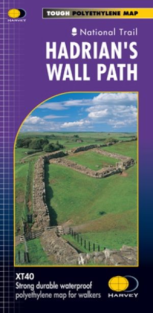
Wandelkaart Hadrian's Wall Path - Harvey maps • 9781851374380
Wandelkaart Hadrian's Wall Path - Harvey maps Productomschrijving: Kaart van de gehele Hadrians Way op één kaart. 130km (81 mijl) van de Solway Coast naar Newcastle. Met de gelegenheid voor een bezoek aan een groot aantal historische plekken langs de weg. Informatie over het vinden van accommodatie, camping, voedsel. Met routebeschrijving naar de start van de route. Nieuwe generatie H…


