
Wandelgids Pembrokeshire Coast Path - Trailblazer Publ.
299 km Rond de prachtige kustlijn van het Pembrokeshire Coast
Korte omschrijving
Pembrokeshire Coast Path - Trailblazer Productomschrijving: Amroth tot Cardigan - Het Pembrokeshire Coast Path, volgt een Nationaal Pad over 186 mijl (299 km) rond de prachtige kustlijn van ...

Specificaties
- Uitgever: Trailblazer Publications
- ISBN-13: 9781912716135
- HOOFDCATEGORIEËN: Wandelgids
- Activiteiten: Wandelen, Hiking & Trekking
- Auteur: Henry Stedman, Jim Manthorpe
- Regio: Pembrokeshire, Wales, South-West Wales
- Land: Wales
- Lange afstand wandelroutes: Pembrokeshire Coast Path National Trail (299 km)
- Nationale parken: Pembrokeshire Coast NP, Wales
- Editie: 6
- Taal: Engels
Volledige omschrijving
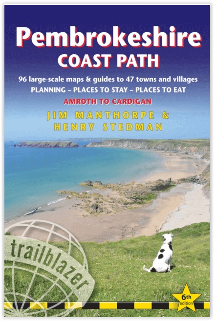
Pembrokeshire Coast Path - Trailblazer
Productomschrijving: Amroth tot Cardigan - Het Pembrokeshire Coast Path, volgt een Nationaal Pad over 186 mijl (299 km) rond de prachtige kustlijn van het Pembrokeshire Coast National Park in het zuidwesten van Wales. Bekend om zijn ongerepte zandstranden, afgelegen baaien, kleine vissersdorpjes en eilanden rijk aan vogels en zeeleven, biedt dit nationale pad enkele van de beste kustwandelingen in Groot-Brittannië.Planning - Plaatsen om te overnachten - Plaatsen om te eten
Engelse omschrijving: The Pembrokeshire Coast Path follows a National Trail for 186 miles (299km) around the magnificent coastline of the Pembrokeshire Coast National Park in south-west Wales. Renowned for its unspoilt sandy beaches, secluded coves, tiny fishing villages and off-shore islands rich in bird and marine life, this National Trail provides some of the best coastal walking in Britain.Planning – Places to stay – Places to eat
236 pages
96 trail maps & 15 town plans
60 colour photos; 4pp colour flower guide
14 stage maps and 2 overview maps
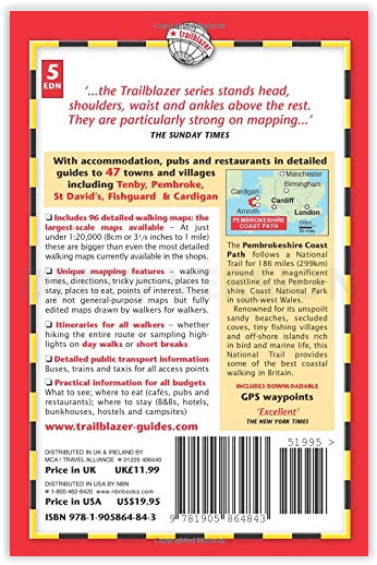
Features:
1. Unique mapping features – In many walking guides the reader has to read a route description then try to relate it to the map. Our guides are easier to use because walking directions, tricky junctions, places to stay and eat, points of interest and walking times are all written onto the maps themselves in the places to which they apply. With their uncluttered clarity, these are not general-purpose maps but fullyedited maps drawn by walkers for walkers. Downloadable GPS waypoints also included.
2. The largest scale walking maps available – At just under 1:20,000 (8cm or 31/8 inches to 1 mile) our maps are bigger than even the most detailed walking maps currently available in the shops.
3. An all-in-one guide – Trailblazer guides include practical information not usually found in walking guides to the UK: reviews of places to stay, places to eat, attractions along the way and detailed public transport information showing all access points on the path, for weekend and day walkers.

Artikelen uit dezelfde regio
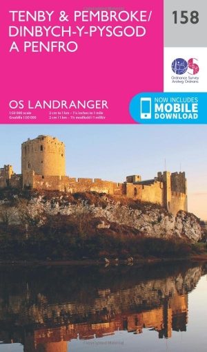
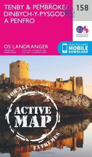
Wandelkaart 158 Tenby & Pembroke - Wales - OSI • 9780319262566
Wandelkaart Tenby & Pembroke in Wales Productbeschrijving: Deze OS Landranger kaart 158 van Tenby & Pembroke omvat ook Kilgetty, Freystrop, Yerbeston, Milford Haven, Wolfsdale, Llandissilio, het Nationaal Park van Pembrokeshire Coast en de Pembrokeshire Coast Path. De OS Landranger kaarten reeks heeft betrekking op Groot-Brittannië met 204 gedetailleerde kaarten, perfect voor dagtochten e…
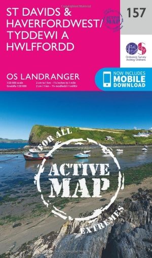
Wandelkaart 157 St-David's & Haverfordwest - Wales - OSI • 9780319474808
Wandelkaart St Davids & Haverfordwest - Wales OSI Productbeschrijving: De eigenschappen van het Pembrokeshire Coast Path sterkt zich op deze OS Landranger kaart 157 door langs de iconische kustlijn rond de landtong en St. Brides Bay, de traditionele Welsh steden van Pembroke, Milford Haven, Haverfordwest, St. David's en Goodwick. Hoogtepunten van St. David's Cathedral en de schitterende ba…
Wandelkaart 158 Tenby & Pembroke - Wales - OSI • 9780319474815
Wandelkaart Tenby & Pembroke in Pembrokeshire Wales Productbeschrijving: Deze OS Landranger kaart 158 omvat Tenby & Pembroke, alsook Kilgetty, Freystrop, Yerbeston, Milford Haven, Wolfsdale, Llandissilio, het Nationaal Park van Pembrokeshire Coast en de Pembrokeshire Coast Path. De OS Landranger kaarten reeks heeft betrekking op Groot-Brittannië met 204 gedetailleerde kaarten, perfect voo…
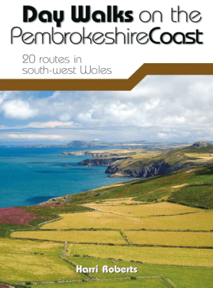
Wandelgids Day Walks on the Pembrokeshire Coast - Vertebrate publ • 9781910240984
Day Walks on the Pembrokeshire Coast - Vertebrate Productomschrijving: 20 routes in south-west Wales Day Walks on the Pembrokeshire Coast features 20 classic coastal routes between 6.5 miles and 13 miles (10.4km and 20.8km) in length, suitable for hillwalkers of all abilities. Local author and walker Harri Roberts shares his favourite walks in the national park, including a meander al…

Wandelgids Walking in Pembrokeshire - Cicerone Press • 9781852849153
Walking in Pembrokeshire - Cicerone Productomschrijving: Gids met 40 cirkelvormigewandelingen in Pembrokeshire in Wales. De routes gaan langs de dramatische schoonheid van het nationale park en de kust, de Daugleddau en de Preseli Hills, terwijl u beboste kloven, prehistorische heuvelforten en middeleeuwse kastelen verkent. De wandelingen variëren van 1 tot 12 mijl en de routebeschrijvinge…