

Wandelgids Coast to Coast path - Trailblazer
St-Bees to Robin Hood's Bay - 307 km door 3 Nationale parken

Korte omschrijving
Wandelgidsen Cumbria & Lake District, England en Yorkshire, England van Trailblazer Publications. Ideaal voor tochten in England.
Coast to Coast path 370 km - Trailblazer Productomschrijving: 109 kaarten, 14 etappe kaarten en 60 kleurfoto's van één van Engeland's mooiste wandelroutes, en tevens meest gekend. Het Coast ...

Specificaties
- Uitgever: Trailblazer Publications
- ISBN-13: 9781912716258
- HOOFDCATEGORIEËN: Wandelgids
- Activiteiten: Wandelen, Hiking & Trekking
- Auteur: Henry Stedman, Joel Newton
- Regio: Cumbria & Lake District, England, Yorkshire, England
- Land: England
- Lange afstand wandelroutes: Coast to Coast- St-Bees to Robinhood's bay England (370 km)
- Editie: 10
- Taal: Engels
- Iconische Wandelroutes: Coast to coast path, UK
- National Trails UK, England & Wales: Coast to Coast Walk, England
Volledige omschrijving
Coast to Coast path 370 km - Trailblazer
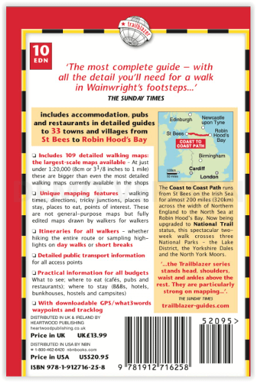
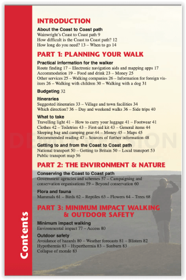
Productomschrijving: 109 kaarten, 14 etappe kaarten en 60 kleurfoto's van één van Engeland's mooiste wandelroutes, en tevens meest gekend. Het Coast to Coast Pad is een pad van 307 km dat loopt van St Bees aan de Ierse Zee over de breedte van Noord-Engeland naar de Noordzee bij Robin Hood's Bay. Deze spectaculaire wandeling van twee weken doorkruist drie nationale parken - het Lake District, de Yorkshire Dales en de North York Moors. Bedacht door de legendarische fellwalker Alfred Wainwright is dit een zeer populaire route en in 2022 kreeg hij eindelijk de status van National Trail.
Engelse omschrijving: Coast to Coast Path: St Bees to Robin Hood's Bay
The Coast to Coast Path is a 191½-mile (307km) trail that runs from St Bees on the Irish Sea across the width of Northern England to the North Sea at Robin Hood’s Bay.This spectacular two-week walk crosses three National Parks – the Lake District, the Yorkshire Dales and the North York Moors. Devised by legendary fellwalker Alfred Wainwright this is a very popular trail and in 2022 it was finally awarded National Trail status.
- Now designated a National Trail – The award of £5.6 million for trail upgrading (2023-5) should ensure ongoing publicity.
- Post pandemic, stay-cations remain the holidays of choice
- Text and maps in clear two-colour style
- All-in-one guide – Trailblazer guides include practical information not usually found in walking guides to the UK: reviews of places to stay, places to eat, attractions along the way and detailed public transport information showing all access points on the path and car parks near the trail, for weekend and day walkers.
- The largest scale walking maps available – At just under 1:20,000 (8cm or 31/8 inches to 1 mile) our maps (fully-edited and drawn by walkers for walkers) are igger than even the most detailed walking maps currently available in the shops.
- 109 trail maps and town plans
- 14 stage maps with profiles and 2 overview maps
- 60 colour photos; colour flower guide.
.png)
Locatie op kaart
Artikelen uit dezelfde regio
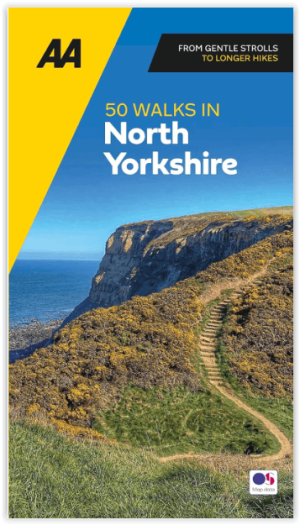
Wandelgids 50 walks in North Yorkshire - AA Publi. • 9780749583781
50 walks in North Yorkshire - AA Publishing Productomschrijving: North Yorkshire, met zijn uitgestrekte landschappen en rijke geschiedenis, is een paradijs voor wandelaars. De wandelgids "50 Walks in North Yorkshire" biedt routes door enkele van de mooiste plekken in het Verenigd Koninkrijk. Wat Kun Je Er Vinden? Adembenemende Landschappen: Yorkshire Dales en North York Moors b…
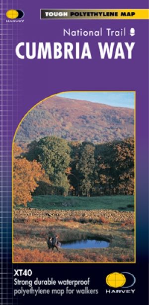
Wandelkaart Cumbria Way - Harvey maps • 9781851374243
Wandelkaart Cumbria Way - Long Distance Paths - Harvey maps Productomschrijving: Deze kaart heeft betrekking op de volledige lengte van The Cumbria Way, 112km (70 mijl) van Ulverston naar Carlisle. Het passeert Coniston, Dungeon Gildors, Keswick en Caldbeck. Meestal door valleien in plaats van over hoge toppen. Informatie over het vinden van accommodatie, camping, voedsel. Routebeschrijvin…
Wandelkaart OL21 South Pennines - OS • 9780319242605
Wandelkaart South Pennines - Ordnance Survey Productomschrijving: Parts of the Peak District National Park, South Pennines, Brontë Way, Burnley Way, Calder / Aire Link, Calderdale Way, Colne Valley Circular Walk, Dales High Way, E2 European long distance Path, Irwell Sculpture trail, Kirklees Way, Meltham Way, Millenium Way, Oldhan Way & Crompton Circuit, Pendle Way, Pennine Bridleway, Pen…

Wandelgids The Cleveland Way - Rucksack Readers • 9781898481973
Wandelgids Cleveland Way - Rucksack Readers Productomschrijving: De Cleveland Way is één van de oudste en meest geliefde National Trails van Engeland. De route loopt over een afstand van 174 km rond het North York Moors National Park en begint in het binnenland bij Helmsley, met een panoramisch uitzicht over de valleien van York en Mowbray en vanaf de Cleveland Hills. Na de kust bij Saltb…

Wandelgids The Dales Way - Trailblazer • 9781912716302
Wandelgids The Dales Way - Trailblazer Publications Productomschrijving: Dales Way: Ilkley to Bowness-on-Windermere - Het langeafstandswandelpad Dales Way begint in Ilkley, in het Yorkshire Dales National Park en loopt over 81 mijl (130 km) om te eindigen in het Lake District, in Bowness-on-Windermere. Het volgt de prachtige rivier de Wharf richting Ribblehead, meandert dan langs de rivier…