

Fietsgids South West Mountain Biking - Vertebrate Publ.
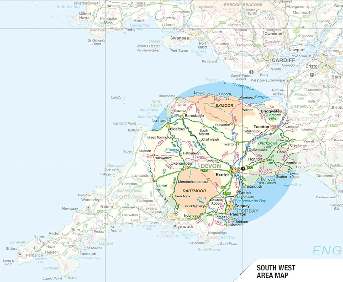
Quantocks AONB - Exmoor NP & Dartmoor NP
Korte omschrijving
Fietsgidsen South West England van Vertebrate Publishing. Ideaal voor tochten in England.
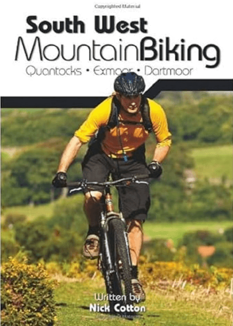
South West Mountain Biking - Vertebrate Productomschrijving: A guide to the mountain biking in the south west of England. It features 26 of the best mountain bike rides in Dartmoor, Exmoor ...

Specificaties
- Uitgever: Vertebrate Publishing
- ISBN-13: 9781906148263
- HOOFDCATEGORIEËN: Fietsgids
- Activiteiten: Fietsen / VTT / MTB
- Auteur: Nick Cotton, Tom Fenton
- Regio: South West England
- Land: England
- Nationale parken: Dartmoor NP, Devon England, Exmoor NP, Devon England
- AONB - Area of Outstanding Beauty/National Landscape: Quantock Hills AONB
- Taal: Engels
- VTT / MTB: Mountainbike
Volledige omschrijving
South West Mountain Biking - Vertebrate
Productomschrijving: A guide to the mountain biking in the south west of England. It features 26 of the best mountain bike rides in Dartmoor, Exmoor and the Quantock Hills, between 10km and 30km in length, suitable for different levels of mountain bikers. It also features industry-standard Ordnance Survey mapping.
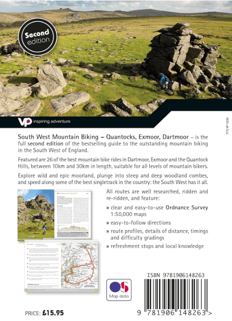
South West Mountain Biking – Quantocks, Exmoor, Dartmoor is the full, revised second edition of the bestselling guide to the outstanding mountain bike riding in the South West of England. Featured are 26 of the best mountain bike rides in Dartmoor, Exmoor and the Quantock Hills, between 10 and 30 kilometres in length, suitable for all levels of mountain bikers.
All route information has been thoroughly checked for this new edition to give the most up to date and – currently – the only comprehensive guidebook to this great area. Explore wild and epic moorland, plunge into steep and deep woodland combes, and speed along some of the best singletrack in the country: the South West has it all.
As with most Vertebrate MTB guidebooks, this new edition features industry standard Ordnance Survey mapping, and is illustrated with stunning, all new action photography. This new addition also features route altitude profiles. Researched, ridden and written by experienced authors Nick Cotton (Dartmoor and Exmoor) and Tom Fenton (Quantocks) each route features clear and easy to use Ordnance Survey 1:50,000 maps, easy to follow directions, details of distance, timings and difficulty gradings, route profiles, and refreshment stops and local knowledge. A detailed Appendix provides essential information on where to eat, drink and sleep.
Artikelen uit dezelfde regio
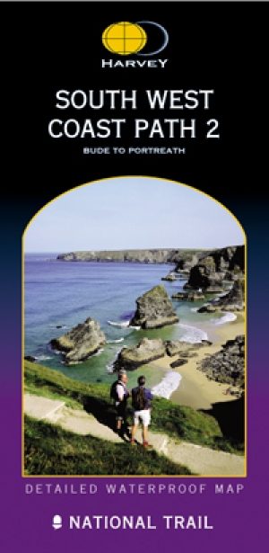
Wandelkaart South West Coast Path 2 - Harvey maps • 9781851374274
Wandelkaart - South West Coast Path 2 - Harvey maps - Covers: The path from Bude to Portreath. Productomschrijving: Waterdichte XT40 kaart van Harvey. Een ideale kaart voor wandelaars op de langste en op één van haar meest populairste nationale routes. Het loopt langs de kust van Somerset, Cornwall en Devon, Dorset van Minehead round via Land's end naar Poole. Het omvat alle 95 mijls …

Wandelkaart 172 Bristol- Bath & Thornbury- S.W. England - OSI • 9780319474952
Wandelkaart Bristol- Bath & Thornbury - South West England Productbeschrijving: OS Landranger kaart 172 toont Bristol, de rivier de Avon, de Georgische stad Bath en de zuidkant van de Cotswolds way. De Roman Baths in Bad zijn het hoogtepunt van de stad, maar niet missen sommige van de uitgebreide architectuur - er zijn dat diverse voorgesteld wandeltochten die wijzen op de beste. De OS…

Wandelkaart - South West Coast Path 4 - Harvey maps • 9781851374373
Wandelkaart - South West Coast Path 4 - Harvey maps Productomschrijving: Waterdichte XT40 kaart van Harvey. Een ideale kaart voor wandelaars op de langste en op één van haar meest populairste nationale routes. Het loopt langs de kust van Somerset, Cornwall en Devon, Dorset van Minehead round via Land's end naar Poole. Het omvat alle 95 mijls van het World Heritage site bekend als de Jurass…

Wandelgids Part 2 SWCP Map Booklet St Ives to Plymouth - Cicerone • 9781786312785
Map Booklet Part 2 SWCP - St Ives to Plymouth - Cicerone Productomschrijving: Map of part of the southern section of the 630 mile (1014km) South West Coast Path National Trail. Covers: the trail from St Ives to Plymouth along the west Cornwall and Devon coastline. This convenient and compact booklet of Ordnance Survey 1:25,000 maps shows the route, providing all of the mapping you ne…

Fietsgids South West England Gravel Rides - Vertebrate Publ. • 9781839812545
South West England Gravel Rides - Vertebrate Publ. Productomschrijving: 24 gravel bike adventures in the West Country Gravel Rides South West England features 24 cycling routes, ranging from 16 to 180 kilometres, showcasing the extensive gravel trails of the West Country. Gravel enthusiast and experienced route creator Katherine Moore has taken her love of the South West and extensive …