

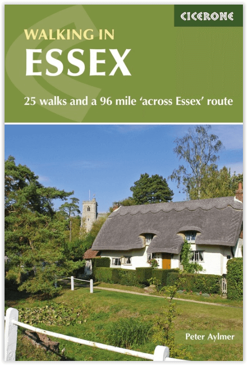
Wandelgids Walking in Essex - Cicerone Press
25-day walks - met The Essex Way in 11 etappes omschreven
Korte omschrijving
Wandelgidsen Essex South England van CICERONE Press. Ideaal voor tochten in England.
Wandelgids - Walking in Essex - Cicerone Press Productomschrijving: Wandelen in Essex beschrijft 25 dagwandelingen door het hele historische graafschap Essex. De Essex Way zelf word ook omsc...

Specificaties
- Uitgever: CICERONE Press
- ISBN-13: 9781786310224
- HOOFDCATEGORIEËN: Wandelgids
- Activiteiten: Wandelen, Hiking & Trekking
- Auteur: Peter Aylmer
- Regio: Essex South England
- Land: England
- Lange afstand wandelroutes: The Essex Way, Essex England (102 km)
- Editie: 2
- Taal: Engels
- De Engelse Graafschappen: Essex
Volledige omschrijving
Wandelgids - Walking in Essex - Cicerone Press
Productomschrijving: Wandelen in Essex beschrijft 25 dagwandelingen door het hele historische graafschap Essex. De Essex Way zelf word ook omschreven in 11 etappes van Manor Park, naar de haven van Harwich. Essex is misschien niet de eerste plaats waar je aan denkt om te wandelen, het gevarieerde landschap omvat eeuwenoude bossen en kilometerslange kustlijn, allemaal binnen handbereik van Londen.
Engelse omschrijving: Walking in Essex describes 25 day walks across the whole of the historic county of Essex. The Essex Way is also covered in 11 stages from Manor Park, to the port of Harwich. Essex may not be the first place you think of for walking, it's varied landscape includes ancient forests and miles of coastline all within easy reach of London.
Seasons:
All four seasons can be enjoyed by the walker in Essex; with its mostly clay soils, it's a good idea to wear boots after prolonged rain.
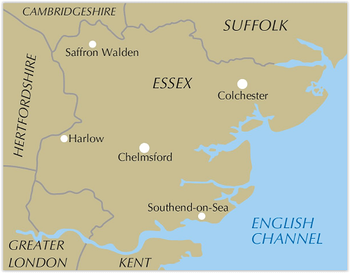
Centres:
Chelmsford, Colchester, Harlow, Saffron Walden, Southend; easy access also from neighbouring counties (including Kent by the Dartford crossing) and east and north London.
Difficulty:
Walks are suitable for all abilities; ascents are mostly short and rarely steep; some longer walks of up to 18 miles are included for those seeking more challenge.
Must See:
The coast - unspoilt and barely known away from the famous resorts; an internationally-important refuge for bird life; green lanes - Essex has more than any county save Dorset; wood and forest - Epping, Hatfield, Hainault and many others.

Locatie op kaart
Artikelen uit dezelfde regio

Wandelkaart 195 Braintree & Saffron Walden Essex - OSI • 9780319243886
Wandelkaart Braintree- Saffron Walden - Essex England Productbeschrijving: Halstead & Great Dunmow 195 / Braintree, Saffron & Walden, Essex, England - Kaart nummer 195 in de OS Explorer-serie dekt de oppervlakte van Essex van Saffron Walden in het noorden aan Great Dunmow en Braintree in het zuiden, en Halstead in het oosten aan Bishop's Stortford in het westen. Hoogtepunten van het g…

Wandelkaart 167 Chelmsford & Harlow- Essex England - OSI • 9780319262658
Wandelkaart Chelmsford & Harlow - Essex England Productbeschrijving: Chelmsford is een toegankelijke plaats in het hart van Essex. Het heeft een bruisende centrum met veel winkels en restaurant faciliteiten. Kaart OS Landranger 167 dekt ook de steden Harlowm Bishop's Stortford, Billericay, Epping en Braintree. De OS Landranger kaarten reeks heeft betrekking op Groot-Brittannië met 204 gede…

Wandelkaart 184 Colchester Harwich & Clacton-on-Sea - OSI • 9780319243770
Wandelkaart Colchester - Harwich & Clacton-on-Sea - Essex Productbeschrijving: Harwich & Clacton-on-Sea. 184 / Colchester, Harwich & Clacton-on-Sea, Essex, England - Kaart nummer 184 in de OS Explorer reeks heeft betrekking op het oosten van Essex op de kust van de Noordzee. De Essex Way loopt langs het bovenste gedeelte van de kaart van Harwich, en passeert in de buurt van Colchester…

Wandelgids 044 Pathfinder guides Essex England - OS • 9780319091166
Wandelgids Essex England - OS Productomschrijving: This book has 28 circular, graded walks all around Essex. The routes range from extended 4.8km (3 miles) up to 15.6km (10 miles), so there is something for everyone of all abilities. Each walk includes a detailed description, an extract of the OS Explorer 1:25k map, GPS waypoints and key features to look out for. You can also find informa…

Wandelkaart 174 Epping Forest & Lee Valley- Essex - OSI • 9780319243671
Wandelkaart Epping Forest & Lee Valley - Essex England Productbeschrijving: Hertford & Harlow. 174 / Epping Forest & Lee Valley, Essex, England - Kaart nummer 174 in de OS Explorer reeks omvat Epping Forest en het gebied naar het Noord Oosten van Londen. Het verdragsgebied van de kaart omvat Hertford en Harlow in het noorden tot Ilford en Tottenham naar het zuiden, en omvat hoogtepunte…